Where to find Warbling Vireo in July
within 25 miles of New York City, United States
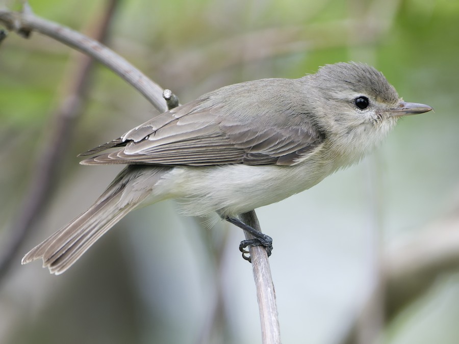
This page shows which locations in the selected region historically had the highest probability of a checklist including Warbling Vireo in July. Because some locations may be undersampled, the results are sorted based on a confidence score which takes into account how many samples are available. The bar chart shows how the probability of observing this species varies over the year.
- Click on a month in the bar chart to switch to that month.
- Click on a location to view its top birds.
- Click here to view a map on eBird.
| Evidence | Sampling | Score | ||||||||
|---|---|---|---|---|---|---|---|---|---|---|
| # | Location | Dist | Media | Years | Birders | Hits | Lists | Freq | Conf | |
| 1 | Cemetery of the Resurrection--North Overlook | 17.6 | 0 | 6 | 2 | 81 | 109 | 74.3% | 65.4% | |
| 2 | Sharrotts Pond | 16.9 | 0 | 4 | 57 | 63 | 88 | 71.6% | 61.4% | |
| 3 | Cemetery of the Resurrection--Perpendicular Pond | 17.5 | 0 | 13 | 3 | 235 | 404 | 58.2% | 53.3% | |
| 4 | Melanie Lane Wetlands | 21.4 | 0 | 4 | 4 | 43 | 68 | 63.2% | 51.4% | |
| 5 | Hempstead Lake SP--south end | 18.9 | 0 | 14 | 17 | 79 | 135 | 58.5% | 50.1% | |
| 6 | Alley Pond Park--Restoration Pond | 14.1 | 1 | 5 | 6 | 10 | 13 | 76.9% | 49.7% | |
| 7 | Smith Pond, Rockville Center | 18.8 | 0 | 4 | 5 | 8 | 10 | 80.0% | 49.0% | |
| 8 | Clove Lakes Park | 8.6 | 0 | 20 | 8 | 153 | 280 | 54.6% | 48.8% | |
| 9 | Mt. Loretto Unique Area | 18.0 | 0 | 18 | 62 | 66 | 125 | 52.8% | 44.1% | |
| 10 | Branch Brook Park--North | 10.0 | 0 | 3 | 2 | 3 | 3 | 100.0% | 43.8% | |
| 11 | Silver Lake Park (Richmond Co.) | 7.6 | 0 | 10 | 5 | 18 | 31 | 58.1% | 40.8% | |
| 12 | North Mt. Loretto SF--Reed Marsh | 17.6 | 0 | 3 | 1 | 29 | 54 | 53.7% | 40.6% | |
| 13 | Canarsie Beach Park | 8.4 | 2 | 7 | 15 | 35 | 69 | 50.7% | 39.2% | |
| 14 | Commerce Road Wetlands | 19.8 | 1 | 5 | 23 | 69 | 148 | 46.6% | 38.8% | |
| 15 | Central Park-Hanover Twp./Whippany Paper Board (private) | 23.6 | 0 | 3 | 1 | 4 | 5 | 80.0% | 37.6% | |
| 16 | Prospect Park | 4.2 | 8 | 20 | 154 | 510 | 1278 | 39.9% | 37.3% | |
| 17 | Mariners Marsh | 10.3 | 0 | 2 | 1 | 5 | 7 | 71.4% | 35.9% | |
| 18 | White's Pond | 21.8 | 0 | 2 | 4 | 5 | 7 | 71.4% | 35.9% | |
| 19 | Alley Pond Park--Restoration Area | 14.0 | 0 | 2 | 3 | 5 | 7 | 71.4% | 35.9% | |
| 20 | Weequahic Park | 10.3 | 0 | 4 | 2 | 9 | 15 | 60.0% | 35.7% | |
| 21 | Cemetery of the Resurrection--scrub W of maint. bldgs | 17.6 | 0 | 4 | 1 | 49 | 110 | 44.5% | 35.6% | |
| 22 | Baisley Pond Park | 11.8 | 0 | 4 | 4 | 7 | 11 | 63.6% | 35.4% | |
| 23 | Ellis Rd., waterfront (Richmond Co.) | 17.3 | 0 | 1 | 1 | 2 | 2 | 100.0% | 34.2% | |
| 24 | Cemetery of the Resurrection--S entrance (maint. bldgs) | 17.5 | 0 | 5 | 1 | 46 | 108 | 42.6% | 33.7% | |
| 25 | Calvert Vaux Park (Dreier-Offerman Park) | 9.0 | 1 | 18 | 25 | 84 | 212 | 39.6% | 33.3% | |
| 26 | Loantaka Brook Reservation | 23.9 | 0 | 10 | 9 | 66 | 170 | 38.8% | 31.8% | |
| 27 | Whitney Pond Park | 16.6 | 0 | 6 | 2 | 9 | 17 | 52.9% | 31.0% | |
| 28 | Cemetery of the Resurrection | 17.4 | 0 | 6 | 3 | 23 | 53 | 43.4% | 31.0% | |
| 29 | Ernest L. Oros Wildlife Preserve | 16.1 | 0 | 10 | 25 | 27 | 64 | 42.2% | 30.9% | |
| 30 | Baldwin Harbor Park | 21.7 | 0 | 3 | 3 | 3 | 4 | 75.0% | 30.1% | |
| 31 | Grant Park, Hewlett | 17.3 | 2 | 2 | 2 | 3 | 4 | 75.0% | 30.1% | |
| 32 | Alley Pond Park | 14.0 | 0 | 12 | 14 | 37 | 95 | 38.9% | 29.8% | |
| 33 | Bronx Zoo | 11.6 | 0 | 10 | 8 | 82 | 232 | 35.3% | 29.5% | |
| 34 | Hempstead Lake SP | 19.2 | 0 | 11 | 14 | 29 | 73 | 39.7% | 29.3% | |
| 35 | Dyker Beach Park | 7.1 | 2 | 7 | 2 | 17 | 40 | 42.5% | 28.5% | |
| 36 | Swindler Cove Park and Sherman Creek | 10.9 | 3 | 9 | 21 | 63 | 183 | 34.4% | 27.9% | |
| 37 | Van Cortlandt Park | 14.2 | 0 | 9 | 15 | 19 | 47 | 40.4% | 27.6% | |
| 38 | Walker Avenue Wetlands | 20.7 | 0 | 10 | 23 | 69 | 206 | 33.5% | 27.4% | |
| 39 | Alley Pond Park--Oakland Lake | 13.3 | 0 | 10 | 14 | 53 | 155 | 34.2% | 27.2% | |
| 40 | Lincoln Park Gravel Pits | 21.5 | 0 | 8 | 3 | 18 | 45 | 40.0% | 27.0% | |
| 41 | Twin Lakes Park, Eastchester | 19.4 | 0 | 4 | 2 | 5 | 9 | 55.6% | 26.7% | |
| 42 | Garret Mountain Reservation (Park) | 15.7 | 1 | 12 | 19 | 58 | 175 | 33.1% | 26.6% | |
| 43 | Marshlands Conservancy | 22.9 | 3 | 17 | 109 | 157 | 528 | 29.7% | 26.0% | |
| 44 | Prospect Park--Feeders | 4.4 | 0 | 3 | 3 | 4 | 7 | 57.1% | 25.0% | |
| 45 | Highland Park (Queens Co.) | 6.6 | 0 | 2 | 1 | 4 | 7 | 57.1% | 25.0% | |
| 46 | Milton Lake Park | 17.0 | 0 | 3 | 4 | 4 | 7 | 57.1% | 25.0% | |
| 47 | Kissena Park | 10.6 | 0 | 8 | 13 | 16 | 42 | 38.1% | 25.0% | |
| 48 | Flushing Meadows Corona Park--Willow Lake | 9.1 | 0 | 6 | 5 | 12 | 30 | 40.0% | 24.6% | |
| 49 | Flushing Airport | 10.0 | 0 | 2 | 2 | 8 | 18 | 44.4% | 24.6% | |
| 50 | Manhasset Valley County Park | 16.5 | 0 | 6 | 2 | 8 | 18 | 44.4% | 24.6% | |
| 51 | Fort Washington Park--S of GWB (Little Red Lighthouse-155th St.) | 9.4 | 2 | 1 | 1 | 11 | 27 | 40.7% | 24.5% | |
| 52 | Tanglewood Preserve | 18.5 | 0 | 4 | 5 | 9 | 21 | 42.9% | 24.5% | |
| 53 | Flushing Meadows Corona Park--Meadow Lake | 8.8 | 1 | 6 | 13 | 27 | 80 | 33.8% | 24.3% | |
| 54 | Linden Hawk Rise Sanctuary | 14.8 | 1 | 15 | 23 | 67 | 227 | 29.5% | 24.0% | |
| 55 | Alley Pond Park--Environmental Center | 13.6 | 0 | 7 | 14 | 28 | 86 | 32.6% | 23.6% | |
| 56 | Pelham Bay Park--The Meadow and adj. woodland | 15.0 | 0 | 5 | 4 | 6 | 13 | 46.2% | 23.2% | |
| 57 | Randalls Island | 6.8 | 2 | 8 | 20 | 46 | 158 | 29.1% | 22.6% | |
| 58 | Brookville Park | 14.2 | 1 | 7 | 6 | 10 | 26 | 38.5% | 22.4% | |
| 59 | Liberty SP | 2.4 | 1 | 16 | 22 | 96 | 360 | 26.7% | 22.4% | |
| 60 | Salt Marsh Nature Center at Marine Park | 9.1 | 1 | 19 | 58 | 147 | 575 | 25.6% | 22.2% | |
| 61 | Bronxville Lake, Tuckahoe | 18.4 | 0 | 3 | 3 | 9 | 23 | 39.1% | 22.2% | |
| 62 | Green-Wood Cemetery, Brooklyn | 4.4 | 1 | 11 | 71 | 161 | 636 | 25.3% | 22.1% | |
| 63 | Lemon Creek Pier | 17.7 | 0 | 3 | 1 | 17 | 51 | 33.3% | 22.0% | |
| 64 | Clay Pit Ponds | 17.0 | 0 | 3 | 4 | 4 | 8 | 50.0% | 21.5% | |
| 65 | Poplar Rd. Wildlife Sanctuary | 21.2 | 0 | 3 | 3 | 4 | 8 | 50.0% | 21.5% | |
| 66 | Van Cortlandt Park--VC Lake and Vault Hill | 13.9 | 0 | 6 | 5 | 6 | 14 | 42.9% | 21.4% | |
| 67 | Randalls Island--Southwest section | 6.1 | 0 | 2 | 2 | 5 | 11 | 45.5% | 21.3% | |
| 68 | Ocean Breeze Park | 9.6 | 0 | 3 | 4 | 5 | 11 | 45.5% | 21.3% | |
| 69 | East Irvington Nature Preserve | 24.6 | 0 | 1 | 2 | 2 | 3 | 66.7% | 20.8% | |
| 70 | Darwin James Preserve (private) | 21.6 | 0 | 1 | 2 | 1 | 1 | 100.0% | 20.7% | |
| 71 | Shepard Kollock Park | 19.2 | 0 | 1 | 1 | 1 | 1 | 100.0% | 20.7% | |
| 72 | Beaverdam Park | 15.6 | 0 | 1 | 1 | 1 | 1 | 100.0% | 20.7% | |
| 73 | Bronx River at Scout Field | 17.6 | 0 | 1 | 1 | 1 | 1 | 100.0% | 20.7% | |
| 74 | Paraiso Garden (El Jardin del Paraiso) | 1.5 | 0 | 1 | 1 | 1 | 1 | 100.0% | 20.7% | |
| 75 | Norton Basin Natural Resource Area | 14.6 | 0 | 1 | 1 | 1 | 1 | 100.0% | 20.7% | |
| 76 | Oakwood Beach—Roma Ave. marsh (dead end) | 12.0 | 0 | 1 | 1 | 1 | 1 | 100.0% | 20.7% | |
| 77 | Borough Of Montvale Trail | 23.3 | 0 | 1 | 1 | 1 | 1 | 100.0% | 20.7% | |
| 78 | Jersey Gardens Mall--Bayfront Wetlands--Restricted Access | 9.1 | 1 | 4 | 5 | 14 | 43 | 32.6% | 20.5% | |
| 79 | The Celery Farm | 23.1 | 1 | 19 | 36 | 128 | 536 | 23.9% | 20.5% | |
| 80 | Woodlawn Cemetery | 14.0 | 0 | 3 | 6 | 7 | 18 | 38.9% | 20.3% | |
| 81 | Fort Washington Park--Dyckman St. Boat Marina | 11.4 | 0 | 3 | 3 | 7 | 18 | 38.9% | 20.3% | |
| 82 | Meadowlands IBA--Mill Creek Marsh | 6.1 | 1 | 12 | 63 | 84 | 347 | 24.2% | 20.0% | |
| 83 | Nassau County Stormwater Basin No. 21 | 16.7 | 0 | 6 | 2 | 19 | 65 | 29.2% | 19.6% | |
| 84 | Meadowlands IBA--Losen Slote Creek Park | 8.8 | 0 | 4 | 5 | 5 | 12 | 41.7% | 19.3% | |
| 85 | Van Saun Park--Walden Pond | 14.7 | 0 | 6 | 4 | 11 | 34 | 32.4% | 19.1% | |
| 86 | Paerdegat Basin Natural Area and Ecology Park | 8.1 | 0 | 2 | 3 | 4 | 9 | 44.4% | 18.9% | |
| 87 | Piermont Pier | 23.4 | 1 | 16 | 28 | 147 | 674 | 21.8% | 18.9% | |
| 88 | Central Park--The Ramble | 4.7 | 2 | 16 | 59 | 115 | 518 | 22.2% | 18.8% | |
| 89 | Central Park--North End | 6.2 | 0 | 9 | 20 | 30 | 119 | 25.2% | 18.3% | |
| 90 | North Mt. Loretto SF--Snag Swamp | 17.8 | 0 | 4 | 1 | 14 | 48 | 29.2% | 18.2% | |
| 91 | Maplewood Memorial Park | 14.1 | 0 | 6 | 5 | 27 | 106 | 25.5% | 18.1% | |
| 92 | Cemetery of the Resurrection--Parallel Pond | 17.4 | 0 | 11 | 1 | 43 | 188 | 22.9% | 17.4% | |
| 93 | Richard W. DeKorte Park | 6.9 | 7 | 17 | 119 | 302 | 1597 | 18.9% | 17.1% | |
| 94 | Cemetery of the Resurrection--North Pond | 17.4 | 0 | 5 | 1 | 18 | 70 | 25.7% | 16.9% | |
| 95 | Pelham Bay Park--Thomas Pell WS and Goose Creek Marsh | 15.0 | 0 | 6 | 5 | 10 | 34 | 29.4% | 16.8% | |
| 96 | Fresh Creek Park | 8.1 | 0 | 2 | 5 | 4 | 10 | 40.0% | 16.8% | |
| 97 | Overpeck County Park | 10.5 | 0 | 9 | 13 | 25 | 106 | 23.6% | 16.5% | |
| 98 | Verona Park | 14.8 | 0 | 5 | 7 | 14 | 53 | 26.4% | 16.4% | |
| 99 | Inwood Hill Park | 11.7 | 1 | 9 | 31 | 134 | 700 | 19.1% | 16.4% | |
| 100 | Van Cortlandt Park--Southwest Zone | 13.8 | 0 | 4 | 6 | 5 | 14 | 35.7% | 16.3% | |
| 101 | Hillside Woods & Children's Village | 20.7 | 0 | 4 | 3 | 13 | 49 | 26.5% | 16.2% | |
| 102 | Highbridge Park--S of Alexander Hamilton Bridge | 9.4 | 0 | 6 | 4 | 8 | 27 | 29.6% | 15.9% | |
| 103 | Welwyn Preserve | 22.5 | 0 | 3 | 2 | 3 | 7 | 42.9% | 15.8% | |
| 104 | Spring Lake Park | 23.2 | 0 | 3 | 3 | 3 | 7 | 42.9% | 15.8% | |
| 105 | Central Park | 4.3 | 2 | 21 | 65 | 161 | 884 | 18.2% | 15.8% | |
| 106 | Mill Creek | 18.2 | 0 | 2 | 2 | 7 | 23 | 30.4% | 15.6% | |
| 107 | Floyd Bennett Field | 10.3 | 0 | 13 | 13 | 58 | 298 | 19.5% | 15.4% | |
| 108 | Orange Reservoir | 15.0 | 0 | 5 | 10 | 12 | 47 | 25.5% | 15.3% | |
| 109 | North Mt. Loretto SF | 17.9 | 0 | 1 | 1 | 5 | 15 | 33.3% | 15.2% | |
| 110 | Bayswater Point SP | 14.2 | 0 | 3 | 1 | 4 | 11 | 36.4% | 15.2% | |
| 111 | Van Saun Park | 15.0 | 0 | 4 | 4 | 4 | 11 | 36.4% | 15.2% | |
| 112 | Indian Pond | 13.3 | 0 | 2 | 1 | 4 | 11 | 36.4% | 15.2% | |
| 113 | Queens Botanical Garden | 9.5 | 0 | 1 | 2 | 2 | 4 | 50.0% | 15.0% | |
| 114 | Hendrix Creek | 8.2 | 0 | 2 | 4 | 2 | 4 | 50.0% | 15.0% | |
| 115 | Spring Creek Park Preserve (Brooklyn) | 8.5 | 0 | 1 | 1 | 2 | 4 | 50.0% | 15.0% | |
| 116 | Lower Essex Street Park | 15.9 | 0 | 1 | 1 | 2 | 4 | 50.0% | 15.0% | |
| 117 | Pelham Bay Park--Southern Meadow and environs | 13.6 | 0 | 6 | 6 | 10 | 38 | 26.3% | 15.0% | |
| 118 | Pelham Bay Park--Hunter Island | 15.9 | 0 | 5 | 8 | 7 | 24 | 29.2% | 14.9% | |
| 119 | Meadowlands District IBA | 7.6 | 0 | 9 | 6 | 16 | 69 | 23.2% | 14.8% | |
| 120 | Jefferson Rd. Pond | 23.4 | 1 | 8 | 10 | 15 | 64 | 23.4% | 14.7% | |
| 121 | Lincoln Park West | 4.5 | 0 | 5 | 9 | 8 | 29 | 27.6% | 14.7% | |
| 122 | Edith G. Read Wildlife Sanctuary | 24.9 | 0 | 6 | 5 | 38 | 198 | 19.2% | 14.3% | |
| 123 | Overpeck County Park--Stables/Wildlife Refuge | 10.1 | 0 | 3 | 6 | 5 | 16 | 31.2% | 14.2% | |
| 124 | Sound View Park | 9.9 | 0 | 2 | 2 | 5 | 16 | 31.2% | 14.2% | |
| 125 | Dismal Swamp | 22.9 | 0 | 3 | 3 | 4 | 12 | 33.3% | 13.8% | |
| 126 | Freshkills Park--North Park (Phase l) | 12.8 | 0 | 2 | 4 | 4 | 12 | 33.3% | 13.8% | |
| 127 | Teaneck Creek Conservancy | 11.1 | 0 | 9 | 10 | 19 | 91 | 20.9% | 13.8% | |
| 128 | Brookfield Park | 13.3 | 0 | 4 | 10 | 12 | 52 | 23.1% | 13.7% | |
| 129 | South Mountain Reservation | 15.5 | 1 | 7 | 7 | 17 | 80 | 21.2% | 13.7% | |
| 130 | Kings Point Park | 15.1 | 0 | 3 | 2 | 7 | 26 | 26.9% | 13.7% | |
| 131 | Goffle Brook Park | 17.9 | 0 | 1 | 3 | 3 | 8 | 37.5% | 13.7% | |
| 132 | Alley Pond Park--Southern Woodlands | 14.0 | 0 | 1 | 1 | 3 | 8 | 37.5% | 13.7% | |
| 133 | Meadowlands IBA--Kearny Marsh | 7.4 | 0 | 9 | 9 | 16 | 76 | 21.1% | 13.4% | |
| 134 | Hatfield Swamp IBA--West Essex Park | 18.2 | 0 | 10 | 3 | 21 | 108 | 19.4% | 13.1% | |
| 135 | Wolfe's Pond Park | 16.8 | 0 | 10 | 9 | 33 | 184 | 17.9% | 13.1% | |
| 136 | Hempstead Lake SP--north end | 19.3 | 1 | 5 | 9 | 9 | 38 | 23.7% | 13.0% | |
| 137 | Cunningham Park | 12.6 | 0 | 3 | 2 | 4 | 13 | 30.8% | 12.7% | |
| 138 | Arthur J. Hendrickson Park | 16.4 | 0 | 2 | 1 | 4 | 13 | 30.8% | 12.7% | |
| 139 | Overpeck County Park--Henry Hoebel Area | 10.7 | 0 | 3 | 3 | 4 | 13 | 30.8% | 12.7% | |
| 140 | Middle Village Cemetery | 6.4 | 0 | 4 | 1 | 4 | 13 | 30.8% | 12.7% | |
| 141 | Pelham Bay Park | 14.8 | 1 | 9 | 10 | 21 | 113 | 18.6% | 12.5% | |
| 142 | Watchung Reservation | 19.7 | 0 | 6 | 6 | 10 | 46 | 21.7% | 12.3% | |
| 143 | Great Swamp NWR | 23.9 | 0 | 15 | 13 | 32 | 189 | 16.9% | 12.3% | |
| 144 | Brooklyn Botanic Garden | 3.9 | 0 | 6 | 20 | 35 | 210 | 16.7% | 12.2% | |
| 145 | Fort Totten Park | 13.2 | 0 | 4 | 7 | 7 | 29 | 24.1% | 12.2% | |
| 146 | Pelham Bay Park--Bridle Path around golf courses | 15.0 | 0 | 3 | 3 | 3 | 9 | 33.3% | 12.1% | |
| 147 | Crestwood Park | 23.3 | 0 | 2 | 1 | 3 | 9 | 33.3% | 12.1% | |
| 148 | Alley Pond Park--Oakland Lake Wildflower Meadow | 13.4 | 0 | 2 | 2 | 3 | 9 | 33.3% | 12.1% | |
| 149 | Salt Marsh Nature Center at Marine Park--Southwest | 9.4 | 0 | 9 | 10 | 12 | 59 | 20.3% | 12.0% | |
| 150 | Meadowlands IBA--Harrier Meadows (restricted access) | 7.8 | 0 | 7 | 6 | 13 | 66 | 19.7% | 11.9% | |
| 151 | Wood Dale County Park | 21.3 | 0 | 1 | 1 | 2 | 5 | 40.0% | 11.8% | |
| 152 | Crotona Park | 10.4 | 0 | 2 | 2 | 2 | 5 | 40.0% | 11.8% | |
| 153 | VE Macy Park, Ardsley | 22.6 | 0 | 2 | 2 | 2 | 5 | 40.0% | 11.8% | |
| 154 | Closter Nature Center | 18.3 | 0 | 7 | 4 | 15 | 81 | 18.5% | 11.6% | |
| 155 | Prospect Park--Prospect Lake | 4.5 | 0 | 6 | 14 | 18 | 105 | 17.1% | 11.1% | |
| 156 | Riverside Park--North of 96th St. | 6.7 | 0 | 3 | 4 | 10 | 51 | 19.6% | 11.0% | |
| 157 | Natco Lake | 20.5 | 0 | 2 | 3 | 4 | 15 | 26.7% | 10.9% | |
| 158 | Halsey Pond Park | 23.1 | 0 | 3 | 3 | 3 | 10 | 30.0% | 10.8% | |
| 159 | Goethals Bridge Pond | 10.7 | 0 | 7 | 9 | 10 | 53 | 18.9% | 10.6% | |
| 160 | Lake Tappan (NY) | 23.3 | 0 | 4 | 5 | 8 | 40 | 20.0% | 10.5% | |
| 161 | Palisades Park IBA--Green Brook Sanctuary | 14.6 | 1 | 6 | 4 | 10 | 54 | 18.5% | 10.4% | |
| 162 | Central Park--Strawberry Field | 4.6 | 0 | 5 | 4 | 7 | 34 | 20.6% | 10.3% | |
| 163 | Echo Lake Park | 18.0 | 1 | 6 | 6 | 10 | 55 | 18.2% | 10.2% | |
| 164 | Hastings Meadowlands & Rowley's Bridge Trail | 19.9 | 0 | 2 | 1 | 3 | 11 | 27.3% | 9.7% | |
| 165 | Bloodgoods Pond | 16.4 | 0 | 2 | 3 | 2 | 6 | 33.3% | 9.7% | |
| 166 | Raritan Center (Restricted Access) | 23.0 | 0 | 2 | 2 | 2 | 6 | 33.3% | 9.7% | |
| 167 | Central Park--North Meadow Butterfly Gardens | 6.1 | 0 | 2 | 1 | 2 | 6 | 33.3% | 9.7% | |
| 168 | Edward W. Cahill Memorial Park | 16.0 | 0 | 1 | 1 | 2 | 6 | 33.3% | 9.7% | |
| 169 | Highbridge Park--N of Alexander Hamilton Bridge | 10.4 | 0 | 1 | 3 | 2 | 6 | 33.3% | 9.7% | |
| 170 | Scenic Hudson Park, Irvington | 23.3 | 0 | 1 | 1 | 2 | 6 | 33.3% | 9.7% | |
| 171 | Seguine Point | 17.2 | 0 | 2 | 2 | 2 | 6 | 33.3% | 9.7% | |
| 172 | Pascack Brook County Park | 19.0 | 0 | 3 | 4 | 5 | 23 | 21.7% | 9.7% | |
| 173 | Clarks Pond | 11.9 | 0 | 3 | 3 | 5 | 23 | 21.7% | 9.7% | |
| 174 | Green-Wood Cemetery--Dell Water | 4.5 | 0 | 1 | 4 | 4 | 17 | 23.5% | 9.6% | |
| 175 | Saxon Woods Park | 22.9 | 0 | 1 | 1 | 1 | 2 | 50.0% | 9.5% | |
| 176 | Beechmont Lake | 19.1 | 0 | 1 | 1 | 1 | 2 | 50.0% | 9.5% | |
| 177 | Lenape Park--Pond | 16.9 | 0 | 1 | 1 | 1 | 2 | 50.0% | 9.5% | |
| 178 | Freshkills Park--South Mounds | 13.6 | 0 | 1 | 1 | 1 | 2 | 50.0% | 9.5% | |
| 179 | Floyd Bennett Field--Return-a-Gift Pond | 9.9 | 0 | 1 | 1 | 1 | 2 | 50.0% | 9.5% | |
| 180 | Captain Tilly Park | 10.8 | 0 | 1 | 1 | 1 | 2 | 50.0% | 9.5% | |
| 181 | Green Brook Park | 24.2 | 0 | 1 | 1 | 1 | 2 | 50.0% | 9.5% | |
| 182 | Wilson Park, Mineola | 20.0 | 0 | 1 | 1 | 1 | 2 | 50.0% | 9.5% | |
| 183 | Veterans Park (Hazlet) | 21.9 | 0 | 1 | 2 | 1 | 2 | 50.0% | 9.5% | |
| 184 | Todt Hill Woodlands | 10.1 | 0 | 1 | 1 | 1 | 2 | 50.0% | 9.5% | |
| 185 | Fort Wadsworth Beach | 8.5 | 0 | 1 | 1 | 1 | 2 | 50.0% | 9.5% | |
| 186 | Pelham Bay Park--Orchard Beach & parking lot | 15.3 | 0 | 6 | 9 | 9 | 52 | 17.3% | 9.4% | |
| 187 | Franklin Lakes Nature Preserve | 21.1 | 0 | 4 | 5 | 5 | 24 | 20.8% | 9.2% | |
| 188 | Brooklyn Bridge Park | 1.1 | 1 | 5 | 11 | 54 | 461 | 11.7% | 9.1% | |
| 189 | New York Botanical Garden | 12.3 | 0 | 7 | 13 | 22 | 164 | 13.4% | 9.0% | |
| 190 | All Faiths Cemetery | 6.1 | 0 | 3 | 1 | 3 | 12 | 25.0% | 8.9% | |
| 191 | Central Park--The Lake (Upper Lobe) | 4.8 | 0 | 4 | 6 | 6 | 32 | 18.8% | 8.9% | |
| 192 | Pelham Bay Park--Turtle Cove | 14.7 | 1 | 7 | 8 | 15 | 105 | 14.3% | 8.9% | |
| 193 | Lenape Park | 16.4 | 0 | 7 | 7 | 9 | 59 | 15.3% | 8.2% | |
| 194 | Warinanco Park | 12.8 | 1 | 1 | 2 | 2 | 7 | 28.6% | 8.2% | |
| 195 | Kissena Corridor Park | 10.0 | 0 | 2 | 2 | 2 | 7 | 28.6% | 8.2% | |
| 196 | Watchung Reservation--Lake Surprise | 19.1 | 0 | 2 | 2 | 2 | 7 | 28.6% | 8.2% | |
| 197 | Inwood Hill Park--Shorakkopoch Rock | 11.8 | 0 | 1 | 1 | 2 | 7 | 28.6% | 8.2% | |
| 198 | Hempstead Plains Preserve | 22.1 | 0 | 2 | 1 | 3 | 13 | 23.1% | 8.2% | |
| 199 | Queens County Farm Museum | 15.0 | 0 | 2 | 1 | 3 | 13 | 23.1% | 8.2% | |
| 200 | Silver Lake (Bergen Co.) | 22.4 | 0 | 1 | 1 | 3 | 13 | 23.1% | 8.2% | |
| 201 | Udall's Mill Pond | 14.7 | 0 | 2 | 5 | 6 | 35 | 17.1% | 8.1% | |
| 202 | Central Park--Reservoir | 5.5 | 0 | 8 | 14 | 23 | 197 | 11.7% | 7.9% | |
| 203 | Ridgewood Reservoir | 6.5 | 0 | 3 | 4 | 5 | 28 | 17.9% | 7.9% | |
| 204 | Mission of Immaculate Virgin, Mt. Loretto | 17.9 | 0 | 2 | 1 | 5 | 29 | 17.2% | 7.6% | |
| 205 | Tibbetts Brook Park | 15.9 | 0 | 2 | 3 | 3 | 14 | 21.4% | 7.6% | |
| 206 | Hackensack--Foschini Park | 11.9 | 0 | 2 | 1 | 3 | 14 | 21.4% | 7.6% | |
| 207 | Central Park--The Ravine (incl. The Loch) | 6.1 | 0 | 7 | 11 | 15 | 124 | 12.1% | 7.5% | |
| 208 | Central Park--Turtle Pond | 4.9 | 0 | 9 | 11 | 23 | 210 | 11.0% | 7.4% | |
| 209 | Central Park--Belvedere Castle | 4.9 | 0 | 3 | 4 | 4 | 22 | 18.2% | 7.3% | |
| 210 | Goethals Bridge Pond--Observation Platform | 10.6 | 0 | 5 | 4 | 8 | 57 | 14.0% | 7.3% | |
| 211 | West Essex Wetlands, Livingston, New Jersey, US (40.808, -74.344) | 18.9 | 0 | 4 | 5 | 7 | 48 | 14.6% | 7.2% | |
| 212 | Governors Island (reopening Spring 2021) | 1.9 | 1 | 7 | 23 | 44 | 462 | 9.5% | 7.2% | |
| 213 | Staten Island Industrial Park--Pond (South Ave. X Glen St.) | 10.7 | 0 | 2 | 1 | 2 | 8 | 25.0% | 7.1% | |
| 214 | Central Park--The Dene Slope (Wildflower Meadow) | 4.2 | 0 | 1 | 1 | 2 | 8 | 25.0% | 7.1% | |
| 215 | Flushing Meadows Corona Park--Meridian Rd. Circle (Museum, Unisphere etc.) | 8.9 | 0 | 4 | 3 | 5 | 31 | 16.1% | 7.1% | |
| 216 | Roslyn Pond Town Park | 19.6 | 0 | 3 | 3 | 3 | 15 | 20.0% | 7.0% | |
| 217 | Paerdegat Basin | 8.4 | 0 | 1 | 3 | 3 | 15 | 20.0% | 7.0% | |
| 218 | Richard W. DeKorte Park--Marsh Discovery Trail | 7.0 | 0 | 6 | 15 | 13 | 111 | 11.7% | 7.0% | |
| 219 | Fort Tryon Park | 10.9 | 1 | 4 | 7 | 16 | 144 | 11.1% | 7.0% | |
| 220 | Central Park--The Lake | 4.7 | 0 | 5 | 9 | 7 | 50 | 14.0% | 7.0% | |
| 221 | Piermont Pier--Art Rittenberg Ball Field & Ferry Road to Scheffold Memorial | 23.1 | 0 | 2 | 2 | 8 | 61 | 13.1% | 6.8% | |
| 222 | Old Westbury Gardens | 21.9 | 0 | 3 | 2 | 3 | 16 | 18.8% | 6.6% | |
| 223 | Sheldrake Lake (Larchmont Reservoir) | 20.5 | 0 | 4 | 5 | 5 | 34 | 14.7% | 6.4% | |
| 224 | 5th Avenue Wetlands, Hackensack River | 24.6 | 0 | 3 | 4 | 5 | 34 | 14.7% | 6.4% | |
| 225 | Inwood Hill Park--Dyckman Fields | 11.6 | 0 | 2 | 2 | 2 | 9 | 22.2% | 6.3% | |
| 226 | McGuire Fields | 8.5 | 0 | 2 | 2 | 2 | 9 | 22.2% | 6.3% | |
| 227 | Randalls Island--saltmarsh at Little Hell Gate Inlet | 6.8 | 0 | 3 | 6 | 5 | 35 | 14.3% | 6.3% | |
| 228 | Snug Harbor Cultural Center & Botanical Garden | 7.1 | 0 | 4 | 1 | 6 | 45 | 13.3% | 6.3% | |
| 229 | Willowbrook Park | 11.2 | 0 | 3 | 4 | 3 | 17 | 17.6% | 6.2% | |
| 230 | Mindowaskin Park | 18.3 | 0 | 2 | 1 | 3 | 17 | 17.6% | 6.2% | |
| 231 | Forest Park--Strack Pond | 8.0 | 0 | 2 | 2 | 3 | 17 | 17.6% | 6.2% | |
| 232 | Kingsland Park and Yantacaw Pond | 10.5 | 0 | 1 | 1 | 1 | 3 | 33.3% | 6.1% | |
| 233 | Pelham Bay Park--Central Woodland | 14.6 | 0 | 1 | 2 | 1 | 3 | 33.3% | 6.1% | |
| 234 | Floyd Bennett Field--North Forty Preserve | 9.8 | 0 | 1 | 1 | 1 | 3 | 33.3% | 6.1% | |
| 235 | MacNeil Park | 9.7 | 1 | 1 | 1 | 1 | 3 | 33.3% | 6.1% | |
| 236 | Watchung Reservation--Scout Camp area | 19.5 | 0 | 1 | 1 | 1 | 3 | 33.3% | 6.1% | |
| 237 | Scarsdale Public Library, Olmsted | 22.6 | 0 | 1 | 1 | 1 | 3 | 33.3% | 6.1% | |
| 238 | Jersey City and Harsimus Cemetery | 2.7 | 0 | 1 | 1 | 1 | 3 | 33.3% | 6.1% | |
| 239 | Union Field Cemetery | 6.4 | 0 | 1 | 2 | 1 | 3 | 33.3% | 6.1% | |
| 240 | Mackay Park | 12.4 | 0 | 1 | 1 | 1 | 3 | 33.3% | 6.1% | |
| 241 | Troy Meadows Natural Area | 21.1 | 0 | 7 | 4 | 10 | 94 | 10.6% | 5.9% | |
| 242 | Crocheron Park | 13.1 | 0 | 2 | 3 | 3 | 18 | 16.7% | 5.8% | |
| 243 | Branch Brook Park--South | 9.8 | 0 | 3 | 4 | 3 | 18 | 16.7% | 5.8% | |
| 244 | Pelham Bay Park--Twin Islands | 15.9 | 1 | 3 | 3 | 3 | 18 | 16.7% | 5.8% | |
| 245 | Cedar Grove Beach | 11.9 | 0 | 3 | 2 | 3 | 18 | 16.7% | 5.8% | |
| 246 | Freshkills Park | 13.4 | 0 | 2 | 7 | 5 | 38 | 13.2% | 5.8% | |
| 247 | Lake Tappan (NY), Convent Rd. | 23.5 | 0 | 2 | 17 | 13 | 135 | 9.6% | 5.7% | |
| 248 | Schmidt's Woods | 6.4 | 0 | 3 | 4 | 4 | 28 | 14.3% | 5.7% | |
| 249 | Nomahegan Park | 16.7 | 0 | 2 | 1 | 2 | 10 | 20.0% | 5.7% | |
| 250 | Powells Cove Park | 10.3 | 0 | 1 | 2 | 2 | 10 | 20.0% | 5.7% | |
| 251 | Central Park--The Lake (Lower Lobe aka Wagner Cove) | 4.5 | 0 | 2 | 2 | 2 | 10 | 20.0% | 5.7% | |
| 252 | Wave Hill | 13.6 | 0 | 5 | 4 | 6 | 50 | 12.0% | 5.6% | |
| 253 | Frank M. Chapman Birding Trail | 13.8 | 0 | 2 | 1 | 3 | 19 | 15.8% | 5.5% | |
| 254 | Bayshore Waterfront Park | 19.5 | 0 | 4 | 1 | 8 | 75 | 10.7% | 5.5% | |
| 255 | Waterlands Park | 13.8 | 0 | 3 | 3 | 4 | 29 | 13.8% | 5.5% | |
| 256 | Saddle River County Park | 14.4 | 0 | 3 | 3 | 3 | 20 | 15.0% | 5.2% | |
| 257 | Central Park--Blockhouse | 6.4 | 0 | 2 | 1 | 2 | 11 | 18.2% | 5.1% | |
| 258 | South Amboy Waterworks Pond (Judge Hoffman Wildlife Refuge) | 21.8 | 0 | 2 | 2 | 2 | 11 | 18.2% | 5.1% | |
| 259 | Van Cortlandt Park--NW Forest | 14.5 | 0 | 2 | 2 | 2 | 11 | 18.2% | 5.1% | |
| 260 | The Landing, Dobbs Ferry | 22.1 | 1 | 3 | 3 | 10 | 108 | 9.3% | 5.1% | |
| 261 | Central Park--The Lake (Hernshead) | 4.7 | 0 | 1 | 2 | 3 | 21 | 14.3% | 5.0% | |
| 262 | Disposal Rd. | 7.7 | 0 | 6 | 5 | 8 | 87 | 9.2% | 4.7% | |
| 263 | Memorial Field, Douglaston | 14.2 | 0 | 2 | 2 | 2 | 12 | 16.7% | 4.7% | |
| 264 | Great Kills Park | 13.0 | 0 | 10 | 7 | 14 | 180 | 7.8% | 4.7% | |
| 265 | Hatfield Swamp IBA--Great Piece Meadow | 20.6 | 0 | 4 | 4 | 6 | 61 | 9.8% | 4.6% | |
| 266 | Keansburg Beach | 19.3 | 0 | 1 | 1 | 1 | 4 | 25.0% | 4.6% | |
| 267 | Cedarmere Preserve | 20.0 | 0 | 1 | 1 | 1 | 4 | 25.0% | 4.6% | |
| 268 | Guggenheim Preserve | 18.8 | 0 | 1 | 1 | 1 | 4 | 25.0% | 4.6% | |
| 269 | Kreischer St., creek | 17.5 | 0 | 1 | 1 | 1 | 4 | 25.0% | 4.6% | |
| 270 | Hudson River Greenway--Pier 25 (N Moore St.) | 0.7 | 0 | 1 | 1 | 1 | 4 | 25.0% | 4.6% | |
| 271 | New York Institute of Technology | 22.0 | 0 | 1 | 1 | 1 | 4 | 25.0% | 4.6% | |
| 272 | Weinberg Nature Center | 22.3 | 0 | 1 | 1 | 1 | 4 | 25.0% | 4.6% | |
| 273 | Glen Rock Duck Pond | 17.9 | 0 | 1 | 1 | 1 | 4 | 25.0% | 4.6% | |
| 274 | South Mountain Reservation--Southern Section | 15.6 | 0 | 1 | 1 | 1 | 4 | 25.0% | 4.6% | |
| 275 | Cemetery of the Resurrection--N entrance | 17.3 | 0 | 4 | 1 | 18 | 254 | 7.1% | 4.5% | |
| 276 | Cow Meadow Park and Preserve | 23.5 | 0 | 5 | 4 | 6 | 64 | 9.4% | 4.4% | |
| 277 | Edgemere Landfill (restricted access) | 14.1 | 0 | 1 | 3 | 2 | 13 | 15.4% | 4.3% | |
| 278 | Hillview Reservoir (restricted access) | 15.4 | 0 | 5 | 2 | 8 | 97 | 8.2% | 4.2% | |
| 279 | Fort Wadsworth | 8.3 | 0 | 3 | 2 | 5 | 52 | 9.6% | 4.2% | |
| 280 | Central Park--Triplets Br. area (btwn 77th-79th St. transv.) | 4.9 | 0 | 3 | 3 | 5 | 54 | 9.3% | 4.0% | |
| 281 | Watchung Lake | 24.1 | 0 | 2 | 2 | 2 | 14 | 14.3% | 4.0% | |
| 282 | Rahway River--Yacht Club Overlook | 15.5 | 0 | 2 | 1 | 2 | 14 | 14.3% | 4.0% | |
| 283 | Central Park Zoo | 4.1 | 0 | 2 | 1 | 3 | 26 | 11.5% | 4.0% | |
| 284 | Central Park--Conservatory Water & Pilgrim Hill | 4.6 | 0 | 4 | 3 | 4 | 40 | 10.0% | 4.0% | |
| 285 | Pelham Bay Park--The Lagoon | 15.5 | 0 | 2 | 3 | 4 | 40 | 10.0% | 4.0% | |
| 286 | Green-Wood Cemetery--Sylvan Water | 4.2 | 0 | 1 | 4 | 3 | 27 | 11.1% | 3.9% | |
| 287 | Lenoir Preserve | 19.2 | 0 | 3 | 2 | 5 | 58 | 8.6% | 3.7% | |
| 288 | High Mountain Preserve | 20.5 | 0 | 1 | 1 | 2 | 15 | 13.3% | 3.7% | |
| 289 | Lake Tappan | 21.5 | 0 | 2 | 2 | 2 | 15 | 13.3% | 3.7% | |
| 290 | Brightwood Park | 19.5 | 0 | 2 | 2 | 2 | 15 | 13.3% | 3.7% | |
| 291 | Oakwood Beach--Kissam Ave. marshes | 12.3 | 0 | 2 | 2 | 3 | 28 | 10.7% | 3.7% | |
| 292 | Pugsley Creek Park | 10.5 | 0 | 1 | 1 | 1 | 5 | 20.0% | 3.6% | |
| 293 | Ash Brook Reservation | 19.7 | 0 | 1 | 1 | 1 | 5 | 20.0% | 3.6% | |
| 294 | Hempstead Harbor Shoreline Trail, May Newburger Cove | 19.8 | 0 | 1 | 1 | 1 | 5 | 20.0% | 3.6% | |
| 295 | Great Oak Park | 24.8 | 0 | 1 | 1 | 1 | 5 | 20.0% | 3.6% | |
| 296 | Crystal Lake Park | 11.1 | 0 | 1 | 1 | 1 | 5 | 20.0% | 3.6% | |
| 297 | New Creek Watershed, Mason x Rowan Ave. access site | 10.4 | 0 | 1 | 1 | 1 | 5 | 20.0% | 3.6% | |
| 298 | Rahway River Park | 16.1 | 0 | 2 | 1 | 2 | 16 | 12.5% | 3.5% | |
| 299 | Oak Ridge Park | 19.5 | 0 | 2 | 2 | 2 | 16 | 12.5% | 3.5% | |
| 300 | Fort Washington Park (W 155th St. to Dyckman St.) | 9.9 | 0 | 2 | 2 | 2 | 16 | 12.5% | 3.5% | |
| 301 | Laurel Hill Park | 5.2 | 0 | 3 | 4 | 5 | 62 | 8.1% | 3.5% | |
| 302 | River Rd. marshes and RR tracks | 11.9 | 0 | 3 | 4 | 5 | 62 | 8.1% | 3.5% | |
| 303 | Central Park--The Pond and Hallett Sanctuary | 4.0 | 1 | 6 | 11 | 15 | 263 | 5.7% | 3.5% | |
| 304 | Meadowlands IBA--Skeetkill Marsh | 7.8 | 0 | 3 | 3 | 3 | 30 | 10.0% | 3.5% | |
| 305 | Richard A. Rutkowski Park | 5.8 | 0 | 3 | 4 | 7 | 102 | 6.9% | 3.4% | |
| 306 | Prospect Park--Vale of Cashmere | 3.7 | 0 | 3 | 2 | 4 | 47 | 8.5% | 3.4% | |
| 307 | Piermont Marsh | 22.5 | 0 | 2 | 3 | 3 | 31 | 9.7% | 3.3% | |
| 308 | Central Park--North Woods | 6.3 | 0 | 1 | 3 | 2 | 17 | 11.8% | 3.3% | |
| 309 | Malfitano Park | 23.5 | 0 | 2 | 2 | 2 | 17 | 11.8% | 3.3% | |
| 310 | Great Kills Park--Mudflats | 13.0 | 0 | 4 | 6 | 10 | 169 | 5.9% | 3.2% | |
| 311 | Bush Terminal Piers Park | 4.2 | 0 | 3 | 3 | 6 | 86 | 7.0% | 3.2% | |
| 312 | Hilltop Reservation | 15.8 | 0 | 3 | 3 | 3 | 33 | 9.1% | 3.1% | |
| 313 | Essex County Riverfront Park in Newark | 7.4 | 0 | 2 | 2 | 3 | 33 | 9.1% | 3.1% | |
| 314 | Cooper's Pond | 14.9 | 0 | 1 | 1 | 2 | 18 | 11.1% | 3.1% | |
| 315 | Jay Estate | 23.0 | 0 | 2 | 2 | 2 | 18 | 11.1% | 3.1% | |
| 316 | Port Liberte | 4.0 | 0 | 1 | 1 | 1 | 6 | 16.7% | 3.0% | |
| 317 | Briant Park | 17.3 | 0 | 1 | 1 | 1 | 6 | 16.7% | 3.0% | |
| 318 | Meadowlands IBA--Ballfield | 7.0 | 0 | 1 | 2 | 1 | 6 | 16.7% | 3.0% | |
| 319 | Randalls Island--Icahn Stadium and environs | 6.9 | 0 | 1 | 1 | 1 | 6 | 16.7% | 3.0% | |
| 320 | Prospect Park--Zoo | 4.0 | 0 | 1 | 1 | 1 | 6 | 16.7% | 3.0% | |
| 321 | VE Macy Park--Great Hunger Memorial | 23.0 | 0 | 1 | 1 | 1 | 6 | 16.7% | 3.0% | |
| 322 | Rivers Run Community Garden | 14.8 | 0 | 1 | 1 | 1 | 6 | 16.7% | 3.0% | |
| 323 | Riverside Park Bird Sanctuary (btwn 116th-124th Streets) | 6.9 | 0 | 1 | 1 | 1 | 6 | 16.7% | 3.0% | |
| 324 | Bronx Zoo--Mitsubishi Riverwalk | 11.9 | 1 | 1 | 1 | 1 | 6 | 16.7% | 3.0% | |
| 325 | Eisenhower Park | 22.8 | 0 | 2 | 2 | 2 | 19 | 10.5% | 2.9% | |
| 326 | Saddle River Duck Pond | 18.6 | 0 | 1 | 3 | 2 | 19 | 10.5% | 2.9% | |
| 327 | Cameron Field Park Pond | 13.6 | 0 | 2 | 2 | 2 | 19 | 10.5% | 2.9% | |
| 328 | Oradell Reservoir and Emerson Woods | 17.7 | 0 | 3 | 3 | 3 | 38 | 7.9% | 2.7% | |
| 329 | Great Swamp NWR--Long Hill Rd | 24.9 | 0 | 1 | 1 | 1 | 7 | 14.3% | 2.6% | |
| 330 | Watchung Reservation--Deserted Village and Fields | 20.3 | 0 | 1 | 1 | 1 | 7 | 14.3% | 2.6% | |
| 331 | Fairview Park | 17.2 | 0 | 1 | 1 | 1 | 7 | 14.3% | 2.6% | |
| 332 | Dundee Island Preserve | 13.2 | 0 | 1 | 1 | 1 | 7 | 14.3% | 2.6% | |
| 333 | Burke Estate, Hastings-on-Hudson | 20.3 | 0 | 1 | 1 | 1 | 7 | 14.3% | 2.6% | |
| 334 | Central Park--Conservatory Garden | 6.2 | 0 | 2 | 2 | 2 | 22 | 9.1% | 2.5% | |
| 335 | Old Bridge Waterfront Park | 21.7 | 0 | 3 | 1 | 4 | 64 | 6.2% | 2.5% | |
| 336 | Demarest Nature Center | 17.3 | 0 | 2 | 2 | 2 | 23 | 8.7% | 2.4% | |
| 337 | Clark Botanic Garden | 19.6 | 0 | 1 | 3 | 2 | 23 | 8.7% | 2.4% | |
| 338 | Saw Mill Creek Trail | 7.3 | 0 | 3 | 3 | 3 | 44 | 6.8% | 2.3% | |
| 339 | Central Park--Falconers Hill | 4.4 | 0 | 1 | 1 | 1 | 8 | 12.5% | 2.2% | |
| 340 | Nature Study Woods, New Rochelle | 18.5 | 0 | 1 | 1 | 1 | 8 | 12.5% | 2.2% | |
| 341 | Central Park--East Meadow (East Dr. to 102nd St.) | 5.9 | 0 | 1 | 1 | 1 | 8 | 12.5% | 2.2% | |
| 342 | Hilltop Reservation--Courter Lane | 15.9 | 0 | 1 | 1 | 1 | 8 | 12.5% | 2.2% | |
| 343 | Greenway, E of Riverside Dr. btwn W 158th-165th St. | 9.1 | 0 | 1 | 1 | 1 | 8 | 12.5% | 2.2% | |
| 344 | Saddle River Pathway | 17.1 | 0 | 1 | 2 | 2 | 26 | 7.7% | 2.1% | |
| 345 | Central Park--Maintenance Meadow | 4.8 | 0 | 2 | 1 | 3 | 49 | 6.1% | 2.1% | |
| 346 | Garvies Point Preserve | 21.1 | 0 | 1 | 2 | 2 | 27 | 7.4% | 2.1% | |
| 347 | Great Kills Park--Crookes Point | 14.3 | 0 | 2 | 3 | 3 | 51 | 5.9% | 2.0% | |
| 348 | Central Park--Arthur Ross Pinetum | 5.2 | 0 | 2 | 3 | 3 | 51 | 5.9% | 2.0% | |
| 349 | Central Park--Tupelo Meadow | 4.8 | 0 | 1 | 1 | 1 | 9 | 11.1% | 2.0% | |
| 350 | Canarsie Pier | 8.7 | 0 | 1 | 1 | 1 | 9 | 11.1% | 2.0% | |
| 351 | Cemetery of the Resurrection--eastern section | 17.5 | 0 | 1 | 1 | 1 | 9 | 11.1% | 2.0% | |
| 352 | New Bridge Landing | 13.8 | 0 | 1 | 1 | 1 | 9 | 11.1% | 2.0% | |
| 353 | Pond Park, Great Neck Estates | 14.6 | 0 | 1 | 1 | 1 | 9 | 11.1% | 2.0% | |
| 354 | Bronx River, Mouth to Hunts Point Riverside Park | 9.8 | 0 | 1 | 1 | 1 | 9 | 11.1% | 2.0% | |
| 355 | Cunningham Park Southeast Preserve | 12.4 | 0 | 1 | 1 | 1 | 9 | 11.1% | 2.0% | |
| 356 | Brookdale Park | 12.7 | 0 | 1 | 4 | 3 | 52 | 5.8% | 2.0% | |
| 357 | Arbutus Lake | 16.0 | 0 | 2 | 2 | 2 | 28 | 7.1% | 2.0% | |
| 358 | Conference House Park | 19.7 | 0 | 3 | 3 | 4 | 80 | 5.0% | 2.0% | |
| 359 | Jamaica Bay Wildlife Refuge | 11.6 | 0 | 11 | 35 | 34 | 1246 | 2.7% | 2.0% | |
| 360 | Florham Park Fields | 21.4 | 0 | 1 | 1 | 1 | 10 | 10.0% | 1.8% | |
| 361 | Central Park--Wildflower Meadow | 6.1 | 0 | 1 | 1 | 1 | 10 | 10.0% | 1.8% | |
| 362 | Deep Cut Gardens | 23.3 | 0 | 1 | 1 | 1 | 10 | 10.0% | 1.8% | |
| 363 | Alley Pond Park--Alley Creek | 13.7 | 0 | 1 | 2 | 1 | 10 | 10.0% | 1.8% | |
| 364 | Queens High School of Teaching Campus | 14.7 | 0 | 1 | 1 | 1 | 10 | 10.0% | 1.8% | |
| 365 | Central Park--Andrew Haswell Green Bench and environs | 6.2 | 0 | 1 | 1 | 1 | 10 | 10.0% | 1.8% | |
| 366 | Central Park--North Meadow | 5.9 | 0 | 2 | 2 | 2 | 31 | 6.5% | 1.8% | |
| 367 | Oakwood Beach--Delwit Ave. marsh | 12.6 | 0 | 4 | 4 | 4 | 90 | 4.4% | 1.7% | |
| 368 | Tenafly Nature Center | 14.8 | 0 | 2 | 2 | 2 | 33 | 6.1% | 1.7% | |
| 369 | Pelham Bay Park--Pelham Bridge | 14.3 | 0 | 1 | 1 | 1 | 11 | 9.1% | 1.6% | |
| 370 | Central Park--Spector Playground and vicinity | 5.2 | 0 | 1 | 1 | 1 | 11 | 9.1% | 1.6% | |
| 371 | Central Park--The Pool | 6.0 | 0 | 5 | 4 | 5 | 139 | 3.6% | 1.5% | |
| 372 | Astoria Park | 6.3 | 0 | 2 | 1 | 2 | 36 | 5.6% | 1.5% | |
| 373 | Plumb Beach | 10.3 | 0 | 8 | 16 | 22 | 977 | 2.3% | 1.5% | |
| 374 | Passaic River County Park (Morris) | 22.6 | 0 | 1 | 1 | 1 | 12 | 8.3% | 1.5% | |
| 375 | Central Park--Cherry Hill | 4.5 | 0 | 1 | 1 | 1 | 12 | 8.3% | 1.5% | |
| 376 | stakeout Yellow-headed Blackbird, 479 S Pleasant Ave, Ridgewood (2021) | 17.8 | 0 | 1 | 1 | 1 | 12 | 8.3% | 1.5% | |
| 377 | Otter Creek Preserve | 22.0 | 0 | 1 | 1 | 1 | 13 | 7.7% | 1.4% | |
| 378 | Flushing Meadows Corona Park--Queens Zoo | 8.5 | 0 | 1 | 2 | 1 | 13 | 7.7% | 1.4% | |
| 379 | Sands Point Preserve | 19.0 | 0 | 2 | 4 | 3 | 77 | 3.9% | 1.3% | |
| 380 | Raritan Bay Waterfront Park & Morgan Avenue Mudflats | 21.4 | 0 | 3 | 7 | 7 | 265 | 2.6% | 1.3% | |
| 381 | Old Place Creek--Kayak Access Site | 11.0 | 0 | 2 | 2 | 2 | 43 | 4.7% | 1.3% | |
| 382 | Pelham Bay Park--Bartow-Pell Mansion | 15.1 | 0 | 1 | 1 | 1 | 14 | 7.1% | 1.3% | |
| 383 | Jacksons Pond | 15.7 | 0 | 1 | 1 | 1 | 14 | 7.1% | 1.3% | |
| 384 | Roosevelt Park | 20.9 | 0 | 1 | 1 | 1 | 14 | 7.1% | 1.3% | |
| 385 | Hartshorne Woods Park--Claypit Creek | 22.1 | 0 | 1 | 1 | 1 | 14 | 7.1% | 1.3% | |
| 386 | Duck Pond (Gardens Lake), Larchmont | 20.7 | 0 | 1 | 1 | 1 | 14 | 7.1% | 1.3% | |
| 387 | Central Park--Harlem Meer | 6.4 | 0 | 1 | 2 | 2 | 46 | 4.3% | 1.2% | |
| 388 | Owls Head Park | 5.3 | 1 | 1 | 1 | 1 | 15 | 6.7% | 1.2% | |
| 389 | Palisades Park IBA--Alpine Section | 16.2 | 0 | 1 | 1 | 1 | 15 | 6.7% | 1.2% | |
| 390 | Udalls Cove Park Preserve | 14.4 | 0 | 1 | 2 | 1 | 15 | 6.7% | 1.2% | |
| 391 | Fort Washington Park--N of GWB (Dyckman St. to GW Bridge) | 10.7 | 0 | 1 | 2 | 1 | 15 | 6.7% | 1.2% | |
| 392 | West Essex Wetlands | 18.9 | 0 | 1 | 1 | 1 | 15 | 6.7% | 1.2% | |
| 393 | Little Bay Park, Bayside | 12.5 | 0 | 1 | 1 | 1 | 16 | 6.2% | 1.1% | |
| 394 | Flat Rock Brook Nature Center | 11.4 | 0 | 1 | 2 | 1 | 16 | 6.2% | 1.1% | |
| 395 | Garden City (Nassau Co.) | 19.4 | 0 | 1 | 1 | 1 | 16 | 6.2% | 1.1% | |
| 396 | Central Park--Evodia Field | 4.8 | 0 | 1 | 1 | 1 | 16 | 6.2% | 1.1% | |
| 397 | Central Park--Met Museum (E Drive; 79th-85th St. transv.) | 5.0 | 1 | 1 | 2 | 1 | 16 | 6.2% | 1.1% | |
| 398 | Richmond Creek | 13.3 | 0 | 1 | 1 | 1 | 16 | 6.2% | 1.1% | |
| 399 | Linden Hill Cemetery | 4.8 | 0 | 1 | 1 | 1 | 16 | 6.2% | 1.1% | |
| 400 | Inwood Hill Park--Spuyten Duyvil Creek | 12.0 | 0 | 2 | 3 | 2 | 52 | 3.8% | 1.1% | |
| 401 | Jamaica Bay Wildlife Refuge--East Pond, north end | 11.1 | 0 | 3 | 2 | 6 | 261 | 2.3% | 1.1% | |
| 402 | Manorhaven Town Park | 17.5 | 0 | 1 | 1 | 1 | 17 | 5.9% | 1.0% | |
| 403 | Jamaica Bay Wildlife Refuge--West Pond | 11.3 | 0 | 8 | 14 | 11 | 602 | 1.8% | 1.0% | |
| 404 | Norman J. Levy Park and Preserve | 23.7 | 0 | 2 | 2 | 2 | 55 | 3.6% | 1.0% | |
| 405 | Shore Road Park | 6.6 | 0 | 1 | 1 | 1 | 18 | 5.6% | 1.0% | |
| 406 | Ferry Point Park | 11.1 | 0 | 1 | 1 | 1 | 18 | 5.6% | 1.0% | |
| 407 | Bridge Creek, Western Ave. | 10.9 | 0 | 2 | 2 | 2 | 56 | 3.6% | 1.0% | |
| 408 | Meadowlands IBA--Mill Creek Point | 6.7 | 0 | 2 | 3 | 3 | 108 | 2.8% | 0.9% | |
| 409 | New Creek Watershed, Olympia Blvd. bridge | 10.3 | 0 | 2 | 3 | 2 | 60 | 3.3% | 0.9% | |
| 410 | Jamaica Bay Wildlife Refuge--East Pond | 11.5 | 0 | 4 | 16 | 10 | 605 | 1.7% | 0.9% | |
| 411 | River Barge Park | 7.0 | 0 | 3 | 5 | 3 | 119 | 2.5% | 0.9% | |
| 412 | Parsons Pond Park | 23.2 | 0 | 1 | 1 | 1 | 21 | 4.8% | 0.8% | |
| 413 | Central Park--The Knoll | 6.1 | 0 | 1 | 1 | 1 | 21 | 4.8% | 0.8% | |
| 414 | Passaic River Park (Union) | 22.1 | 0 | 1 | 1 | 1 | 21 | 4.8% | 0.8% | |
| 415 | Atlantic Highlands Marina | 20.6 | 0 | 1 | 1 | 1 | 21 | 4.8% | 0.8% | |
| 416 | Five Islands Park | 18.6 | 0 | 1 | 1 | 1 | 22 | 4.5% | 0.8% | |
| 417 | The Narrows (Brooklyn) | 6.8 | 0 | 1 | 1 | 1 | 22 | 4.5% | 0.8% | |
| 418 | Creedmore State Hospital | 14.6 | 0 | 1 | 1 | 1 | 22 | 4.5% | 0.8% | |
| 419 | Oceanside Marine Nature Study Area | 21.0 | 0 | 4 | 4 | 17 | 1322 | 1.3% | 0.8% | |
| 420 | Oakwood Beach--tidal marshes, NW to Mill Rd. | 12.7 | 0 | 2 | 2 | 3 | 129 | 2.3% | 0.8% | |
| 421 | Lemon Creek Park | 17.2 | 0 | 2 | 2 | 2 | 71 | 2.8% | 0.8% | |
| 422 | Leeds Pond Preserve | 17.4 | 0 | 1 | 1 | 1 | 23 | 4.3% | 0.8% | |
| 423 | Brooklyn Bridge Park--Pier 1 | 1.0 | 0 | 1 | 1 | 1 | 23 | 4.3% | 0.8% | |
| 424 | Idlewild Park | 13.8 | 0 | 1 | 1 | 1 | 24 | 4.2% | 0.7% | |
| 425 | McCarren Park | 2.9 | 0 | 1 | 1 | 1 | 24 | 4.2% | 0.7% | |
| 426 | Central Park--The Oven and The Point | 4.6 | 0 | 1 | 1 | 1 | 25 | 4.0% | 0.7% | |
| 427 | Palisades Park IBA--State Line Lookout | 19.7 | 0 | 3 | 1 | 3 | 147 | 2.0% | 0.7% | |
| 428 | Central Park--SW from 65th St. transv.-Center Dr. | 4.1 | 0 | 1 | 1 | 1 | 26 | 3.8% | 0.7% | |
| 429 | Riverside Park South (59th-72nd St.) | 4.5 | 0 | 1 | 1 | 1 | 26 | 3.8% | 0.7% | |
| 430 | Little Neck Bay, Cross Island Parkway | 13.1 | 0 | 1 | 1 | 1 | 27 | 3.7% | 0.7% | |
| 431 | Worlds Fair Marina, Flushing | 8.6 | 0 | 1 | 1 | 1 | 27 | 3.7% | 0.7% | |
| 432 | Liberty SP--Tidal Bay | 3.4 | 0 | 1 | 1 | 1 | 27 | 3.7% | 0.7% | |
| 433 | Central Park--Tennis Center and vicinity | 5.7 | 0 | 1 | 1 | 1 | 27 | 3.7% | 0.7% | |
| 434 | Saw Mill Creek Marsh | 12.1 | 0 | 1 | 1 | 1 | 28 | 3.6% | 0.6% | |
| 435 | Larchmont (Westchester Co.) | 19.9 | 0 | 1 | 1 | 1 | 28 | 3.6% | 0.6% | |
| 436 | Dead Horse Point | 11.0 | 0 | 2 | 2 | 2 | 87 | 2.3% | 0.6% | |
| 437 | Central Park--Great Hill | 6.2 | 0 | 1 | 1 | 1 | 29 | 3.4% | 0.6% | |
| 438 | Meadowlands IBA--Valley Brook Ave. | 7.2 | 0 | 2 | 2 | 2 | 93 | 2.2% | 0.6% | |
| 439 | Oakwood Beach | 12.4 | 0 | 1 | 2 | 1 | 30 | 3.3% | 0.6% | |
| 440 | Central Park--Compost Area | 6.2 | 0 | 1 | 1 | 1 | 31 | 3.2% | 0.6% | |
| 441 | Sandy Hook--Horseshoe Cove area | 18.5 | 0 | 1 | 1 | 1 | 34 | 2.9% | 0.5% | |
| 442 | Sandy Hook | 19.0 | 0 | 5 | 5 | 5 | 446 | 1.1% | 0.5% | |
| 443 | Oakwood Beach--Riga St. marsh | 12.5 | 0 | 1 | 1 | 1 | 37 | 2.7% | 0.5% | |
| 444 | Flushing Meadows Corona Park--Porpoise Bridge | 9.1 | 0 | 1 | 1 | 1 | 37 | 2.7% | 0.5% | |
| 445 | Conaskonk Point | 20.1 | 0 | 2 | 2 | 2 | 115 | 1.7% | 0.5% | |
| 446 | Goethals Bridge Pond--Goethals Homes | 10.8 | 0 | 1 | 1 | 1 | 40 | 2.5% | 0.4% | |
| 447 | Breezy Point Tip | 11.9 | 0 | 2 | 3 | 3 | 235 | 1.3% | 0.4% | |
| 448 | Central Park--Cedar Hill | 4.8 | 0 | 2 | 1 | 2 | 127 | 1.6% | 0.4% | |
| 449 | Shirley Chisholm SP (Fountain Ave. Landfill) | 8.8 | 0 | 1 | 1 | 1 | 42 | 2.4% | 0.4% | |
| 450 | Cliffwood Beach Waterfront Park | 21.5 | 0 | 1 | 1 | 1 | 44 | 2.3% | 0.4% | |
| 451 | Fort Greene Park | 2.2 | 0 | 1 | 1 | 1 | 46 | 2.2% | 0.4% | |
| 452 | Hartshorne Woods | 22.4 | 0 | 1 | 1 | 1 | 48 | 2.1% | 0.4% | |
| 453 | Huber Woods County Park | 22.6 | 0 | 1 | 1 | 1 | 50 | 2.0% | 0.4% | |
| 454 | Jamaica Bay Wildlife Refuge--East Pond, south end | 11.7 | 0 | 2 | 3 | 3 | 312 | 1.0% | 0.3% | |
| 455 | Central Park--Greywacke Arch | 5.0 | 0 | 1 | 1 | 1 | 67 | 1.5% | 0.3% | |
| 456 | Boonton Reservoir | 24.0 | 0 | 1 | 1 | 1 | 74 | 1.4% | 0.2% | |
| 457 | Ocean Terminal--The Peninsula | 4.9 | 0 | 1 | 1 | 1 | 78 | 1.3% | 0.2% | |
| 458 | Cheesequake State Park | 23.6 | 0 | 1 | 1 | 1 | 81 | 1.2% | 0.2% | |
| 459 | Flushing Meadows Corona Park--Ilse Metzger Sitting Area | 9.2 | 0 | 1 | 1 | 1 | 82 | 1.2% | 0.2% | |
| 460 | MacEchron Waterfront Park, Hastings on Hudson | 20.6 | 0 | 1 | 1 | 1 | 85 | 1.2% | 0.2% | |
| 461 | Marciante-Jackson-Millet Park | 9.9 | 0 | 1 | 1 | 1 | 93 | 1.1% | 0.2% | |
| 462 | Inwood Hill Park--Muscota Marsh | 11.9 | 0 | 1 | 1 | 1 | 97 | 1.0% | 0.2% | |
| 463 | Carl Schurz Park | 5.3 | 0 | 1 | 1 | 1 | 100 | 1.0% | 0.2% | |
| 464 | Olympia Blvd. Pond | 10.5 | 0 | 1 | 1 | 1 | 123 | 0.8% | 0.1% | |
| 465 | Stuyvesant Town | 1.9 | 0 | 1 | 1 | 1 | 133 | 0.8% | 0.1% | |
| 466 | Bryant Park | 3.0 | 0 | 1 | 2 | 1 | 176 | 0.6% | 0.1% | |
| 467 | Lido Beach Passive Nature Area | 23.1 | 0 | 1 | 1 | 1 | 305 | 0.3% | 0.1% | |