Where to find American Redstart in July
within 25 miles of New York City, United States
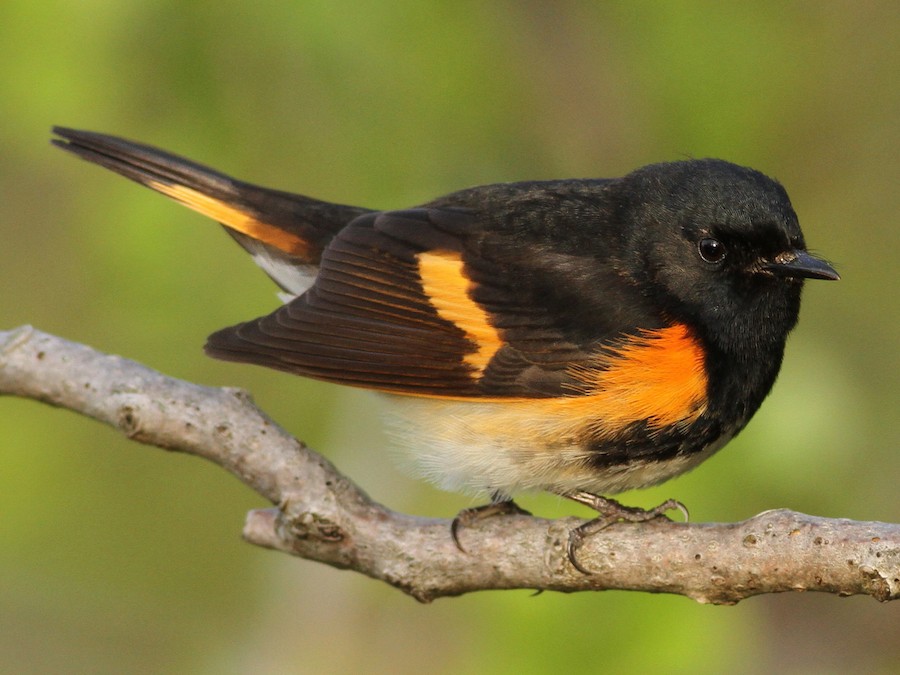
This page shows which locations in the selected region historically had the highest probability of a checklist including American Redstart in July. Because some locations may be undersampled, the results are sorted based on a confidence score which takes into account how many samples are available. The bar chart shows how the probability of observing this species varies over the year.
- Click on a month in the bar chart to switch to that month.
- Click on a location to view its top birds.
- Click here to view a map on eBird.
| Evidence | Sampling | Score | ||||||||
|---|---|---|---|---|---|---|---|---|---|---|
| # | Location | Dist | Media | Years | Birders | Hits | Lists | Freq | Conf | |
| 1 | Hempstead Harbor Shoreline Trail, May Newburger Cove | 19.8 | 0 | 3 | 3 | 4 | 5 | 80.0% | 37.6% | |
| 2 | Alley Pond Park | 14.0 | 1 | 11 | 14 | 44 | 95 | 46.3% | 36.6% | |
| 3 | Sandy Hook | 19.0 | 3 | 20 | 91 | 169 | 446 | 37.9% | 33.5% | |
| 4 | Hartshorne Woods | 22.4 | 3 | 11 | 18 | 21 | 48 | 43.8% | 30.7% | |
| 5 | Sands Point Preserve | 19.0 | 1 | 9 | 19 | 27 | 77 | 35.1% | 25.3% | |
| 6 | Alley Pond Park--Southern Woodlands | 14.0 | 0 | 2 | 2 | 4 | 8 | 50.0% | 21.5% | |
| 7 | Floyd Bennett Field--North Forty Preserve | 9.8 | 0 | 2 | 2 | 2 | 3 | 66.7% | 20.8% | |
| 8 | Sandy Hook--Scout Camp & Randolph Drive | 18.2 | 1 | 4 | 7 | 10 | 28 | 35.7% | 20.7% | |
| 9 | Staten Island Greenbelt--White Trail | 12.6 | 0 | 1 | 1 | 1 | 1 | 100.0% | 20.7% | |
| 10 | Canarsie Beach Park | 8.4 | 1 | 5 | 10 | 19 | 69 | 27.5% | 18.4% | |
| 11 | Dead Horse Point | 11.0 | 0 | 9 | 7 | 22 | 87 | 25.3% | 17.3% | |
| 12 | Weinberg Nature Center | 22.3 | 0 | 2 | 2 | 2 | 4 | 50.0% | 15.0% | |
| 13 | Sharrotts Pond | 16.9 | 0 | 1 | 18 | 19 | 88 | 21.6% | 14.3% | |
| 14 | Floyd Bennett Field--Ecology Village Area | 10.9 | 0 | 3 | 7 | 3 | 8 | 37.5% | 13.7% | |
| 15 | Great Kills Park--Crookes Point | 14.3 | 0 | 7 | 6 | 11 | 51 | 21.6% | 12.5% | |
| 16 | Sandy Hook--Platform & North Pond | 16.8 | 0 | 6 | 12 | 13 | 63 | 20.6% | 12.5% | |
| 17 | Kissena Park | 10.6 | 0 | 6 | 8 | 9 | 42 | 21.4% | 11.7% | |
| 18 | Sandy Hook--F Lot/Fishing Beach | 19.1 | 0 | 3 | 5 | 3 | 10 | 30.0% | 10.8% | |
| 19 | Mt. Loretto Unique Area | 18.0 | 0 | 8 | 14 | 19 | 125 | 15.2% | 10.0% | |
| 20 | Carteret Waterfront Park | 14.7 | 0 | 1 | 1 | 1 | 2 | 50.0% | 9.5% | |
| 21 | Sandy Hook--North End | 16.4 | 1 | 9 | 24 | 22 | 157 | 14.0% | 9.4% | |
| 22 | Dyker Beach Park | 7.1 | 0 | 1 | 1 | 7 | 40 | 17.5% | 8.7% | |
| 23 | Hempstead Lake SP | 19.2 | 0 | 6 | 9 | 11 | 73 | 15.1% | 8.6% | |
| 24 | Hempstead Lake SP--south end | 18.9 | 0 | 8 | 11 | 18 | 135 | 13.3% | 8.6% | |
| 25 | Sandy Hook--Horseshoe Cove area | 18.5 | 1 | 5 | 7 | 6 | 34 | 17.6% | 8.3% | |
| 26 | Watchung Reservation--Deserted Village and Fields | 20.3 | 0 | 2 | 2 | 2 | 7 | 28.6% | 8.2% | |
| 27 | Cunningham Park | 12.6 | 0 | 3 | 3 | 3 | 13 | 23.1% | 8.2% | |
| 28 | Jamaica Bay Wildlife Refuge | 11.6 | 2 | 22 | 80 | 118 | 1246 | 9.5% | 8.0% | |
| 29 | Great Swamp NWR | 23.9 | 0 | 10 | 14 | 22 | 189 | 11.6% | 7.8% | |
| 30 | Cemetery of the Resurrection--North Overlook | 17.6 | 0 | 4 | 1 | 14 | 109 | 12.8% | 7.8% | |
| 31 | Watchung Reservation | 19.7 | 0 | 4 | 4 | 7 | 46 | 15.2% | 7.6% | |
| 32 | Floyd Bennett Field | 10.3 | 1 | 11 | 11 | 31 | 298 | 10.4% | 7.4% | |
| 33 | Great Swamp Outdoor Education Center | 21.7 | 0 | 2 | 2 | 2 | 8 | 25.0% | 7.1% | |
| 34 | Jamaica Bay Wildlife Refuge--North Garden | 11.3 | 0 | 4 | 4 | 4 | 24 | 16.7% | 6.7% | |
| 35 | Fort Wadsworth | 8.3 | 0 | 5 | 3 | 7 | 52 | 13.5% | 6.7% | |
| 36 | Paerdegat Basin Natural Area and Ecology Park | 8.1 | 0 | 2 | 1 | 2 | 9 | 22.2% | 6.3% | |
| 37 | Cunningham Park Southeast Preserve | 12.4 | 0 | 1 | 1 | 2 | 9 | 22.2% | 6.3% | |
| 38 | Pelham Bay Park--Central Woodland | 14.6 | 0 | 1 | 1 | 1 | 3 | 33.3% | 6.1% | |
| 39 | Union Field Cemetery | 6.4 | 0 | 1 | 1 | 1 | 3 | 33.3% | 6.1% | |
| 40 | Ridgewood Reservoir | 6.5 | 1 | 3 | 4 | 4 | 28 | 14.3% | 5.7% | |
| 41 | Green-Wood Cemetery, Brooklyn | 4.4 | 1 | 6 | 32 | 45 | 636 | 7.1% | 5.3% | |
| 42 | Bayswater Point SP | 14.2 | 1 | 2 | 1 | 2 | 11 | 18.2% | 5.1% | |
| 43 | Guggenheim Preserve | 18.8 | 0 | 1 | 1 | 1 | 4 | 25.0% | 4.6% | |
| 44 | New York Institute of Technology | 22.0 | 0 | 1 | 1 | 1 | 4 | 25.0% | 4.6% | |
| 45 | Manorhaven Preserve and Nature Trail | 17.9 | 0 | 1 | 1 | 1 | 4 | 25.0% | 4.6% | |
| 46 | Sandy Hook--Atlantic Drive | 18.0 | 0 | 1 | 1 | 1 | 4 | 25.0% | 4.6% | |
| 47 | Sandy Hook--Spermaceti Cove area | 19.9 | 1 | 6 | 8 | 8 | 93 | 8.6% | 4.4% | |
| 48 | Pelham Bay Park--The Meadow and adj. woodland | 15.0 | 0 | 2 | 1 | 2 | 13 | 15.4% | 4.3% | |
| 49 | Alley Pond Park--Restoration Pond | 14.1 | 0 | 2 | 2 | 2 | 13 | 15.4% | 4.3% | |
| 50 | Queens County Farm Museum | 15.0 | 0 | 2 | 1 | 2 | 13 | 15.4% | 4.3% | |
| 51 | Oradell Reservoir and Emerson Woods | 17.7 | 0 | 4 | 5 | 4 | 38 | 10.5% | 4.2% | |
| 52 | Hartshorne Woods Park--Claypit Creek | 22.1 | 0 | 1 | 1 | 2 | 14 | 14.3% | 4.0% | |
| 53 | Fort Washington Park--S of GWB (Little Red Lighthouse-155th St.) | 9.4 | 1 | 1 | 1 | 3 | 27 | 11.1% | 3.9% | |
| 54 | Cemetery of the Resurrection--S entrance (maint. bldgs) | 17.5 | 0 | 1 | 1 | 8 | 108 | 7.4% | 3.8% | |
| 55 | Alley Pond Park--Little Alley Pond | 14.0 | 0 | 1 | 1 | 1 | 5 | 20.0% | 3.6% | |
| 56 | Old Mill Road, LaTourette Park | 12.4 | 0 | 1 | 1 | 1 | 5 | 20.0% | 3.6% | |
| 57 | Ridge Road Park | 23.6 | 0 | 1 | 1 | 1 | 5 | 20.0% | 3.6% | |
| 58 | Jamaica Bay Wildlife Refuge--West Pond | 11.3 | 3 | 12 | 24 | 29 | 602 | 4.8% | 3.4% | |
| 59 | Van Cortlandt Park | 14.2 | 0 | 3 | 2 | 4 | 47 | 8.5% | 3.4% | |
| 60 | Flushing Airport | 10.0 | 0 | 2 | 2 | 2 | 18 | 11.1% | 3.1% | |
| 61 | Pelham Bay Park--Thomas Pell WS and Goose Creek Marsh | 15.0 | 0 | 2 | 4 | 3 | 34 | 8.8% | 3.0% | |
| 62 | 5th Avenue Wetlands, Hackensack River | 24.6 | 0 | 1 | 1 | 3 | 34 | 8.8% | 3.0% | |
| 63 | Rutgers University Newark Campus | 9.1 | 0 | 1 | 1 | 4 | 52 | 7.7% | 3.0% | |
| 64 | Central Park--The Ramble | 4.7 | 0 | 10 | 18 | 22 | 518 | 4.2% | 2.8% | |
| 65 | Valley Stream SP | 16.6 | 0 | 1 | 1 | 1 | 7 | 14.3% | 2.6% | |
| 66 | Mariners Marsh | 10.3 | 0 | 1 | 1 | 1 | 7 | 14.3% | 2.6% | |
| 67 | Irvington Woods | 23.8 | 0 | 1 | 1 | 1 | 7 | 14.3% | 2.6% | |
| 68 | Fairview Park | 17.2 | 0 | 1 | 1 | 1 | 7 | 14.3% | 2.6% | |
| 69 | Alley Pond Park--Restoration Area | 14.0 | 0 | 1 | 1 | 1 | 7 | 14.3% | 2.6% | |
| 70 | Demarest Nature Center | 17.3 | 1 | 1 | 1 | 2 | 23 | 8.7% | 2.4% | |
| 71 | Jamaica Bay Wildlife Refuge--East Pond | 11.5 | 0 | 10 | 30 | 22 | 605 | 3.6% | 2.4% | |
| 72 | Liberty SP | 2.4 | 0 | 7 | 7 | 14 | 360 | 3.9% | 2.3% | |
| 73 | Great Kills Park | 13.0 | 0 | 6 | 5 | 8 | 180 | 4.4% | 2.3% | |
| 74 | Goffle Brook Park | 17.9 | 0 | 1 | 1 | 1 | 8 | 12.5% | 2.2% | |
| 75 | Sandy Hook--E & D Lot Beaches | 19.7 | 0 | 2 | 2 | 2 | 25 | 8.0% | 2.2% | |
| 76 | Rockaway Beach--Edgemere (Beach 32nd-56th St.) | 14.8 | 0 | 2 | 1 | 3 | 49 | 6.1% | 2.1% | |
| 77 | Hillside Woods & Children's Village | 20.7 | 0 | 1 | 1 | 3 | 49 | 6.1% | 2.1% | |
| 78 | Bayshore Waterfront Park | 19.5 | 0 | 2 | 2 | 4 | 75 | 5.3% | 2.1% | |
| 79 | Twin Lakes Park, Eastchester | 19.4 | 1 | 1 | 1 | 1 | 9 | 11.1% | 2.0% | |
| 80 | McGuire Fields | 8.5 | 0 | 1 | 1 | 1 | 9 | 11.1% | 2.0% | |
| 81 | Clove Lakes Park | 8.6 | 0 | 8 | 2 | 10 | 280 | 3.6% | 2.0% | |
| 82 | Jamaica Bay Wildlife Refuge--Big Johns Pond | 11.5 | 0 | 3 | 7 | 4 | 81 | 4.9% | 1.9% | |
| 83 | McGolrick Park | 3.4 | 0 | 1 | 5 | 5 | 112 | 4.5% | 1.9% | |
| 84 | Prospect Park | 4.2 | 3 | 10 | 26 | 34 | 1278 | 2.7% | 1.9% | |
| 85 | Pelham Bay Park | 14.8 | 0 | 3 | 4 | 5 | 113 | 4.4% | 1.9% | |
| 86 | Flushing Meadows Corona Park--Willow Lake | 9.1 | 0 | 2 | 2 | 2 | 30 | 6.7% | 1.8% | |
| 87 | Jamaica Bay Wildlife Refuge--East Pond, north end | 11.1 | 0 | 3 | 9 | 9 | 261 | 3.4% | 1.8% | |
| 88 | Central Park--North End | 6.2 | 0 | 5 | 4 | 5 | 119 | 4.2% | 1.8% | |
| 89 | Oceanic Bridge--north end | 22.7 | 0 | 1 | 1 | 1 | 10 | 10.0% | 1.8% | |
| 90 | Crescent Beach Park | 14.4 | 0 | 1 | 1 | 1 | 10 | 10.0% | 1.8% | |
| 91 | Christopher Morley County Park | 18.7 | 0 | 1 | 1 | 1 | 10 | 10.0% | 1.8% | |
| 92 | Cemetery of the Resurrection--Perpendicular Pond | 17.5 | 0 | 6 | 1 | 12 | 404 | 3.0% | 1.7% | |
| 93 | Oakwood Beach--tidal marshes, NW to Mill Rd. | 12.7 | 0 | 3 | 3 | 5 | 129 | 3.9% | 1.7% | |
| 94 | Van Cortlandt Park--NW Forest | 14.5 | 0 | 1 | 1 | 1 | 11 | 9.1% | 1.6% | |
| 95 | Ocean Breeze Park | 9.6 | 0 | 1 | 1 | 1 | 11 | 9.1% | 1.6% | |
| 96 | Hudson River Waterfront Walk | 3.6 | 1 | 1 | 1 | 1 | 12 | 8.3% | 1.5% | |
| 97 | Meadowlands IBA--Losen Slote Creek Park | 8.8 | 0 | 1 | 1 | 1 | 12 | 8.3% | 1.5% | |
| 98 | Cemetery of the Resurrection--North Pond | 17.4 | 0 | 1 | 1 | 3 | 70 | 4.3% | 1.5% | |
| 99 | Pelham Bay Park--The Lagoon | 15.5 | 0 | 2 | 2 | 2 | 40 | 5.0% | 1.4% | |
| 100 | Otter Creek Preserve | 22.0 | 0 | 1 | 1 | 1 | 13 | 7.7% | 1.4% | |
| 101 | Middle Village Cemetery | 6.4 | 0 | 1 | 1 | 1 | 13 | 7.7% | 1.4% | |
| 102 | Brooklyn Botanic Garden | 3.9 | 0 | 3 | 4 | 6 | 210 | 2.9% | 1.3% | |
| 103 | Central Park | 4.3 | 0 | 12 | 16 | 18 | 884 | 2.0% | 1.3% | |
| 104 | Van Cortlandt Park--VC Lake and Vault Hill | 13.9 | 1 | 1 | 1 | 1 | 14 | 7.1% | 1.3% | |
| 105 | Pelham Bay Park--Bartow-Pell Mansion | 15.1 | 0 | 1 | 1 | 1 | 14 | 7.1% | 1.3% | |
| 106 | Tibbetts Brook Park | 15.9 | 0 | 1 | 1 | 1 | 14 | 7.1% | 1.3% | |
| 107 | Jamaica Bay Wildlife Refuge--South Garden | 11.6 | 0 | 2 | 2 | 2 | 44 | 4.5% | 1.3% | |
| 108 | Sandy Hook--Lighthouse & bike path | 17.4 | 0 | 1 | 1 | 1 | 15 | 6.7% | 1.2% | |
| 109 | Palisades Park IBA--Alpine Section | 16.2 | 0 | 1 | 1 | 1 | 15 | 6.7% | 1.2% | |
| 110 | Udalls Cove Park Preserve | 14.4 | 0 | 1 | 1 | 1 | 15 | 6.7% | 1.2% | |
| 111 | Central Park--The Pool | 6.0 | 0 | 2 | 4 | 4 | 139 | 2.9% | 1.1% | |
| 112 | Flat Rock Brook Nature Center | 11.4 | 0 | 1 | 1 | 1 | 16 | 6.2% | 1.1% | |
| 113 | Old Westbury Gardens | 21.9 | 0 | 1 | 1 | 1 | 16 | 6.2% | 1.1% | |
| 114 | Pelham Bay Park--Orchard Beach & parking lot | 15.3 | 0 | 2 | 2 | 2 | 52 | 3.8% | 1.1% | |
| 115 | Forest Park--Strack Pond | 8.0 | 0 | 1 | 1 | 1 | 17 | 5.9% | 1.0% | |
| 116 | Marshlands Conservancy | 22.9 | 0 | 6 | 10 | 10 | 528 | 1.9% | 1.0% | |
| 117 | Governors Island (reopening Spring 2021) | 1.9 | 2 | 5 | 10 | 9 | 462 | 1.9% | 1.0% | |
| 118 | The Celery Farm | 23.1 | 0 | 7 | 7 | 10 | 536 | 1.9% | 1.0% | |
| 119 | Crocheron Park | 13.1 | 1 | 1 | 1 | 1 | 18 | 5.6% | 1.0% | |
| 120 | Shore Road Park | 6.6 | 0 | 1 | 1 | 1 | 18 | 5.6% | 1.0% | |
| 121 | Woodlawn Cemetery | 14.0 | 0 | 1 | 2 | 1 | 18 | 5.6% | 1.0% | |
| 122 | Fort Washington Park--Dyckman St. Boat Marina | 11.4 | 0 | 1 | 1 | 1 | 18 | 5.6% | 1.0% | |
| 123 | Jay Estate | 23.0 | 0 | 1 | 1 | 1 | 18 | 5.6% | 1.0% | |
| 124 | Salt Marsh Nature Center at Marine Park--Southwest | 9.4 | 0 | 2 | 1 | 2 | 59 | 3.4% | 0.9% | |
| 125 | River Rd. marshes and RR tracks | 11.9 | 0 | 1 | 2 | 2 | 62 | 3.2% | 0.9% | |
| 126 | Sandy Hook--Lot I, Proving Grounds, and North Beach Pavillion | 17.1 | 0 | 1 | 1 | 1 | 20 | 5.0% | 0.9% | |
| 127 | Saddle River County Park | 14.4 | 0 | 1 | 1 | 1 | 20 | 5.0% | 0.9% | |
| 128 | Tanglewood Preserve | 18.5 | 0 | 1 | 1 | 1 | 21 | 4.8% | 0.8% | |
| 129 | Central Park--Shakespeare Garden | 4.9 | 0 | 1 | 1 | 1 | 23 | 4.3% | 0.8% | |
| 130 | North Mt. Loretto SF--Sand Pits (Turtle Nesting Area) | 17.6 | 0 | 1 | 1 | 1 | 24 | 4.2% | 0.7% | |
| 131 | Idlewild Park | 13.8 | 0 | 1 | 1 | 1 | 24 | 4.2% | 0.7% | |
| 132 | Calvert Vaux Park (Dreier-Offerman Park) | 9.0 | 0 | 3 | 5 | 4 | 212 | 1.9% | 0.7% | |
| 133 | Conference House Park | 19.7 | 0 | 2 | 2 | 2 | 80 | 2.5% | 0.7% | |
| 134 | Prospect Point | 18.8 | 0 | 1 | 1 | 1 | 26 | 3.8% | 0.7% | |
| 135 | Kings Point Park | 15.1 | 0 | 1 | 1 | 1 | 26 | 3.8% | 0.7% | |
| 136 | Garvies Point Preserve | 21.1 | 0 | 1 | 1 | 1 | 27 | 3.7% | 0.7% | |
| 137 | Jamaica Bay, Big Egg Marsh | 12.5 | 0 | 1 | 1 | 1 | 27 | 3.7% | 0.7% | |
| 138 | Highbridge Park--S of Alexander Hamilton Bridge | 9.4 | 0 | 1 | 1 | 1 | 27 | 3.7% | 0.7% | |
| 139 | Liberty SP--Tidal Bay | 3.4 | 0 | 1 | 1 | 1 | 27 | 3.7% | 0.7% | |
| 140 | Sandy Hook--Salt Marsh | 18.3 | 0 | 1 | 1 | 1 | 28 | 3.6% | 0.6% | |
| 141 | McFaul Environmental Center | 21.7 | 0 | 1 | 1 | 1 | 28 | 3.6% | 0.6% | |
| 142 | Frelinghuysen Arboretum | 24.3 | 0 | 1 | 1 | 1 | 29 | 3.4% | 0.6% | |
| 143 | Lincoln Park West | 4.5 | 1 | 1 | 1 | 1 | 29 | 3.4% | 0.6% | |
| 144 | Fort Totten Park | 13.2 | 0 | 1 | 2 | 1 | 29 | 3.4% | 0.6% | |
| 145 | Great Kills Park--Mudflats | 13.0 | 0 | 3 | 3 | 3 | 169 | 1.8% | 0.6% | |
| 146 | Loantaka Brook Reservation | 23.9 | 0 | 2 | 2 | 3 | 170 | 1.8% | 0.6% | |
| 147 | Oakwood Beach | 12.4 | 0 | 1 | 2 | 1 | 30 | 3.3% | 0.6% | |
| 148 | Troy Meadows Natural Area | 21.1 | 0 | 1 | 2 | 2 | 94 | 2.1% | 0.6% | |
| 149 | Silver Lake Park (Richmond Co.) | 7.6 | 0 | 1 | 1 | 1 | 31 | 3.2% | 0.6% | |
| 150 | Flushing Meadows Corona Park--Meridian Rd. Circle (Museum, Unisphere etc.) | 8.9 | 0 | 1 | 2 | 1 | 31 | 3.2% | 0.6% | |
| 151 | Tenafly Nature Center | 14.8 | 0 | 1 | 1 | 1 | 33 | 3.0% | 0.5% | |
| 152 | Hilltop Reservation | 15.8 | 1 | 1 | 1 | 1 | 33 | 3.0% | 0.5% | |
| 153 | Essex County Riverfront Park in Newark | 7.4 | 0 | 1 | 1 | 1 | 33 | 3.0% | 0.5% | |
| 154 | Central Park--Strawberry Field | 4.6 | 0 | 1 | 1 | 1 | 34 | 2.9% | 0.5% | |
| 155 | Sheldrake Lake (Larchmont Reservoir) | 20.5 | 0 | 1 | 1 | 1 | 34 | 2.9% | 0.5% | |
| 156 | Alonzo F. Bonsal Wildlife Preserve | 13.4 | 0 | 1 | 1 | 1 | 34 | 2.9% | 0.5% | |
| 157 | The Landing, Dobbs Ferry | 22.1 | 0 | 2 | 1 | 2 | 108 | 1.9% | 0.5% | |
| 158 | Udall's Mill Pond | 14.7 | 0 | 1 | 1 | 1 | 35 | 2.9% | 0.5% | |
| 159 | Jamaica Bay Wildlife Refuge--East Pond, south end | 11.7 | 0 | 4 | 12 | 4 | 312 | 1.3% | 0.5% | |
| 160 | Flushing Meadows Corona Park | 8.8 | 0 | 1 | 1 | 1 | 37 | 2.7% | 0.5% | |
| 161 | Coney Island Creek Park | 9.2 | 0 | 1 | 1 | 1 | 37 | 2.7% | 0.5% | |
| 162 | Hempstead Lake SP--north end | 19.3 | 0 | 1 | 1 | 1 | 38 | 2.6% | 0.5% | |
| 163 | Central Park--The Ravine (incl. The Loch) | 6.1 | 0 | 1 | 2 | 2 | 124 | 1.6% | 0.4% | |
| 164 | Old Place Creek--Kayak Access Site | 11.0 | 0 | 1 | 2 | 1 | 43 | 2.3% | 0.4% | |
| 165 | Central Park--The Pond and Hallett Sanctuary | 4.0 | 1 | 3 | 3 | 3 | 263 | 1.1% | 0.4% | |
| 166 | Jamaica Bay, North Channel Bridge | 10.5 | 0 | 1 | 1 | 1 | 46 | 2.2% | 0.4% | |
| 167 | Fort Tilden | 12.3 | 0 | 2 | 2 | 2 | 143 | 1.4% | 0.4% | |
| 168 | Prospect Park--Vale of Cashmere | 3.7 | 0 | 1 | 1 | 1 | 47 | 2.1% | 0.4% | |
| 169 | West Essex Wetlands, Livingston, New Jersey, US (40.808, -74.344) | 18.9 | 0 | 1 | 1 | 1 | 48 | 2.1% | 0.4% | |
| 170 | Alley Pond Park--Oakland Lake | 13.3 | 0 | 1 | 2 | 2 | 155 | 1.3% | 0.4% | |
| 171 | Randalls Island | 6.8 | 1 | 2 | 2 | 2 | 158 | 1.3% | 0.3% | |
| 172 | Lemon Creek Pier | 17.7 | 0 | 1 | 1 | 1 | 51 | 2.0% | 0.3% | |
| 173 | New York Botanical Garden | 12.3 | 0 | 2 | 2 | 2 | 164 | 1.2% | 0.3% | |
| 174 | Lido Beach Passive Nature Area | 23.1 | 0 | 3 | 3 | 3 | 305 | 1.0% | 0.3% | |
| 175 | Bryant Park | 3.0 | 0 | 1 | 1 | 2 | 176 | 1.1% | 0.3% | |
| 176 | Lenoir Preserve | 19.2 | 0 | 1 | 1 | 1 | 58 | 1.7% | 0.3% | |
| 177 | New Creek Watershed, Olympia Blvd. bridge | 10.3 | 0 | 1 | 1 | 1 | 60 | 1.7% | 0.3% | |
| 178 | Hatfield Swamp IBA--Great Piece Meadow | 20.6 | 0 | 1 | 1 | 1 | 61 | 1.6% | 0.3% | |
| 179 | Walker Avenue Wetlands | 20.7 | 0 | 2 | 2 | 2 | 206 | 1.0% | 0.3% | |
| 180 | Meadowlands District IBA | 7.6 | 0 | 1 | 1 | 1 | 69 | 1.4% | 0.3% | |
| 181 | Linden Hawk Rise Sanctuary | 14.8 | 0 | 1 | 2 | 2 | 227 | 0.9% | 0.2% | |
| 182 | Jacob Riis Park | 12.3 | 0 | 1 | 1 | 1 | 74 | 1.4% | 0.2% | |
| 183 | Bronx Zoo | 11.6 | 0 | 2 | 1 | 2 | 232 | 0.9% | 0.2% | |
| 184 | Cheesequake State Park | 23.6 | 0 | 1 | 1 | 1 | 81 | 1.2% | 0.2% | |
| 185 | Alley Pond Park--Environmental Center | 13.6 | 0 | 1 | 1 | 1 | 86 | 1.2% | 0.2% | |
| 186 | Marciante-Jackson-Millet Park | 9.9 | 1 | 1 | 1 | 1 | 93 | 1.1% | 0.2% | |
| 187 | Hillview Reservoir (restricted access) | 15.4 | 0 | 1 | 2 | 1 | 97 | 1.0% | 0.2% | |
| 188 | Richard A. Rutkowski Park | 5.8 | 0 | 1 | 1 | 1 | 102 | 1.0% | 0.2% | |
| 189 | Prospect Park--Prospect Lake | 4.5 | 0 | 1 | 1 | 1 | 105 | 1.0% | 0.2% | |
| 190 | Pelham Bay Park--Turtle Cove | 14.7 | 0 | 1 | 1 | 1 | 105 | 1.0% | 0.2% | |
| 191 | Hatfield Swamp IBA--West Essex Park | 18.2 | 0 | 1 | 1 | 1 | 108 | 0.9% | 0.2% | |
| 192 | Cemetery of the Resurrection--scrub W of maint. bldgs | 17.6 | 0 | 1 | 1 | 1 | 110 | 0.9% | 0.2% | |
| 193 | River Barge Park | 7.0 | 0 | 1 | 1 | 1 | 119 | 0.8% | 0.1% | |
| 194 | Richard W. DeKorte Park | 6.9 | 0 | 4 | 4 | 5 | 1597 | 0.3% | 0.1% | |
| 195 | Commerce Road Wetlands | 19.8 | 0 | 1 | 1 | 1 | 148 | 0.7% | 0.1% | |
| 196 | Salt Marsh Nature Center at Marine Park | 9.1 | 0 | 2 | 6 | 2 | 575 | 0.3% | 0.1% | |
| 197 | Central Park--Reservoir | 5.5 | 0 | 1 | 1 | 1 | 197 | 0.5% | 0.1% | |
| 198 | Central Park--Turtle Pond | 4.9 | 0 | 1 | 1 | 1 | 210 | 0.5% | 0.1% | |
| 199 | Inwood Hill Park | 11.7 | 0 | 2 | 2 | 2 | 700 | 0.3% | 0.1% | |
| 200 | Wagner College | 8.3 | 0 | 1 | 1 | 1 | 233 | 0.4% | 0.1% | |
| 201 | Breezy Point Tip | 11.9 | 1 | 1 | 1 | 1 | 235 | 0.4% | 0.1% | |
| 202 | Cemetery of the Resurrection--N entrance | 17.3 | 0 | 1 | 1 | 1 | 254 | 0.4% | 0.1% | |
| 203 | Meadowlands IBA--Mill Creek Marsh | 6.1 | 0 | 1 | 1 | 1 | 347 | 0.3% | 0.1% | |
| 204 | Brooklyn Bridge Park | 1.1 | 1 | 1 | 1 | 1 | 461 | 0.2% | 0.0% | |
| 205 | Oceanside Marine Nature Study Area | 21.0 | 0 | 1 | 1 | 1 | 1322 | 0.1% | 0.0% | |