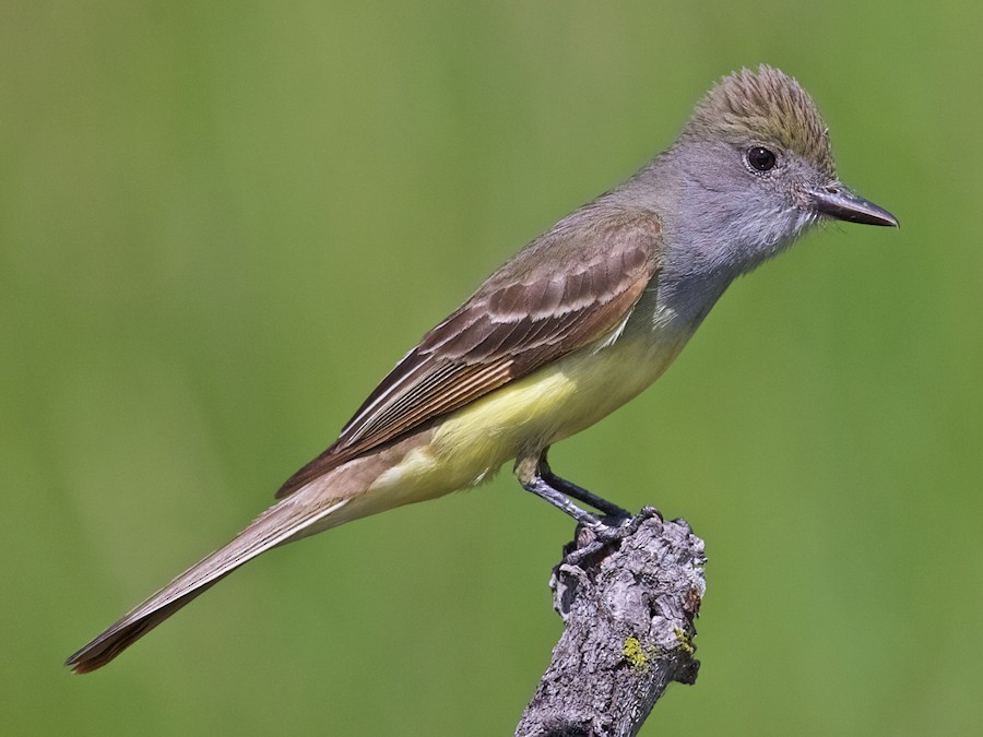
Where to find Great Crested Flycatcher in July
within 25 miles of New York City, United States
This page shows which locations in the selected region historically had the highest probability of a checklist including Great Crested Flycatcher in July. Because some locations may be undersampled, the results are sorted based on a confidence score which takes into account how many samples are available. The bar chart shows how the probability of observing this species varies over the year.
- Click on a month in the bar chart to switch to that month.
- Click on a location to view its top birds.
- Click here to view a map on eBird.
| Evidence | Sampling | Score | ||||||||
|---|---|---|---|---|---|---|---|---|---|---|
| # | Location | Dist | Media | Years | Birders | Hits | Lists | Freq | Conf | |
| 1 | North Mt. Loretto SF--Reed Marsh | 17.6 | 0 | 5 | 1 | 47 | 54 | 87.0% | 75.6% | |
| 2 | Cemetery of the Resurrection--North Overlook | 17.6 | 0 | 5 | 2 | 77 | 109 | 70.6% | 61.5% | |
| 3 | North Mt. Loretto SF--Snag Swamp | 17.8 | 0 | 6 | 1 | 31 | 48 | 64.6% | 50.4% | |
| 4 | West Essex Wetlands, Livingston, New Jersey, US (40.808, -74.344) | 18.9 | 1 | 4 | 13 | 31 | 48 | 64.6% | 50.4% | |
| 5 | West Essex Wetlands | 18.9 | 0 | 3 | 3 | 11 | 15 | 73.3% | 48.0% | |
| 6 | Hatfield Swamp IBA--West Essex Park | 18.2 | 1 | 11 | 7 | 60 | 108 | 55.6% | 46.2% | |
| 7 | Passaic River Park (Union) | 22.1 | 0 | 5 | 2 | 14 | 21 | 66.7% | 45.4% | |
| 8 | Hempstead Lake SP--south end | 18.9 | 0 | 13 | 15 | 67 | 135 | 49.6% | 41.3% | |
| 9 | North Mt. Loretto SF | 17.9 | 0 | 3 | 3 | 9 | 15 | 60.0% | 35.7% | |
| 10 | Great Swamp NWR | 23.9 | 2 | 18 | 52 | 74 | 189 | 39.2% | 32.5% | |
| 11 | Hempstead Lake SP | 19.2 | 0 | 12 | 15 | 30 | 73 | 41.1% | 30.5% | |
| 12 | Walker Avenue Wetlands | 20.7 | 0 | 13 | 29 | 74 | 206 | 35.9% | 29.7% | |
| 13 | Goodhue Park | 7.2 | 0 | 5 | 1 | 33 | 84 | 39.3% | 29.5% | |
| 14 | Lincoln Park Gravel Pits | 21.5 | 0 | 7 | 8 | 19 | 45 | 42.2% | 29.0% | |
| 15 | Watchung Reservation | 19.7 | 0 | 8 | 11 | 19 | 46 | 41.3% | 28.3% | |
| 16 | Ernest L. Oros Wildlife Preserve | 16.1 | 0 | 9 | 21 | 24 | 64 | 37.5% | 26.7% | |
| 17 | Cemetery of the Resurrection | 17.4 | 0 | 4 | 2 | 20 | 53 | 37.7% | 25.9% | |
| 18 | Passaic River County Park (Morris) | 22.6 | 0 | 4 | 3 | 6 | 12 | 50.0% | 25.4% | |
| 19 | Loantaka Brook Reservation | 23.9 | 0 | 10 | 9 | 54 | 170 | 31.8% | 25.2% | |
| 20 | Troy Meadows Natural Area | 21.1 | 2 | 11 | 17 | 29 | 94 | 30.9% | 22.4% | |
| 21 | Garret Mountain Reservation (Park) | 15.7 | 2 | 10 | 15 | 50 | 175 | 28.6% | 22.4% | |
| 22 | Clay Pit Ponds | 17.0 | 0 | 2 | 5 | 4 | 8 | 50.0% | 21.5% | |
| 23 | Troy Meadows Natural Area--So. Beverwyck Rd/Patriots Path | 21.6 | 0 | 5 | 4 | 6 | 14 | 42.9% | 21.4% | |
| 24 | Palisades Park IBA | 13.3 | 0 | 1 | 2 | 2 | 3 | 66.7% | 20.8% | |
| 25 | Taylor Lake | 17.5 | 0 | 1 | 1 | 2 | 3 | 66.7% | 20.8% | |
| 26 | Morgan Memorial Park | 21.2 | 0 | 1 | 1 | 1 | 1 | 100.0% | 20.7% | |
| 27 | Montclair Hawk Watch | 14.2 | 0 | 1 | 1 | 1 | 1 | 100.0% | 20.7% | |
| 28 | Darwin James Preserve (private) | 21.6 | 0 | 1 | 2 | 1 | 1 | 100.0% | 20.7% | |
| 29 | Coffin Woods Preserve | 24.7 | 0 | 1 | 1 | 1 | 1 | 100.0% | 20.7% | |
| 30 | Great Piece Meadows North - Morris | 21.0 | 0 | 1 | 1 | 1 | 1 | 100.0% | 20.7% | |
| 31 | Rock Spring Golf Club | 14.0 | 0 | 1 | 1 | 1 | 1 | 100.0% | 20.7% | |
| 32 | Green-Wood Cemetery, Brooklyn | 4.4 | 19 | 7 | 61 | 151 | 636 | 23.7% | 20.6% | |
| 33 | Hilltop Reservation | 15.8 | 2 | 6 | 10 | 11 | 33 | 33.3% | 19.8% | |
| 34 | Hillside Woods & Children's Village | 20.7 | 1 | 4 | 7 | 15 | 49 | 30.6% | 19.5% | |
| 35 | Conference House Park | 19.7 | 1 | 8 | 38 | 22 | 80 | 27.5% | 18.9% | |
| 36 | Florham Park--Fish Tract | 19.8 | 0 | 1 | 1 | 4 | 9 | 44.4% | 18.9% | |
| 37 | Essex County Environmental Center | 18.7 | 0 | 2 | 3 | 3 | 6 | 50.0% | 18.8% | |
| 38 | Cemetery of the Resurrection--scrub W of maint. bldgs | 17.6 | 0 | 4 | 2 | 28 | 110 | 25.5% | 18.2% | |
| 39 | Blue Heron Park | 15.6 | 0 | 4 | 4 | 7 | 20 | 35.0% | 18.1% | |
| 40 | Marshlands Conservancy | 22.9 | 4 | 14 | 72 | 111 | 528 | 21.0% | 17.8% | |
| 41 | Palisades Park IBA--Green Brook Sanctuary | 14.6 | 2 | 7 | 6 | 15 | 54 | 27.8% | 17.6% | |
| 42 | Tenafly Nature Center | 14.8 | 0 | 5 | 8 | 10 | 33 | 30.3% | 17.4% | |
| 43 | Sandy Hook | 19.0 | 2 | 17 | 41 | 90 | 446 | 20.2% | 16.7% | |
| 44 | Woodlawn Cemetery | 14.0 | 1 | 1 | 1 | 6 | 18 | 33.3% | 16.3% | |
| 45 | Irvington Woods | 23.8 | 0 | 2 | 3 | 3 | 7 | 42.9% | 15.8% | |
| 46 | Watchung Reservation--Lake Surprise | 19.1 | 1 | 2 | 3 | 3 | 7 | 42.9% | 15.8% | |
| 47 | Van Cortlandt Park--NW Forest | 14.5 | 0 | 2 | 2 | 4 | 11 | 36.4% | 15.2% | |
| 48 | Passaic River South Orange Ave Boat Launch Livingston | 19.5 | 0 | 4 | 2 | 4 | 11 | 36.4% | 15.2% | |
| 49 | Tackamac Park | 24.3 | 0 | 2 | 1 | 2 | 4 | 50.0% | 15.0% | |
| 50 | Clay Pit Ponds State Park Preserve--The Gericke/Winant Farm | 16.4 | 0 | 2 | 2 | 2 | 4 | 50.0% | 15.0% | |
| 51 | North Mt. Loretto SF--Sand Pits (Turtle Nesting Area) | 17.6 | 0 | 2 | 1 | 7 | 24 | 29.2% | 14.9% | |
| 52 | Mt. Loretto Unique Area | 18.0 | 2 | 9 | 34 | 25 | 125 | 20.0% | 13.9% | |
| 53 | Clove Lakes Park | 8.6 | 0 | 15 | 5 | 50 | 280 | 17.9% | 13.8% | |
| 54 | William Cullen Bryant Preserve | 20.2 | 0 | 2 | 2 | 3 | 8 | 37.5% | 13.7% | |
| 55 | Commerce Road Wetlands | 19.8 | 0 | 5 | 9 | 28 | 148 | 18.9% | 13.4% | |
| 56 | Sharrotts Pond | 16.9 | 1 | 3 | 12 | 18 | 88 | 20.5% | 13.3% | |
| 57 | South Mountain Reservation | 15.5 | 0 | 8 | 8 | 16 | 80 | 20.0% | 12.7% | |
| 58 | Pelham Bay Park--The Meadow and adj. woodland | 15.0 | 0 | 4 | 2 | 4 | 13 | 30.8% | 12.7% | |
| 59 | Pelham Bay Park--Thomas Pell WS and Goose Creek Marsh | 15.0 | 0 | 5 | 10 | 8 | 34 | 23.5% | 12.4% | |
| 60 | 5th Avenue Wetlands, Hackensack River | 24.6 | 0 | 2 | 2 | 8 | 34 | 23.5% | 12.4% | |
| 61 | Old Troy County Park | 22.3 | 0 | 3 | 3 | 6 | 24 | 25.0% | 12.0% | |
| 62 | High Rock Park | 10.9 | 0 | 5 | 4 | 7 | 30 | 23.3% | 11.8% | |
| 63 | Ash Brook Reservation | 19.7 | 1 | 2 | 2 | 2 | 5 | 40.0% | 11.8% | |
| 64 | Old Mill Road, LaTourette Park | 12.4 | 0 | 1 | 1 | 2 | 5 | 40.0% | 11.8% | |
| 65 | Hatfield Swamp IBA--Great Piece Meadow | 20.6 | 0 | 4 | 12 | 12 | 61 | 19.7% | 11.6% | |
| 66 | Alley Pond Park | 14.0 | 2 | 9 | 11 | 17 | 95 | 17.9% | 11.5% | |
| 67 | Kings Point Park | 15.1 | 0 | 5 | 2 | 6 | 26 | 23.1% | 11.0% | |
| 68 | Linden Hawk Rise Sanctuary | 14.8 | 0 | 11 | 17 | 34 | 227 | 15.0% | 10.9% | |
| 69 | Garvies Point Preserve | 21.1 | 0 | 3 | 4 | 6 | 27 | 22.2% | 10.6% | |
| 70 | Teaneck Creek Conservancy | 11.1 | 0 | 3 | 8 | 15 | 91 | 16.5% | 10.3% | |
| 71 | Raritan Center (Restricted Access) | 23.0 | 0 | 2 | 2 | 2 | 6 | 33.3% | 9.7% | |
| 72 | Lenoir Preserve | 19.2 | 0 | 6 | 4 | 10 | 58 | 17.2% | 9.6% | |
| 73 | Malfitano Park | 23.5 | 0 | 2 | 3 | 4 | 17 | 23.5% | 9.6% | |
| 74 | Natco Park | 20.8 | 0 | 1 | 1 | 1 | 2 | 50.0% | 9.5% | |
| 75 | Ellis Rd., waterfront (Richmond Co.) | 17.3 | 0 | 1 | 1 | 1 | 2 | 50.0% | 9.5% | |
| 76 | Mountainside Park | 24.5 | 0 | 1 | 1 | 1 | 2 | 50.0% | 9.5% | |
| 77 | Blue Heron Park--Butterfly Pond | 15.3 | 0 | 1 | 1 | 1 | 2 | 50.0% | 9.5% | |
| 78 | Lenape Park--Pond | 16.9 | 0 | 1 | 1 | 1 | 2 | 50.0% | 9.5% | |
| 79 | Seidenburg Park (aka Evergreen Park) | 13.1 | 0 | 1 | 1 | 1 | 2 | 50.0% | 9.5% | |
| 80 | Blauvelt State Park | 24.9 | 0 | 1 | 1 | 1 | 2 | 50.0% | 9.5% | |
| 81 | Deere Park | 9.2 | 1 | 1 | 1 | 1 | 2 | 50.0% | 9.5% | |
| 82 | Veterans Park (Hazlet) | 21.9 | 0 | 1 | 1 | 1 | 2 | 50.0% | 9.5% | |
| 83 | Troy Meadows--Alan Dr. access, gas-line trails and deer exclosure | 21.9 | 0 | 1 | 1 | 1 | 2 | 50.0% | 9.5% | |
| 84 | Short Hills Ponds | 16.7 | 0 | 1 | 1 | 1 | 2 | 50.0% | 9.5% | |
| 85 | Central Park--The Ramble | 4.7 | 5 | 13 | 39 | 62 | 518 | 12.0% | 9.4% | |
| 86 | Dismal Swamp | 22.9 | 0 | 3 | 3 | 3 | 12 | 25.0% | 8.9% | |
| 87 | Cheesequake State Park | 23.6 | 0 | 8 | 10 | 12 | 81 | 14.8% | 8.7% | |
| 88 | Lenape Park | 16.4 | 0 | 7 | 5 | 9 | 59 | 15.3% | 8.2% | |
| 89 | Bloomingdale Park | 16.6 | 0 | 1 | 3 | 2 | 7 | 28.6% | 8.2% | |
| 90 | White's Pond | 21.8 | 0 | 2 | 2 | 2 | 7 | 28.6% | 8.2% | |
| 91 | Tanglewood Preserve | 18.5 | 0 | 2 | 1 | 4 | 21 | 19.0% | 7.7% | |
| 92 | Hempstead Lake SP--north end | 19.3 | 0 | 4 | 7 | 6 | 38 | 15.8% | 7.4% | |
| 93 | Tallman Mountain SP | 22.1 | 0 | 5 | 6 | 5 | 30 | 16.7% | 7.3% | |
| 94 | Hartshorne Woods | 22.4 | 0 | 5 | 8 | 7 | 48 | 14.6% | 7.2% | |
| 95 | Great Swamp Outdoor Education Center | 21.7 | 0 | 2 | 2 | 2 | 8 | 25.0% | 7.1% | |
| 96 | Alley Pond Park--Southern Woodlands | 14.0 | 0 | 1 | 1 | 2 | 8 | 25.0% | 7.1% | |
| 97 | Natco Lake | 20.5 | 0 | 2 | 2 | 3 | 15 | 20.0% | 7.0% | |
| 98 | Prospect Park | 4.2 | 6 | 15 | 59 | 106 | 1278 | 8.3% | 6.9% | |
| 99 | Pelham Bay Park--Hunter Island | 15.9 | 0 | 3 | 4 | 4 | 24 | 16.7% | 6.7% | |
| 100 | Pelham Bay Park--Bridle Path around golf courses | 15.0 | 0 | 1 | 2 | 2 | 9 | 22.2% | 6.3% | |
| 101 | South Mountain Reservation- Crest Drive | 14.7 | 1 | 2 | 2 | 2 | 9 | 22.2% | 6.3% | |
| 102 | Snug Harbor Cultural Center & Botanical Garden | 7.1 | 0 | 3 | 5 | 6 | 45 | 13.3% | 6.3% | |
| 103 | Willowbrook Park | 11.2 | 0 | 3 | 3 | 3 | 17 | 17.6% | 6.2% | |
| 104 | Forest Park--Strack Pond | 8.0 | 0 | 1 | 3 | 3 | 17 | 17.6% | 6.2% | |
| 105 | Green-Wood Cemetery--Dell Water | 4.5 | 0 | 3 | 3 | 3 | 17 | 17.6% | 6.2% | |
| 106 | Rifle Camp Park | 14.9 | 0 | 3 | 3 | 4 | 26 | 15.4% | 6.1% | |
| 107 | East Irvington Nature Preserve | 24.6 | 0 | 1 | 2 | 1 | 3 | 33.3% | 6.1% | |
| 108 | John F. Kennedy Memorial Park | 23.7 | 0 | 1 | 1 | 1 | 3 | 33.3% | 6.1% | |
| 109 | Nassau County Museum of Art | 20.1 | 0 | 1 | 1 | 1 | 3 | 33.3% | 6.1% | |
| 110 | Branch Brook Park--North | 10.0 | 0 | 1 | 1 | 1 | 3 | 33.3% | 6.1% | |
| 111 | Ocean View Cemetery | 12.7 | 1 | 1 | 1 | 1 | 3 | 33.3% | 6.1% | |
| 112 | Cable Way, Graniteville | 10.3 | 0 | 1 | 1 | 1 | 3 | 33.3% | 6.1% | |
| 113 | Hilltop Reservation--Read Ave./Cedar Grove Park | 15.7 | 0 | 1 | 1 | 1 | 3 | 33.3% | 6.1% | |
| 114 | Floyd Bennett Field | 10.3 | 2 | 9 | 9 | 26 | 298 | 8.7% | 6.0% | |
| 115 | Closter Nature Center | 18.3 | 0 | 3 | 5 | 9 | 81 | 11.1% | 6.0% | |
| 116 | Sandy Hook--F Lot/Fishing Beach | 19.1 | 0 | 2 | 4 | 2 | 10 | 20.0% | 5.7% | |
| 117 | Mayapple Hill | 15.3 | 0 | 2 | 2 | 3 | 19 | 15.8% | 5.5% | |
| 118 | Central Park | 4.3 | 7 | 11 | 34 | 61 | 884 | 6.9% | 5.4% | |
| 119 | Bayswater Point SP | 14.2 | 0 | 2 | 1 | 2 | 11 | 18.2% | 5.1% | |
| 120 | Ocean Breeze Park | 9.6 | 0 | 2 | 1 | 2 | 11 | 18.2% | 5.1% | |
| 121 | Parsons Pond Park | 23.2 | 0 | 3 | 2 | 3 | 21 | 14.3% | 5.0% | |
| 122 | Cemetery of the Resurrection--North Pond | 17.4 | 0 | 5 | 1 | 7 | 70 | 10.0% | 4.9% | |
| 123 | Palisades Park IBA--State Line Lookout | 19.7 | 1 | 7 | 9 | 12 | 147 | 8.2% | 4.7% | |
| 124 | Meadowlands IBA--Losen Slote Creek Park | 8.8 | 1 | 2 | 3 | 2 | 12 | 16.7% | 4.7% | |
| 125 | Van Cortlandt Park | 14.2 | 0 | 3 | 6 | 5 | 47 | 10.6% | 4.6% | |
| 126 | Rye Nature Center | 24.5 | 0 | 1 | 1 | 1 | 4 | 25.0% | 4.6% | |
| 127 | William Warren County Park | 18.8 | 0 | 1 | 1 | 1 | 4 | 25.0% | 4.6% | |
| 128 | Metuchen--Centennial Park | 21.6 | 0 | 1 | 1 | 1 | 4 | 25.0% | 4.6% | |
| 129 | Alpine Scout Camp | 19.1 | 0 | 1 | 1 | 1 | 4 | 25.0% | 4.6% | |
| 130 | Kreischer St., creek | 17.5 | 0 | 1 | 1 | 1 | 4 | 25.0% | 4.6% | |
| 131 | New York Institute of Technology | 22.0 | 0 | 1 | 1 | 1 | 4 | 25.0% | 4.6% | |
| 132 | Watchung Reservation--Seeley's Pond | 21.0 | 0 | 1 | 1 | 1 | 4 | 25.0% | 4.6% | |
| 133 | Nokia Fitness Trail | 21.3 | 0 | 1 | 1 | 1 | 4 | 25.0% | 4.6% | |
| 134 | Lower Essex Street Park | 15.9 | 0 | 1 | 1 | 1 | 4 | 25.0% | 4.6% | |
| 135 | South Mountain Reservation--Wildflower and Forest Preserve | 15.0 | 0 | 1 | 1 | 1 | 4 | 25.0% | 4.6% | |
| 136 | South Mountain Reservation--Southern Section | 15.6 | 0 | 1 | 1 | 1 | 4 | 25.0% | 4.6% | |
| 137 | Sands Point Preserve | 19.0 | 1 | 6 | 8 | 7 | 77 | 9.1% | 4.5% | |
| 138 | Otter Creek Preserve | 22.0 | 0 | 1 | 2 | 2 | 13 | 15.4% | 4.3% | |
| 139 | Cemetery of the Resurrection--Perpendicular Pond | 17.5 | 0 | 4 | 2 | 25 | 404 | 6.2% | 4.2% | |
| 140 | Jamaica Bay Wildlife Refuge | 11.6 | 3 | 17 | 67 | 66 | 1246 | 5.3% | 4.2% | |
| 141 | Lake Tappan (NY) | 23.3 | 0 | 1 | 6 | 4 | 40 | 10.0% | 4.0% | |
| 142 | Wagner College | 8.3 | 0 | 6 | 1 | 15 | 233 | 6.4% | 3.9% | |
| 143 | Central Park--The Ravine (incl. The Loch) | 6.1 | 1 | 3 | 7 | 9 | 124 | 7.3% | 3.9% | |
| 144 | High Mountain Preserve | 20.5 | 0 | 1 | 1 | 2 | 15 | 13.3% | 3.7% | |
| 145 | Sandy Hook--Lighthouse & bike path | 17.4 | 0 | 1 | 2 | 2 | 15 | 13.3% | 3.7% | |
| 146 | Rockleigh Woods Sanctuary & Lamont Reserve | 20.4 | 0 | 2 | 2 | 2 | 15 | 13.3% | 3.7% | |
| 147 | Joseph Medwick County Park | 14.5 | 0 | 1 | 2 | 1 | 5 | 20.0% | 3.6% | |
| 148 | Bunker Ponds Park | 16.1 | 0 | 1 | 1 | 1 | 5 | 20.0% | 3.6% | |
| 149 | Ridge Road Park | 23.6 | 0 | 1 | 1 | 1 | 5 | 20.0% | 3.6% | |
| 150 | Lyndhurst Mansion (grounds), Tarrytown | 24.6 | 0 | 1 | 1 | 1 | 5 | 20.0% | 3.6% | |
| 151 | Cemetery of the Resurrection--N entrance | 17.3 | 0 | 4 | 1 | 15 | 254 | 5.9% | 3.6% | |
| 152 | Mission of Immaculate Virgin, Mt. Loretto | 17.9 | 0 | 1 | 1 | 3 | 29 | 10.3% | 3.6% | |
| 153 | Old Westbury Gardens | 21.9 | 0 | 2 | 2 | 2 | 16 | 12.5% | 3.5% | |
| 154 | Central Park--North End | 6.2 | 1 | 4 | 7 | 8 | 119 | 6.7% | 3.4% | |
| 155 | Jamaica Bay Wildlife Refuge--Big Johns Pond | 11.5 | 2 | 5 | 6 | 6 | 81 | 7.4% | 3.4% | |
| 156 | The Celery Farm | 23.1 | 0 | 7 | 14 | 25 | 536 | 4.7% | 3.2% | |
| 157 | Jay Estate | 23.0 | 1 | 2 | 2 | 2 | 18 | 11.1% | 3.1% | |
| 158 | Alonzo F. Bonsal Wildlife Preserve | 13.4 | 0 | 2 | 3 | 3 | 34 | 8.8% | 3.0% | |
| 159 | Pelham Bay Park | 14.8 | 1 | 6 | 5 | 7 | 113 | 6.2% | 3.0% | |
| 160 | Inwood Hill Park | 11.7 | 0 | 7 | 13 | 30 | 700 | 4.3% | 3.0% | |
| 161 | Bloodgoods Pond | 16.4 | 0 | 1 | 2 | 1 | 6 | 16.7% | 3.0% | |
| 162 | Sprain Ridge Park | 19.4 | 0 | 1 | 1 | 1 | 6 | 16.7% | 3.0% | |
| 163 | Wolfe's Pond Park--Acme Pond | 16.5 | 0 | 1 | 1 | 1 | 6 | 16.7% | 3.0% | |
| 164 | Arthur Von Briesen Park | 7.8 | 0 | 1 | 1 | 1 | 6 | 16.7% | 3.0% | |
| 165 | Becker Park | 17.5 | 0 | 1 | 1 | 1 | 6 | 16.7% | 3.0% | |
| 166 | Wolfe's Pond Park | 16.8 | 0 | 7 | 6 | 10 | 184 | 5.4% | 3.0% | |
| 167 | Blauvelt Road Bridge (Hackensack River/Lake Tappan) | 24.0 | 0 | 2 | 1 | 2 | 19 | 10.5% | 2.9% | |
| 168 | Oradell Reservoir and Emerson Woods | 17.7 | 0 | 3 | 4 | 3 | 38 | 7.9% | 2.7% | |
| 169 | Valley Stream SP | 16.6 | 0 | 1 | 1 | 1 | 7 | 14.3% | 2.6% | |
| 170 | Warinanco Park | 12.8 | 0 | 1 | 1 | 1 | 7 | 14.3% | 2.6% | |
| 171 | Great Swamp NWR--Long Hill Rd | 24.9 | 0 | 1 | 1 | 1 | 7 | 14.3% | 2.6% | |
| 172 | Watchung Reservation--Deserted Village and Fields | 20.3 | 0 | 1 | 1 | 1 | 7 | 14.3% | 2.6% | |
| 173 | Spring Lake Park | 23.2 | 0 | 1 | 1 | 1 | 7 | 14.3% | 2.6% | |
| 174 | Long Pond Park--Beaver Pond | 18.3 | 0 | 1 | 1 | 1 | 7 | 14.3% | 2.6% | |
| 175 | Milton Lake Park | 17.0 | 0 | 1 | 1 | 1 | 7 | 14.3% | 2.6% | |
| 176 | Fairview Park | 17.2 | 0 | 1 | 1 | 1 | 7 | 14.3% | 2.6% | |
| 177 | Bond Force Memorial Park | 17.4 | 0 | 1 | 1 | 1 | 7 | 14.3% | 2.6% | |
| 178 | Central Park--Belvedere Castle | 4.9 | 0 | 2 | 2 | 2 | 22 | 9.1% | 2.5% | |
| 179 | Pascack Brook County Park | 19.0 | 0 | 2 | 2 | 2 | 23 | 8.7% | 2.4% | |
| 180 | Forest Park | 8.1 | 0 | 3 | 3 | 3 | 44 | 6.8% | 2.3% | |
| 181 | Melanie Lane Wetlands | 21.4 | 0 | 1 | 3 | 4 | 68 | 5.9% | 2.3% | |
| 182 | Poplar Rd. Wildlife Sanctuary | 21.2 | 0 | 1 | 1 | 1 | 8 | 12.5% | 2.2% | |
| 183 | Floyd Bennett Field--Ecology Village Area | 10.9 | 0 | 1 | 1 | 1 | 8 | 12.5% | 2.2% | |
| 184 | Hilltop Reservation--Courter Lane | 15.9 | 0 | 1 | 1 | 1 | 8 | 12.5% | 2.2% | |
| 185 | Maria Hernandez Park | 4.4 | 0 | 1 | 1 | 1 | 8 | 12.5% | 2.2% | |
| 186 | Central Park--The Oven and The Point | 4.6 | 0 | 1 | 2 | 2 | 25 | 8.0% | 2.2% | |
| 187 | Richard A. Rutkowski Park | 5.8 | 0 | 2 | 5 | 5 | 102 | 4.9% | 2.1% | |
| 188 | Central Park--Maintenance Meadow | 4.8 | 1 | 3 | 3 | 3 | 49 | 6.1% | 2.1% | |
| 189 | Huber Woods County Park | 22.6 | 0 | 3 | 3 | 3 | 50 | 6.0% | 2.1% | |
| 190 | Central Park--The Lake | 4.7 | 0 | 3 | 3 | 3 | 50 | 6.0% | 2.1% | |
| 191 | Wave Hill | 13.6 | 0 | 3 | 1 | 3 | 50 | 6.0% | 2.1% | |
| 192 | Central Park--Sparrow Rock section | 5.1 | 0 | 1 | 1 | 2 | 27 | 7.4% | 2.1% | |
| 193 | Prospect Park--Prospect Lake | 4.5 | 0 | 3 | 5 | 5 | 105 | 4.8% | 2.1% | |
| 194 | Jamaica Bay Wildlife Refuge--West Pond | 11.3 | 1 | 11 | 21 | 19 | 602 | 3.2% | 2.0% | |
| 195 | Great Kills Park--Crookes Point | 14.3 | 0 | 2 | 2 | 3 | 51 | 5.9% | 2.0% | |
| 196 | Bee Meadow Park | 22.8 | 0 | 1 | 1 | 1 | 9 | 11.1% | 2.0% | |
| 197 | Twin Lakes Park, Eastchester | 19.4 | 1 | 1 | 1 | 1 | 9 | 11.1% | 2.0% | |
| 198 | Crestwood Park | 23.3 | 0 | 1 | 1 | 1 | 9 | 11.1% | 2.0% | |
| 199 | Paerdegat Basin Natural Area and Ecology Park | 8.1 | 0 | 1 | 1 | 1 | 9 | 11.1% | 2.0% | |
| 200 | Sandy Hook--Salt Marsh | 18.3 | 0 | 1 | 3 | 2 | 28 | 7.1% | 2.0% | |
| 201 | Sandy Hook--Scout Camp & Randolph Drive | 18.2 | 0 | 2 | 2 | 2 | 28 | 7.1% | 2.0% | |
| 202 | Frelinghuysen Arboretum | 24.3 | 0 | 2 | 2 | 2 | 29 | 6.9% | 1.9% | |
| 203 | Nomahegan Park | 16.7 | 1 | 1 | 1 | 1 | 10 | 10.0% | 1.8% | |
| 204 | Field of Dreams Greenbelt | 12.9 | 0 | 1 | 1 | 1 | 10 | 10.0% | 1.8% | |
| 205 | Florham Park Fields | 21.4 | 0 | 1 | 1 | 1 | 10 | 10.0% | 1.8% | |
| 206 | Central Park--Wildflower Meadow | 6.1 | 0 | 1 | 1 | 1 | 10 | 10.0% | 1.8% | |
| 207 | Blue Heron Park--Barclay Ave. Ponds | 15.3 | 0 | 1 | 2 | 1 | 10 | 10.0% | 1.8% | |
| 208 | Deep Cut Gardens | 23.3 | 0 | 1 | 1 | 1 | 10 | 10.0% | 1.8% | |
| 209 | Silver Lake Park (Richmond Co.) | 7.6 | 0 | 2 | 1 | 2 | 31 | 6.5% | 1.8% | |
| 210 | Sandy Hook--North End | 16.4 | 0 | 4 | 7 | 6 | 157 | 3.8% | 1.8% | |
| 211 | Jamaica Bay Wildlife Refuge--East Pond | 11.5 | 0 | 10 | 16 | 17 | 605 | 2.8% | 1.8% | |
| 212 | Bronx Zoo | 11.6 | 0 | 5 | 3 | 8 | 232 | 3.4% | 1.8% | |
| 213 | Central Park--The Lake (Upper Lobe) | 4.8 | 1 | 2 | 2 | 2 | 32 | 6.2% | 1.7% | |
| 214 | Sheldrake Lake (Larchmont Reservoir) | 20.5 | 0 | 1 | 2 | 2 | 34 | 5.9% | 1.6% | |
| 215 | South Amboy Waterworks Pond (Judge Hoffman Wildlife Refuge) | 21.8 | 0 | 1 | 1 | 1 | 11 | 9.1% | 1.6% | |
| 216 | Borg's Woods | 13.5 | 0 | 1 | 1 | 1 | 11 | 9.1% | 1.6% | |
| 217 | College of Staten Island | 10.8 | 0 | 1 | 1 | 1 | 11 | 9.1% | 1.6% | |
| 218 | Fort Lee Historic Park | 9.8 | 0 | 1 | 1 | 1 | 11 | 9.1% | 1.6% | |
| 219 | Van Saun Park | 15.0 | 0 | 1 | 1 | 1 | 11 | 9.1% | 1.6% | |
| 220 | Canarsie Beach Park | 8.4 | 0 | 2 | 2 | 3 | 69 | 4.3% | 1.5% | |
| 221 | Cemetery of the Resurrection--S entrance (maint. bldgs) | 17.5 | 0 | 2 | 1 | 4 | 108 | 3.7% | 1.4% | |
| 222 | Dyker Beach Park | 7.1 | 0 | 1 | 1 | 2 | 40 | 5.0% | 1.4% | |
| 223 | Kissena Park | 10.6 | 0 | 2 | 3 | 2 | 42 | 4.8% | 1.3% | |
| 224 | Roosevelt Park | 20.9 | 0 | 1 | 1 | 1 | 14 | 7.1% | 1.3% | |
| 225 | Tibbetts Brook Park | 15.9 | 0 | 1 | 1 | 1 | 14 | 7.1% | 1.3% | |
| 226 | Watchung Lake | 24.1 | 0 | 1 | 1 | 1 | 14 | 7.1% | 1.3% | |
| 227 | Van Cortlandt Park--Southwest Zone | 13.8 | 0 | 1 | 1 | 1 | 14 | 7.1% | 1.3% | |
| 228 | Hartshorne Woods Park--Claypit Creek | 22.1 | 0 | 1 | 1 | 1 | 14 | 7.1% | 1.3% | |
| 229 | Palisades Park IBA--Alpine Section | 16.2 | 0 | 1 | 1 | 1 | 15 | 6.7% | 1.2% | |
| 230 | Brightwood Park | 19.5 | 0 | 1 | 1 | 1 | 15 | 6.7% | 1.2% | |
| 231 | Central Park--The Pool | 6.0 | 0 | 3 | 4 | 4 | 139 | 2.9% | 1.1% | |
| 232 | Overpeck County Park--Stables/Wildlife Refuge | 10.1 | 0 | 1 | 1 | 1 | 16 | 6.2% | 1.1% | |
| 233 | Poricy Park | 24.4 | 0 | 1 | 1 | 1 | 16 | 6.2% | 1.1% | |
| 234 | Central Park--Evodia Field | 4.8 | 0 | 1 | 1 | 1 | 16 | 6.2% | 1.1% | |
| 235 | Oak Ridge Park | 19.5 | 0 | 1 | 1 | 1 | 16 | 6.2% | 1.1% | |
| 236 | Sandy Hook--Spermaceti Cove area | 19.9 | 0 | 3 | 4 | 3 | 93 | 3.2% | 1.1% | |
| 237 | Lemon Creek Pier | 17.7 | 0 | 2 | 1 | 2 | 51 | 3.9% | 1.1% | |
| 238 | Verona Park | 14.8 | 0 | 2 | 2 | 2 | 53 | 3.8% | 1.0% | |
| 239 | Echo Lake Park | 18.0 | 0 | 2 | 2 | 2 | 55 | 3.6% | 1.0% | |
| 240 | Stephen R. Gregg County Park | 6.1 | 0 | 1 | 1 | 1 | 18 | 5.6% | 1.0% | |
| 241 | Branch Brook Park--South | 9.8 | 0 | 1 | 1 | 1 | 18 | 5.6% | 1.0% | |
| 242 | Pelham Bay Park--Twin Islands | 15.9 | 0 | 1 | 1 | 1 | 18 | 5.6% | 1.0% | |
| 243 | Fort Washington Park--Dyckman St. Boat Marina | 11.4 | 0 | 1 | 1 | 1 | 18 | 5.6% | 1.0% | |
| 244 | Sandy Hook--Lot I, Proving Grounds, and North Beach Pavillion | 17.1 | 0 | 1 | 1 | 1 | 20 | 5.0% | 0.9% | |
| 245 | Saddle River County Park | 14.4 | 0 | 1 | 1 | 1 | 20 | 5.0% | 0.9% | |
| 246 | Sandy Hook--Platform & North Pond | 16.8 | 0 | 2 | 2 | 2 | 63 | 3.2% | 0.9% | |
| 247 | Jefferson Rd. Pond | 23.4 | 0 | 2 | 2 | 2 | 64 | 3.1% | 0.9% | |
| 248 | Cemetery of the Resurrection--Parallel Pond | 17.4 | 0 | 2 | 1 | 4 | 188 | 2.1% | 0.8% | |
| 249 | Lorrimer Sanctuary (NJAS) | 21.8 | 0 | 1 | 1 | 1 | 22 | 4.5% | 0.8% | |
| 250 | Edith G. Read Wildlife Sanctuary | 24.9 | 1 | 3 | 5 | 4 | 198 | 2.0% | 0.8% | |
| 251 | Lemon Creek Park | 17.2 | 0 | 1 | 2 | 2 | 71 | 2.8% | 0.8% | |
| 252 | Demarest Nature Center | 17.3 | 0 | 1 | 1 | 1 | 23 | 4.3% | 0.8% | |
| 253 | Boonton Reservoir | 24.0 | 0 | 2 | 2 | 2 | 74 | 2.7% | 0.7% | |
| 254 | Central Park--SW from 65th St. transv.-Center Dr. | 4.1 | 0 | 1 | 1 | 1 | 26 | 3.8% | 0.7% | |
| 255 | Alley Pond Park--Oakland Lake | 13.3 | 0 | 3 | 2 | 3 | 155 | 1.9% | 0.7% | |
| 256 | Saw Mill Creek Marsh | 12.1 | 0 | 1 | 1 | 1 | 28 | 3.6% | 0.6% | |
| 257 | Central Park--Great Hill | 6.2 | 0 | 1 | 1 | 1 | 29 | 3.4% | 0.6% | |
| 258 | Fort Totten Park | 13.2 | 0 | 1 | 2 | 1 | 29 | 3.4% | 0.6% | |
| 259 | Pelham Bay Park--Turtle Cove | 14.7 | 0 | 2 | 1 | 2 | 105 | 1.9% | 0.5% | |
| 260 | Central Park--Strawberry Field | 4.6 | 0 | 1 | 1 | 1 | 34 | 2.9% | 0.5% | |
| 261 | Van Saun Park--Walden Pond | 14.7 | 1 | 1 | 2 | 1 | 34 | 2.9% | 0.5% | |
| 262 | Jamaica Bay Wildlife Refuge--East Pond, south end | 11.7 | 0 | 3 | 4 | 4 | 312 | 1.3% | 0.5% | |
| 263 | McGolrick Park | 3.4 | 2 | 2 | 1 | 2 | 112 | 1.8% | 0.5% | |
| 264 | Brooklyn Botanic Garden | 3.9 | 0 | 2 | 3 | 3 | 210 | 1.4% | 0.5% | |
| 265 | Freshkills Park | 13.4 | 0 | 1 | 1 | 1 | 38 | 2.6% | 0.5% | |
| 266 | Governors Island (reopening Spring 2021) | 1.9 | 1 | 2 | 4 | 5 | 462 | 1.1% | 0.5% | |
| 267 | Liberty SP | 2.4 | 1 | 3 | 3 | 4 | 360 | 1.1% | 0.4% | |
| 268 | Lake Tappan (NY), Convent Rd. | 23.5 | 0 | 1 | 2 | 2 | 135 | 1.5% | 0.4% | |
| 269 | Raritan Bay Waterfront Park & Morgan Avenue Mudflats | 21.4 | 0 | 2 | 3 | 3 | 265 | 1.1% | 0.4% | |
| 270 | Prospect Park--Vale of Cashmere | 3.7 | 0 | 1 | 2 | 1 | 47 | 2.1% | 0.4% | |
| 271 | Central Park--Arthur Ross Pinetum | 5.2 | 0 | 1 | 1 | 1 | 51 | 2.0% | 0.3% | |
| 272 | Brookdale Park | 12.7 | 0 | 1 | 1 | 1 | 52 | 1.9% | 0.3% | |
| 273 | Pelham Bay Park--Orchard Beach & parking lot | 15.3 | 0 | 1 | 1 | 1 | 52 | 1.9% | 0.3% | |
| 274 | New York Botanical Garden | 12.3 | 0 | 2 | 2 | 2 | 164 | 1.2% | 0.3% | |
| 275 | Goethals Bridge Pond | 10.7 | 0 | 1 | 1 | 1 | 53 | 1.9% | 0.3% | |
| 276 | Oceanside Marine Nature Study Area | 21.0 | 0 | 3 | 6 | 8 | 1322 | 0.6% | 0.3% | |
| 277 | Great Kills Park | 13.0 | 0 | 2 | 2 | 2 | 180 | 1.1% | 0.3% | |
| 278 | Salt Marsh Nature Center at Marine Park--Southwest | 9.4 | 0 | 1 | 2 | 1 | 59 | 1.7% | 0.3% | |
| 279 | Cow Meadow Park and Preserve | 23.5 | 0 | 1 | 1 | 1 | 64 | 1.6% | 0.3% | |
| 280 | Central Park--Turtle Pond | 4.9 | 0 | 1 | 2 | 2 | 210 | 1.0% | 0.3% | |
| 281 | Meadowlands District IBA | 7.6 | 0 | 1 | 1 | 1 | 69 | 1.4% | 0.3% | |
| 282 | Jamaica Bay Wildlife Refuge--East Pond, north end | 11.1 | 0 | 2 | 2 | 2 | 261 | 0.8% | 0.2% | |
| 283 | Dead Horse Point | 11.0 | 0 | 1 | 1 | 1 | 87 | 1.1% | 0.2% | |
| 284 | Inwood Hill Park--Muscota Marsh | 11.9 | 0 | 1 | 1 | 1 | 97 | 1.0% | 0.2% | |
| 285 | Hillview Reservoir (restricted access) | 15.4 | 1 | 1 | 1 | 1 | 97 | 1.0% | 0.2% | |
| 286 | Salt Marsh Nature Center at Marine Park | 9.1 | 0 | 3 | 4 | 3 | 575 | 0.5% | 0.2% | |
| 287 | Stuyvesant Town | 1.9 | 0 | 1 | 1 | 1 | 133 | 0.8% | 0.1% | |
| 288 | Fort Tryon Park | 10.9 | 1 | 1 | 1 | 1 | 144 | 0.7% | 0.1% | |
| 289 | Randalls Island | 6.8 | 0 | 1 | 1 | 1 | 158 | 0.6% | 0.1% | |
| 290 | Calvert Vaux Park (Dreier-Offerman Park) | 9.0 | 0 | 1 | 1 | 1 | 212 | 0.5% | 0.1% | |
| 291 | Breezy Point Tip | 11.9 | 0 | 1 | 1 | 1 | 235 | 0.4% | 0.1% | |
| 292 | Central Park--The Pond and Hallett Sanctuary | 4.0 | 0 | 1 | 1 | 1 | 263 | 0.4% | 0.1% | |
| 293 | Richard W. DeKorte Park | 6.9 | 0 | 3 | 3 | 3 | 1597 | 0.2% | 0.1% | |
| 294 | Meadowlands IBA--Mill Creek Marsh | 6.1 | 0 | 1 | 1 | 1 | 347 | 0.3% | 0.1% | |
| 295 | Piermont Pier | 23.4 | 0 | 1 | 1 | 1 | 674 | 0.1% | 0.0% | |