Bird Finder

Where to find Yellow-throated Vireo in April
within 25 miles of 35.791540, -78.781117

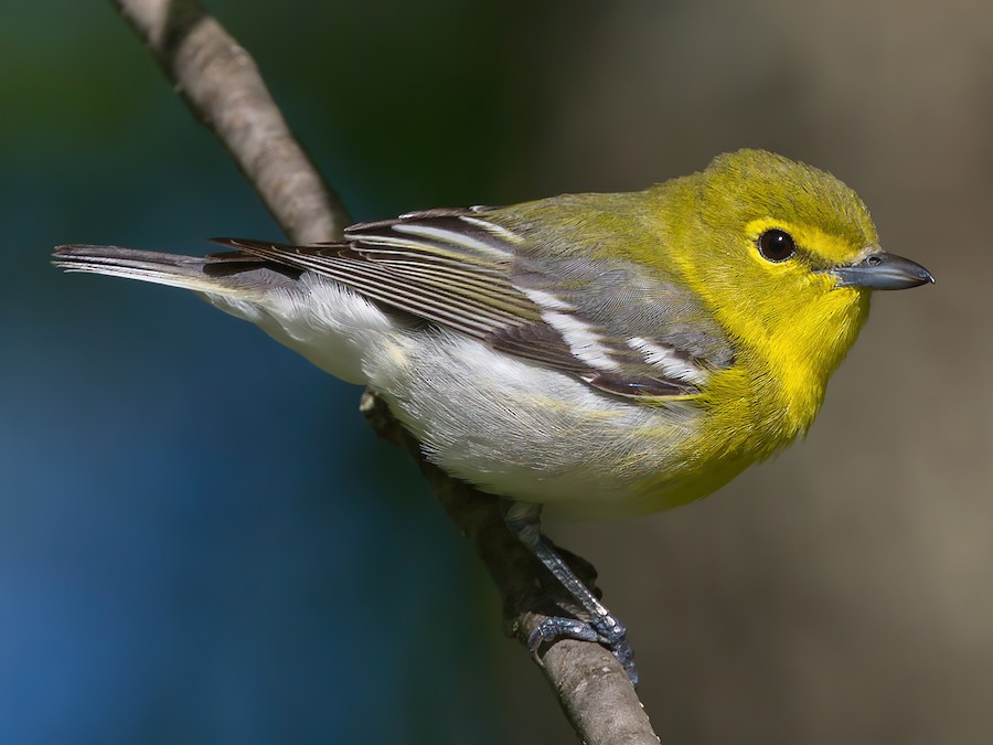
This page shows which locations in the selected region historically had the highest probability of a checklist including Yellow-throated Vireo in April. Because some locations may be undersampled, the results are sorted based on a confidence score which takes into account how many samples are available. The bar chart shows how the probability of observing this species varies over the year.

Back to the Top Birds list

Rank Map Pics Location Distance Observed Sampled Frequency Confidence
1 Cape Fear River--Buckhorn Road 20.9 85 141 60.3% 52.0%
2 Old Bayleaf Rd (foot access only) 15.2 2 2 100.0% 34.2%
3 Butner Game Land--Brickhouse Rd. (Granville Co.) 21.9 31 74 41.9% 31.3%
4 River Forest Park 20.9 3 4 75.0% 30.1%
5 Parker Preserve 15.5 32 81 39.5% 29.6%
6 Raven Rock SP 23.9 32 84 38.1% 28.4%
7 Raven Rock SP--Avents Creek Access Area 22.3 6 11 54.5% 28.0%
8 Falls Lake--Will Suitt Mudflats 18.8 4 7 57.1% 25.0%
9 Neuse River Trail--Mial Plantation Road 18.1 56 185 30.3% 24.1%
10 Lower Haw SNA--Hwy. 64 18.7 75 265 28.3% 23.2%
11 Eno River SP--Cabe Lands Access 20.8 3 5 60.0% 23.1%
12 White Pines Nature Preserve 24.5 35 121 28.9% 21.6%
13 Hamlin Rd.--Mountains-to-Sea Trail Access 19.1 1 1 100.0% 20.7%
14 Eno River SP--Few's Ford 23.2 44 172 25.6% 19.6%
15 O'Kelly Chapel Road Waterfowl Impoundment 9.9 3 6 50.0% 18.8%
16 Falls Lake--Upper Beaver Dam (Granville Co.) 21.0 3 6 50.0% 18.8%
17 Johnston Mill Nature Preserve 20.5 30 116 25.9% 18.8%
18 Harris Lake--NE of New Hill-Holleman Rd. 13.3 12 39 30.8% 18.6%
19 Blue Jay Point County Park 14.5 44 185 23.8% 18.2%
20 American Tobacco Trail--New Hill-Olive Chapel Road Access 10.5 37 158 23.4% 17.5%
21 Falls Lake--Sandling Beach 17.5 11 38 28.9% 17.0%
22 Horton Grove Nature Preserve 24.6 25 105 23.8% 16.7%
23 Lower Haw SNA--Bynum 20.3 34 165 20.6% 15.1%
24 Jordan Lake--Poe's Ridge 19.9 2 4 50.0% 15.0%
25 Falls Lake--Beaverdam Reservoir 18.0 8 29 27.6% 14.7%
26 Knap of Reeds Creek Waterfowl Impoundment 23.9 8 29 27.6% 14.7%
27 Butner Game Land--Brickhouse Rd. (Durham Co.) 21.9 29 142 20.4% 14.6%
28 Haw River--Bynum Dam 20.5 9 35 25.7% 14.2%
29 Jordan Game Land--Seaforth Road South End 17.3 4 12 33.3% 13.8%
30 Falls Lake--New Light Creek 17.6 3 8 37.5% 13.7%
31 Jordan Lake SRA--Robeson Creek Canoe Access 18.4 3 9 33.3% 12.1%
32 Eno River SP--Cole Mill/Pump Station 21.6 20 111 18.0% 12.0%
33 Jordan Game Land--Transis Camp Power Line & Trails ONLY 12.4 7 30 23.3% 11.8%
34 Little River Waterfowl Impoundment 20.6 2 5 40.0% 11.8%
35 Flat River Waterfowl Impoundment 23.4 50 344 14.5% 11.2%
36 Beaver Creek Waterfowl Impoundment 10.6 6 26 23.1% 11.0%
37 Mason Farm Biological Reserve 14.6 142 1111 12.8% 10.9%
38 Lee Game Land 22.6 4 15 26.7% 10.9%
39 Neuse River Trail--Poole Road 14.1 3 10 30.0% 10.8%
40 West Point on the Eno Park 20.5 6 27 22.2% 10.6%
41 Horseshoe Road Nature Preserve 22.1 6 27 22.2% 10.6%
42 Stagecoach Road Waterfowl Impoundment 12.2 6 29 20.7% 9.8%
43 Jordan Lake--New Hope Creek Arm (Durham Co) 12.3 1 2 50.0% 9.5%
44 Penny's Bend Nature Preserve 20.0 9 52 17.3% 9.4%
45 Forest Ridge Park 16.5 5 25 20.0% 8.9%
46 Harris Lake County Park 14.0 18 135 13.3% 8.6%
47 Duke Forest--Korstian Division 19.6 9 59 15.3% 8.2%
48 Neuse River Trail--Thornton Road 15.5 2 7 28.6% 8.2%
49 Ritter Park 4.3 17 136 12.5% 8.0%
50 Neuse River Trail (Historic only. Use more specific location.) 13.5 6 37 16.2% 7.7%
51 Falls Lake--Hwy. 50 Boat Ramp 16.8 3 14 21.4% 7.6%
52 Brumley Nature Preserve--South 22.7 14 117 12.0% 7.3%
53 Rock Ridge Park 23.8 2 8 25.0% 7.1%
54 Neuse River Trail--Anderson Point Park 13.5 7 49 14.3% 7.1%
55 Falls Lake SRA--Information Center 16.3 3 15 20.0% 7.0%
56 Jordan Lake SRA--New Hope Overlook 16.7 3 17 17.6% 6.2%
57 American Tobacco Trail--Olive Chapel Road Access 9.5 5 36 13.9% 6.1%
58 Harris Game Land--Upper Boat Ramp 15.5 14 149 9.4% 5.7%
59 Mary Hayes Barber Holmes Park 22.3 9 85 10.6% 5.7%
60 Butner Game Land--H Street Fields 23.2 2 10 20.0% 5.7%
61 Falls Lake--Olive Grove Church Rd. 17.1 3 20 15.0% 5.2%
62 Middle Creek Bottomlands II 24.9 3 20 15.0% 5.2%
63 Falls Lake--Holly Pt./Shinleaf 15.9 4 34 11.8% 4.7%
64 Morgan Creek Trail 17.5 7 75 9.3% 4.6%
65 Eno River--Pleasant Green to Cole Mill 21.2 1 4 25.0% 4.6%
66 Jordan Game Land--Cub Creek 13.7 1 4 25.0% 4.6%
67 Carolina North--Tripp Farm Gate 19.7 3 24 12.5% 4.3%
68 William B. Umstead SP--Big Lake 5.7 6 65 9.2% 4.3%
69 Clayton Riverwalk--County Line to Sam's Branch Greenway 21.1 4 37 10.8% 4.3%
70 Old Bynum Bridge 20.4 49 886 5.5% 4.2%
71 Duke Forest--Hollow Rock & Hollow Rock Nature Park 17.9 5 52 9.6% 4.2%
72 Jordan Lake--New Hope Creek arm (Chatham Co) 12.0 3 26 11.5% 4.0%
73 Town Lake Park 23.4 4 40 10.0% 4.0%
74 Bass Lake Park & Trail 10.7 11 160 6.9% 3.9%
75 Falls Lake--Ellerbe Creek RR Grade 19.0 6 72 8.3% 3.9%
76 White Deer Park 11.6 8 111 7.2% 3.7%
77 New Hope Waterfowl Impoundment 13.8 4 43 9.3% 3.7%
78 Schenck Forest 3.6 21 382 5.5% 3.6%
79 Roland E. Horne Walking Trail 23.4 2 16 12.5% 3.5%
80 Falls Lake--Hickory Hill Boat Ramp 18.4 3 32 9.4% 3.2%
81 Jordan Lake--B. Everett Jordan Dam 18.7 7 106 6.6% 3.2%
82 Falls Lake--Rolling View 16.1 4 50 8.0% 3.2%
83 Jordan Game Land--(Lystra Rd. Bridge) Overcup Creek 14.0 2 18 11.1% 3.1%
84 Jordan Lake SRA--Parker's Creek 15.0 1 6 16.7% 3.0%
85 Jordan Lake SRA--Visitor's Center 13.8 1 6 16.7% 3.0%
86 Pierce Woods and Pond 15.9 3 35 8.6% 3.0%
87 Lower Booker Creek Trail 17.0 3 36 8.3% 2.9%
88 Horace Williams Tract 19.1 3 40 7.5% 2.6%
89 Cornwallis Road Park 16.1 1 7 14.3% 2.6%
90 Little Beaverdam Creek 18.4 1 7 14.3% 2.6%
91 RTP Mountain Bike Trails 7.2 1 7 14.3% 2.6%
92 Eno River SP--Continental Drive Access 21.6 1 7 14.3% 2.6%
93 Blackwood Farm Park 22.9 3 41 7.3% 2.5%
94 Robertson Millpond Preserve 20.7 2 23 8.7% 2.4%
95 Neuse River Trail--Abbotts Creek 14.5 9 206 4.4% 2.3%
96 Falls Lake--Olive Grove Church Rd. Ramp 18.4 1 8 12.5% 2.2%
97 Sims Branch Greenway 13.1 1 8 12.5% 2.2%
98 Walnut Street Park 2.4 1 8 12.5% 2.2%
99 Leigh Farm Park 14.5 2 25 8.0% 2.2%
100 Eagle Spur Rail Trail--Stagecoach Rd. 11.9 4 75 5.3% 2.1%
101 Hemlock Bluffs Nature Preserve 4.6 5 104 4.8% 2.1%
102 Falls Lake--Will Suitt Rd. RR Grade 20.0 2 27 7.4% 2.1%
103 Falls Lake--Neuse River RR Grade (Granville Co) 20.0 1 9 11.1% 2.0%
104 Duke Forest--Eno Division 22.9 1 9 11.1% 2.0%
105 American Tobacco Trail--Wimberly Road Access 8.1 1 9 11.1% 2.0%
106 Valley Springs Park 20.7 1 9 11.1% 2.0%
107 Jordan Game Land--Mason Point Peninsula 12.1 2 28 7.1% 2.0%
108 Durant Nature Preserve 13.3 7 174 4.0% 2.0%
109 Briar Chapel--Pokeberry Creek 18.2 9 249 3.6% 1.9%
110 Duke Forest--Gate 12 19.9 2 29 6.9% 1.9%
111 Brumley Nature Preserve--North 22.2 24 867 2.8% 1.9%
112 Clemmons Educational State Forest 18.0 2 30 6.7% 1.8%
113 Jordan Game Land--Transis Camp Rd. 12.6 4 85 4.7% 1.8%
114 Duke Forest--Gate 4 18.1 1 10 10.0% 1.8%
115 Falls Lake--Mountains-to-Sea Trail Jimmy Rogers Road Access 15.2 1 10 10.0% 1.8%
116 Robertson Creek Nature Preserve 23.8 1 10 10.0% 1.8%
117 North Carolina Botanical Garden 16.0 7 191 3.7% 1.8%
118 Glennstone/Heron Rookery 18.4 2 32 6.2% 1.7%
119 Harris Game Land--Lower Boat Ramp 18.6 1 11 9.1% 1.6%
120 Bolin Creek--Community Park to MLK Blvd. 17.4 3 64 4.7% 1.6%
121 Mill Bridge Nature Park 19.4 1 12 8.3% 1.5%
122 Macedonia Lake/Speight Branch Greenway 3.5 4 106 3.8% 1.5%
123 Fearrington Village 17.5 3 73 4.1% 1.4%
124 William B. Umstead SP--Turkey Creek Trail 4.2 1 13 7.7% 1.4%
125 Jordan Game Land--Audubon Platform 12.3 2 43 4.7% 1.3%
126 Lake Crabtree County Park 3.6 12 537 2.2% 1.3%
127 Yates Mill County Park 7.2 17 853 2.0% 1.2%
128 Sandy Creek Park 16.1 24 1370 1.8% 1.2%
129 Duke University--Wetland Center 'SWAMP' 16.4 3 92 3.3% 1.1%
130 Piedmont Nature Trail 15.9 1 16 6.2% 1.1%
131 Lake Lynn 7.7 8 366 2.2% 1.1%
132 Jordan Lake SRA--Ebenezer Point 15.0 3 103 2.9% 1.0%
133 Neuse River Trail--Mingo Bridge 13.6 1 18 5.6% 1.0%
134 Horseshoe Farm Nature Preserve 15.1 2 58 3.4% 1.0%
135 17 Acre Woods 18.0 4 167 2.4% 0.9%
136 DO NOT USE--Historical Only for Brumley Nature Preserve 22.4 1 19 5.3% 0.9%
137 Eno River SP--Pleasant Green 21.9 1 20 5.0% 0.9%
138 Third Fork Creek Trail 13.6 2 64 3.1% 0.9%
139 Brian P's Yard (Private) 14.4 4 192 2.1% 0.8%
140 Duke Forest--Shepherd Nature Trail 18.7 1 22 4.5% 0.8%
141 Jordan Lake--Historical Data Only 15.3 1 23 4.3% 0.8%
142 Williamson Preserve 19.2 1 23 4.3% 0.8%
143 Symphony Lake Greenway 4.4 2 72 2.8% 0.8%
144 William B. Umstead SP--Reedy Creek Lake 3.8 1 25 4.0% 0.7%
145 Lake Johnson Park 4.2 7 498 1.4% 0.7%
146 Jordan Lake SRA--Vista Point 16.1 1 27 3.7% 0.7%
147 Swift Creek Bluffs 5.3 3 158 1.9% 0.6%
148 Lake Raleigh 6.0 4 251 1.6% 0.6%
149 Hilltop Needmore Park--North 11.1 1 30 3.3% 0.6%
150 Berryhill Park and Trails 18.4 2 96 2.1% 0.6%
151 Lake Crabtree Nature Trail--Southport Entrance 3.3 4 273 1.5% 0.6%
152 Crowder District Park 6.8 1 32 3.1% 0.6%
153 Dorothea Dix Park 6.9 2 109 1.8% 0.5%
154 Jordan Game Land---(751 bridge) Northeast Creek 10.6 1 36 2.8% 0.5%
155 Whippoorwill Park & Warren Creek Trail 19.4 1 36 2.8% 0.5%
156 Jordan Game Land--Farrington Point Boating Access 13.1 1 38 2.6% 0.5%
157 Duke Forest--Gate 10 19.3 1 42 2.4% 0.4%
158 Crabtree Creek Wetland--West of Raleigh Blvd. 9.8 3 316 0.9% 0.3%
159 Lake Betz 7.3 4 524 0.8% 0.3%
160 Rocky Branch Greenway 6.4 1 64 1.6% 0.3%
161 William B. Umstead SP 5.4 1 66 1.5% 0.3%
162 Apex Community Park 3.7 1 68 1.5% 0.3%
163 Little Creek Waterfowl Impoundment 14.5 1 71 1.4% 0.2%
164 White Oak Creek Greenway--West Side 6.7 1 74 1.4% 0.2%
165 Maple View Farm (Birding From Roads Only) 24.1 2 259 0.8% 0.2%
166 Rainbow Soccer Complex 16.2 1 86 1.2% 0.2%
167 Crabtree Creek Watershed 4.7 1 96 1.0% 0.2%
168 South Ellerbe Creek Trail 16.4 1 98 1.0% 0.2%
169 Duke University--Reclamation Pond 17.3 1 107 0.9% 0.2%
170 Mid Pines Rd. 6.7 3 773 0.4% 0.1%
171 Shelley Lake 8.1 1 195 0.5% 0.1%
172 Jordan Lake--Crosswinds Marina 13.2 1 205 0.5% 0.1%
173 Bond Park 2.7 1 280 0.4% 0.1%
174 Beaver Marsh 16.7 1 350 0.3% 0.1%
175 Prairie Ridge Ecostation for Wildlife Learning 3.9 1 452 0.2% 0.0%