Where to find Cliff Swallow in July
within 25 miles of New York City, United States
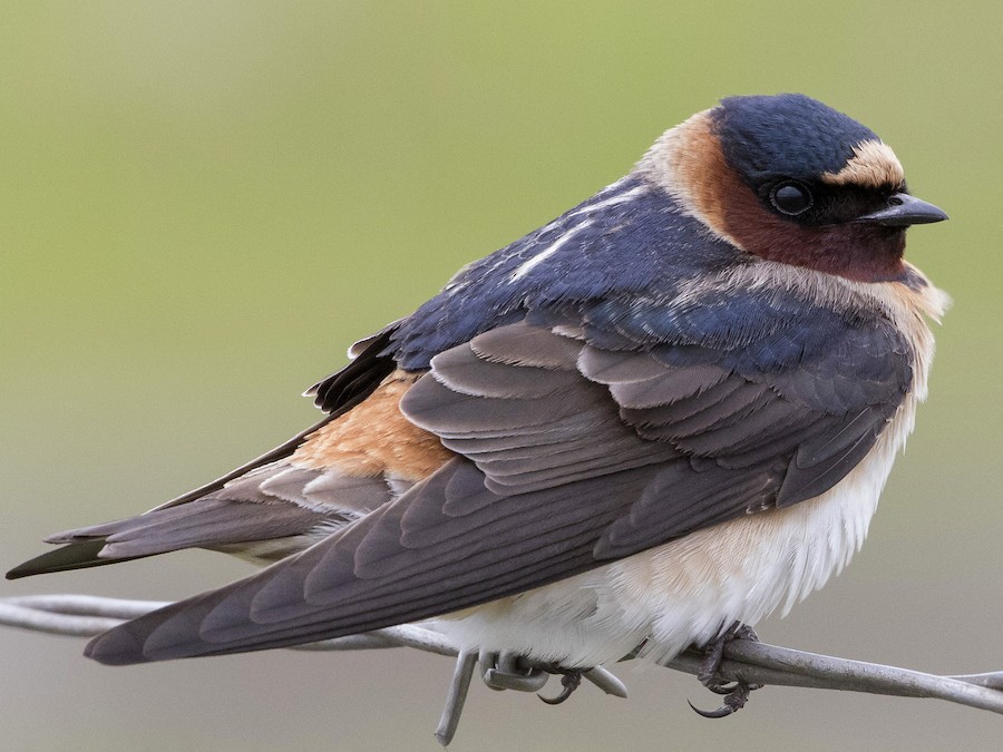
This page shows which locations in the selected region historically had the highest probability of a checklist including Cliff Swallow in July. Because some locations may be undersampled, the results are sorted based on a confidence score which takes into account how many samples are available. The bar chart shows how the probability of observing this species varies over the year.
- Click on a month in the bar chart to switch to that month.
- Click on a location to view its top birds.
- Click here to view a map on eBird.
| Evidence | Sampling | Score | ||||||||
|---|---|---|---|---|---|---|---|---|---|---|
| # | Location | Dist | Media | Years | Birders | Hits | Lists | Freq | Conf | |
| 1 | Two Bridges (Lincoln Park) | 18.9 | 2 | 2 | 11 | 8 | 10 | 80.0% | 49.0% | |
| 2 | McGuire Fields | 8.5 | 7 | 2 | 7 | 7 | 9 | 77.8% | 45.3% | |
| 3 | Hillview Reservoir (restricted access) | 15.4 | 0 | 10 | 4 | 44 | 97 | 45.4% | 35.8% | |
| 4 | Pelham Bay Park--Orchard Beach & parking lot | 15.3 | 11 | 8 | 22 | 25 | 52 | 48.1% | 35.1% | |
| 5 | Boonton Reservoir | 24.0 | 0 | 11 | 11 | 34 | 74 | 45.9% | 35.1% | |
| 6 | Lake Tappan (NY) | 23.3 | 0 | 2 | 20 | 17 | 40 | 42.5% | 28.5% | |
| 7 | Udall's Mill Pond | 14.7 | 5 | 2 | 16 | 14 | 35 | 40.0% | 25.6% | |
| 8 | Alley Pond Park--Alley Creek | 13.7 | 0 | 4 | 5 | 5 | 10 | 50.0% | 23.7% | |
| 9 | Great Oak Park | 24.8 | 2 | 3 | 2 | 3 | 5 | 60.0% | 23.1% | |
| 10 | Glover Field Complex | 16.2 | 0 | 1 | 1 | 1 | 1 | 100.0% | 20.7% | |
| 11 | Two Bridges Road (Essex County) | 18.8 | 1 | 1 | 1 | 1 | 1 | 100.0% | 20.7% | |
| 12 | Blauvelt Road Bridge (Hackensack River/Lake Tappan) | 24.0 | 0 | 3 | 4 | 7 | 19 | 36.8% | 19.1% | |
| 13 | Randalls Island | 6.8 | 12 | 4 | 19 | 38 | 158 | 24.1% | 18.1% | |
| 14 | Alley Pond Park--Environmental Center | 13.6 | 0 | 6 | 12 | 19 | 86 | 22.1% | 14.6% | |
| 15 | Lake Tappan (NY), Convent Rd. | 23.5 | 3 | 3 | 31 | 27 | 135 | 20.0% | 14.1% | |
| 16 | Pelham Bay Park--Southern Meadow and environs | 13.6 | 0 | 5 | 2 | 9 | 38 | 23.7% | 13.0% | |
| 17 | Pelham Bay Park | 14.8 | 4 | 8 | 3 | 21 | 113 | 18.6% | 12.5% | |
| 18 | Oradell Reservoir and Emerson Woods | 17.7 | 0 | 6 | 5 | 8 | 38 | 21.1% | 11.1% | |
| 19 | Pelham Bay Park--The Lagoon | 15.5 | 2 | 5 | 3 | 8 | 40 | 20.0% | 10.5% | |
| 20 | Randalls Island--saltmarsh and backstop 42 vicinity | 7.4 | 1 | 2 | 6 | 6 | 29 | 20.7% | 9.8% | |
| 21 | Randalls Island--NE fields and shoreline | 7.3 | 2 | 3 | 6 | 6 | 30 | 20.0% | 9.5% | |
| 22 | Canarsie Beach Park | 8.4 | 4 | 4 | 12 | 11 | 69 | 15.9% | 9.1% | |
| 23 | Pelham Bay Park--The Meadow and adj. woodland | 15.0 | 0 | 3 | 1 | 3 | 13 | 23.1% | 8.2% | |
| 24 | Pelham Bay Park--Turtle Cove | 14.7 | 0 | 7 | 6 | 13 | 105 | 12.4% | 7.4% | |
| 25 | Poplar Rd. Wildlife Sanctuary | 21.2 | 0 | 2 | 2 | 2 | 8 | 25.0% | 7.1% | |
| 26 | Paerdegat Basin | 8.4 | 1 | 2 | 3 | 3 | 15 | 20.0% | 7.0% | |
| 27 | Lake Tappan | 21.5 | 0 | 2 | 3 | 3 | 15 | 20.0% | 7.0% | |
| 28 | Bronx Zoo | 11.6 | 0 | 5 | 2 | 21 | 232 | 9.1% | 6.0% | |
| 29 | Freshkills Park | 13.4 | 0 | 3 | 6 | 5 | 38 | 13.2% | 5.8% | |
| 30 | Randalls Island--NW fields and shoreline | 7.4 | 2 | 1 | 4 | 3 | 27 | 11.1% | 3.9% | |
| 31 | Point View Reservoir | 22.0 | 0 | 1 | 1 | 1 | 7 | 14.3% | 2.6% | |
| 32 | Alley Pond Park--Restoration Area | 14.0 | 0 | 1 | 1 | 1 | 7 | 14.3% | 2.6% | |
| 33 | Shirley Chisholm SP (Fountain Ave. Landfill) | 8.8 | 2 | 1 | 4 | 3 | 42 | 7.1% | 2.5% | |
| 34 | Pelham Bay Park--Hunter Island | 15.9 | 0 | 1 | 3 | 2 | 24 | 8.3% | 2.3% | |
| 35 | Goffle Brook Park | 17.9 | 0 | 1 | 1 | 1 | 8 | 12.5% | 2.2% | |
| 36 | Alley Pond Park--Oakland Lake Wildflower Meadow | 13.4 | 0 | 1 | 1 | 1 | 9 | 11.1% | 2.0% | |
| 37 | Conaskonk Point | 20.1 | 0 | 2 | 4 | 5 | 115 | 4.3% | 1.9% | |
| 38 | Lakeside Park (Pompton Lake) | 24.7 | 0 | 1 | 1 | 1 | 10 | 10.0% | 1.8% | |
| 39 | Fort Tilden--Battery Harris Platform | 12.1 | 0 | 1 | 1 | 1 | 10 | 10.0% | 1.8% | |
| 40 | Essex County Riverfront Park in Newark | 7.4 | 0 | 2 | 1 | 2 | 33 | 6.1% | 1.7% | |
| 41 | Walker Avenue Wetlands | 20.7 | 0 | 4 | 10 | 7 | 206 | 3.4% | 1.7% | |
| 42 | Pelham Bay Park--Thomas Pell WS and Goose Creek Marsh | 15.0 | 1 | 2 | 2 | 2 | 34 | 5.9% | 1.6% | |
| 43 | Pelham Bay Park--Pelham Bridge | 14.3 | 0 | 1 | 1 | 1 | 11 | 9.1% | 1.6% | |
| 44 | Sunset Cove Park | 12.5 | 0 | 1 | 16 | 2 | 37 | 5.4% | 1.5% | |
| 45 | Alley Pond Park--Oakland Lake | 13.3 | 1 | 3 | 2 | 5 | 155 | 3.2% | 1.4% | |
| 46 | Tallman Mountain SP--Picnic Area | 22.4 | 0 | 1 | 2 | 1 | 13 | 7.7% | 1.4% | |
| 47 | Piermont Marsh, Sparkill Creek (Observation Platform Area) | 22.9 | 0 | 1 | 1 | 1 | 13 | 7.7% | 1.4% | |
| 48 | Van Cortlandt Park--VC Lake and Vault Hill | 13.9 | 1 | 1 | 1 | 1 | 14 | 7.1% | 1.3% | |
| 49 | Van Cortlandt Park--Southwest Zone | 13.8 | 0 | 1 | 1 | 1 | 14 | 7.1% | 1.3% | |
| 50 | Sandy Hook | 19.0 | 0 | 7 | 8 | 10 | 446 | 2.2% | 1.2% | |
| 51 | Richard W. DeKorte Park | 6.9 | 3 | 12 | 20 | 28 | 1597 | 1.8% | 1.2% | |
| 52 | Bush Terminal Piers Park | 4.2 | 0 | 1 | 2 | 3 | 86 | 3.5% | 1.2% | |
| 53 | Jerome Park Reservoir | 12.7 | 0 | 1 | 1 | 1 | 15 | 6.7% | 1.2% | |
| 54 | Lemon Creek Pier | 17.7 | 0 | 1 | 1 | 2 | 51 | 3.9% | 1.1% | |
| 55 | Piermont Pier | 23.4 | 1 | 7 | 9 | 12 | 674 | 1.8% | 1.0% | |
| 56 | Freshkills Park--East Mound | 12.6 | 0 | 1 | 1 | 1 | 18 | 5.6% | 1.0% | |
| 57 | Pelham Bay Park--Twin Islands | 15.9 | 0 | 1 | 1 | 1 | 18 | 5.6% | 1.0% | |
| 58 | Melanie Lane Wetlands | 21.4 | 0 | 1 | 2 | 2 | 68 | 2.9% | 0.8% | |
| 59 | Coney Island Pier | 10.1 | 0 | 1 | 1 | 1 | 22 | 4.5% | 0.8% | |
| 60 | Demarest Nature Center | 17.3 | 0 | 1 | 1 | 1 | 23 | 4.3% | 0.8% | |
| 61 | Jamaica Bay Wildlife Refuge--East Pond, south end | 11.7 | 0 | 3 | 9 | 5 | 312 | 1.6% | 0.7% | |
| 62 | Little Neck Bay, Cross Island Parkway | 13.1 | 0 | 1 | 1 | 1 | 27 | 3.7% | 0.7% | |
| 63 | Piermont Marsh | 22.5 | 0 | 1 | 2 | 1 | 31 | 3.2% | 0.6% | |
| 64 | Calvert Vaux Park (Dreier-Offerman Park) | 9.0 | 0 | 3 | 4 | 3 | 212 | 1.4% | 0.5% | |
| 65 | Coney Island Creek Park | 9.2 | 0 | 1 | 5 | 1 | 37 | 2.7% | 0.5% | |
| 66 | Plumb Beach | 10.3 | 3 | 3 | 9 | 8 | 977 | 0.8% | 0.4% | |
| 67 | Marshlands Conservancy | 22.9 | 1 | 4 | 5 | 5 | 528 | 0.9% | 0.4% | |
| 68 | Shirley Chisholm SP (Pennsylvania Ave. Landfill) | 8.7 | 1 | 1 | 1 | 1 | 44 | 2.3% | 0.4% | |
| 69 | Fort Tilden | 12.3 | 0 | 2 | 3 | 2 | 143 | 1.4% | 0.4% | |
| 70 | Van Cortlandt Park | 14.2 | 0 | 1 | 1 | 1 | 47 | 2.1% | 0.4% | |
| 71 | Commerce Road Wetlands | 19.8 | 0 | 2 | 2 | 2 | 148 | 1.4% | 0.4% | |
| 72 | Hillside Woods & Children's Village | 20.7 | 1 | 1 | 1 | 1 | 49 | 2.0% | 0.4% | |
| 73 | Wave Hill | 13.6 | 0 | 1 | 1 | 1 | 50 | 2.0% | 0.4% | |
| 74 | Great Swamp NWR | 23.9 | 0 | 1 | 2 | 2 | 189 | 1.1% | 0.3% | |
| 75 | Hatfield Swamp IBA--Great Piece Meadow | 20.6 | 0 | 1 | 1 | 1 | 61 | 1.6% | 0.3% | |
| 76 | Jamaica Bay Wildlife Refuge | 11.6 | 0 | 6 | 8 | 7 | 1246 | 0.6% | 0.3% | |
| 77 | Meadowlands District IBA | 7.6 | 0 | 1 | 1 | 1 | 69 | 1.4% | 0.3% | |
| 78 | Breezy Point Tip | 11.9 | 1 | 2 | 4 | 2 | 235 | 0.9% | 0.2% | |
| 79 | South Mountain Reservation | 15.5 | 0 | 1 | 1 | 1 | 80 | 1.2% | 0.2% | |
| 80 | Raritan Bay Waterfront Park & Morgan Avenue Mudflats | 21.4 | 0 | 2 | 2 | 2 | 265 | 0.8% | 0.2% | |
| 81 | Meadowlands IBA--Valley Brook Ave. | 7.2 | 0 | 1 | 1 | 1 | 93 | 1.1% | 0.2% | |
| 82 | Jamaica Bay Wildlife Refuge--East Pond | 11.5 | 1 | 3 | 6 | 3 | 605 | 0.5% | 0.2% | |
| 83 | The Landing, Dobbs Ferry | 22.1 | 0 | 1 | 1 | 1 | 108 | 0.9% | 0.2% | |
| 84 | Sandy Hook--North End | 16.4 | 0 | 1 | 1 | 1 | 157 | 0.6% | 0.1% | |
| 85 | New York Botanical Garden | 12.3 | 0 | 1 | 1 | 1 | 164 | 0.6% | 0.1% | |
| 86 | Great Kills Park | 13.0 | 0 | 1 | 1 | 1 | 180 | 0.6% | 0.1% | |
| 87 | Jamaica Bay Wildlife Refuge--West Pond | 11.3 | 0 | 2 | 2 | 2 | 602 | 0.3% | 0.1% | |
| 88 | Edith G. Read Wildlife Sanctuary | 24.9 | 0 | 1 | 2 | 1 | 198 | 0.5% | 0.1% | |
| 89 | Linden Hawk Rise Sanctuary | 14.8 | 0 | 1 | 1 | 1 | 227 | 0.4% | 0.1% | |
| 90 | Jamaica Bay Wildlife Refuge--East Pond, north end | 11.1 | 0 | 1 | 1 | 1 | 261 | 0.4% | 0.1% | |
| 91 | Meadowlands IBA--Mill Creek Marsh | 6.1 | 0 | 1 | 1 | 1 | 347 | 0.3% | 0.1% | |
| 92 | Nickerson Beach | 22.9 | 0 | 1 | 1 | 1 | 508 | 0.2% | 0.0% | |
| 93 | The Celery Farm | 23.1 | 0 | 1 | 1 | 1 | 536 | 0.2% | 0.0% | |
| 94 | Salt Marsh Nature Center at Marine Park | 9.1 | 0 | 1 | 1 | 1 | 575 | 0.2% | 0.0% | |