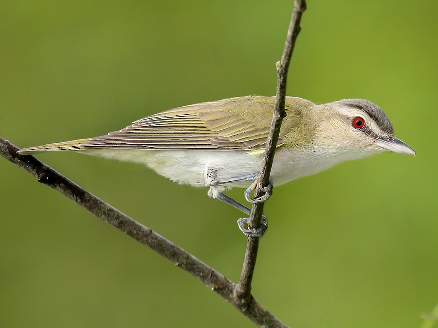
Where to find Red-eyed Vireo in July
within 25 miles of New York City, United States
This page shows which locations in the selected region historically had the highest probability of a checklist including Red-eyed Vireo in July. Because some locations may be undersampled, the results are sorted based on a confidence score which takes into account how many samples are available. The bar chart shows how the probability of observing this species varies over the year.
- Click on a month in the bar chart to switch to that month.
- Click on a location to view its top birds.
- Click here to view a map on eBird.
| Evidence | Sampling | Score | ||||||||
|---|---|---|---|---|---|---|---|---|---|---|
| # | Location | Dist | Media | Years | Birders | Hits | Lists | Freq | Conf | |
| 1 | North Mt. Loretto SF--Reed Marsh | 17.6 | 0 | 4 | 2 | 45 | 54 | 83.3% | 71.3% | |
| 2 | Cemetery of the Resurrection--North Overlook | 17.6 | 0 | 6 | 2 | 82 | 109 | 75.2% | 66.4% | |
| 3 | Goodhue Park | 7.2 | 0 | 5 | 1 | 64 | 84 | 76.2% | 66.1% | |
| 4 | Hempstead Lake SP--south end | 18.9 | 0 | 14 | 18 | 93 | 135 | 68.9% | 60.6% | |
| 5 | Hillside Woods & Children's Village | 20.7 | 0 | 6 | 6 | 33 | 49 | 67.3% | 53.4% | |
| 6 | Watchung Reservation--Deserted Village and Fields | 20.3 | 0 | 3 | 6 | 6 | 7 | 85.7% | 48.7% | |
| 7 | North Mt. Loretto SF | 17.9 | 0 | 5 | 5 | 11 | 15 | 73.3% | 48.0% | |
| 8 | North Mt. Loretto SF--Snag Swamp | 17.8 | 0 | 8 | 2 | 28 | 48 | 58.3% | 44.3% | |
| 9 | Kings Point Park | 15.1 | 0 | 7 | 3 | 16 | 26 | 61.5% | 42.5% | |
| 10 | Hartshorne Woods | 22.4 | 0 | 13 | 24 | 27 | 48 | 56.2% | 42.3% | |
| 11 | Mayapple Hill | 15.3 | 0 | 3 | 1 | 12 | 19 | 63.2% | 41.0% | |
| 12 | Alley Pond Park--Southern Woodlands | 14.0 | 0 | 3 | 1 | 6 | 8 | 75.0% | 40.9% | |
| 13 | Hempstead Lake SP | 19.2 | 0 | 12 | 15 | 38 | 73 | 52.1% | 40.8% | |
| 14 | Alley Pond Park | 14.0 | 1 | 13 | 19 | 47 | 95 | 49.5% | 39.6% | |
| 15 | Marshlands Conservancy | 22.9 | 2 | 16 | 133 | 231 | 528 | 43.8% | 39.6% | |
| 16 | North Mt. Loretto SF--Sand Pits (Turtle Nesting Area) | 17.6 | 0 | 2 | 1 | 14 | 24 | 58.3% | 38.8% | |
| 17 | Sands Point Preserve | 19.0 | 1 | 10 | 23 | 37 | 77 | 48.1% | 37.3% | |
| 18 | Hatfield Swamp IBA--West Essex Park | 18.2 | 0 | 11 | 4 | 49 | 108 | 45.4% | 36.3% | |
| 19 | Cunningham Park | 12.6 | 0 | 7 | 3 | 8 | 13 | 61.5% | 35.5% | |
| 20 | Cunningham Park Southeast Preserve | 12.4 | 0 | 2 | 4 | 6 | 9 | 66.7% | 35.4% | |
| 21 | Van Cortlandt Park--NW Forest | 14.5 | 1 | 5 | 5 | 7 | 11 | 63.6% | 35.4% | |
| 22 | Loantaka Brook Reservation | 23.9 | 0 | 13 | 12 | 71 | 170 | 41.8% | 34.6% | |
| 23 | Ellis Rd., waterfront (Richmond Co.) | 17.3 | 0 | 1 | 1 | 2 | 2 | 100.0% | 34.2% | |
| 24 | Ward Acres Park | 20.5 | 0 | 2 | 2 | 2 | 2 | 100.0% | 34.2% | |
| 25 | Veterans Park (Hazlet) | 21.9 | 0 | 2 | 3 | 2 | 2 | 100.0% | 34.2% | |
| 26 | High Rock Park | 10.9 | 0 | 10 | 10 | 15 | 30 | 50.0% | 33.2% | |
| 27 | Great Swamp NWR | 23.9 | 0 | 19 | 52 | 74 | 189 | 39.2% | 32.5% | |
| 28 | Watchung Reservation | 19.7 | 0 | 9 | 11 | 20 | 46 | 43.5% | 30.2% | |
| 29 | High Mountain Preserve | 20.5 | 0 | 4 | 4 | 8 | 15 | 53.3% | 30.1% | |
| 30 | Rockleigh Woods Sanctuary & Lamont Reserve | 20.4 | 0 | 4 | 4 | 8 | 15 | 53.3% | 30.1% | |
| 31 | Rye Nature Center | 24.5 | 0 | 3 | 3 | 3 | 4 | 75.0% | 30.1% | |
| 32 | Alpine Scout Camp | 19.1 | 0 | 2 | 2 | 3 | 4 | 75.0% | 30.1% | |
| 33 | Wolfe's Pond Park--Acme Pond | 16.5 | 0 | 2 | 4 | 4 | 6 | 66.7% | 30.0% | |
| 34 | Blue Heron Park | 15.6 | 0 | 4 | 6 | 10 | 20 | 50.0% | 29.9% | |
| 35 | Sharrotts Pond | 16.9 | 0 | 2 | 24 | 34 | 88 | 38.6% | 29.1% | |
| 36 | Hatfield Swamp IBA--Great Piece Meadow | 20.6 | 0 | 8 | 11 | 24 | 61 | 39.3% | 28.1% | |
| 37 | Irvington Woods | 23.8 | 0 | 2 | 3 | 4 | 7 | 57.1% | 25.0% | |
| 38 | Palisades Park IBA--Green Brook Sanctuary | 14.6 | 1 | 6 | 7 | 19 | 54 | 35.2% | 23.8% | |
| 39 | Walker Avenue Wetlands | 20.7 | 0 | 9 | 17 | 61 | 206 | 29.6% | 23.8% | |
| 40 | Hempstead Lake SP--north end | 19.3 | 0 | 6 | 8 | 14 | 38 | 36.8% | 23.4% | |
| 41 | Conference House Park | 19.7 | 0 | 5 | 39 | 26 | 80 | 32.5% | 23.2% | |
| 42 | Troy Meadows Natural Area | 21.1 | 0 | 11 | 10 | 29 | 94 | 30.9% | 22.4% | |
| 43 | Clay Pit Ponds | 17.0 | 0 | 2 | 4 | 4 | 8 | 50.0% | 21.5% | |
| 44 | Woodlands School | 24.5 | 0 | 5 | 5 | 12 | 35 | 34.3% | 20.8% | |
| 45 | Branch Brook Park--North | 10.0 | 0 | 2 | 2 | 2 | 3 | 66.7% | 20.8% | |
| 46 | Huber Woods County Park | 22.6 | 0 | 7 | 8 | 16 | 50 | 32.0% | 20.8% | |
| 47 | Passaic River Park (Union) | 22.1 | 0 | 5 | 2 | 8 | 21 | 38.1% | 20.8% | |
| 48 | Montclair Hawk Watch | 14.2 | 0 | 1 | 1 | 1 | 1 | 100.0% | 20.7% | |
| 49 | Darwin James Preserve (private) | 21.6 | 0 | 1 | 2 | 1 | 1 | 100.0% | 20.7% | |
| 50 | Beaverdam Park | 15.6 | 0 | 1 | 1 | 1 | 1 | 100.0% | 20.7% | |
| 51 | Coffin Woods Preserve | 24.7 | 0 | 1 | 1 | 1 | 1 | 100.0% | 20.7% | |
| 52 | Hybrid Oak Woods Park | 18.9 | 0 | 1 | 1 | 1 | 1 | 100.0% | 20.7% | |
| 53 | Arbutus Woods Park | 15.9 | 0 | 1 | 1 | 1 | 1 | 100.0% | 20.7% | |
| 54 | Pondside Green Park | 10.9 | 0 | 1 | 1 | 1 | 1 | 100.0% | 20.7% | |
| 55 | St. Francis Woodlands | 9.8 | 0 | 1 | 1 | 1 | 1 | 100.0% | 20.7% | |
| 56 | Allison Pond Park | 7.3 | 0 | 1 | 2 | 1 | 1 | 100.0% | 20.7% | |
| 57 | Old Croton Aqueduct Trail, Dobbs Ferry | 22.3 | 0 | 1 | 1 | 1 | 1 | 100.0% | 20.7% | |
| 58 | Cemetery of the Resurrection--scrub W of maint. bldgs | 17.6 | 0 | 4 | 1 | 31 | 110 | 28.2% | 20.6% | |
| 59 | Garret Mountain Reservation (Park) | 15.7 | 1 | 11 | 15 | 46 | 175 | 26.3% | 20.3% | |
| 60 | Cemetery of the Resurrection | 17.4 | 0 | 4 | 2 | 16 | 53 | 30.2% | 19.5% | |
| 61 | Tallman Mountain SP | 22.1 | 0 | 6 | 5 | 10 | 30 | 33.3% | 19.2% | |
| 62 | South Mountain Reservation | 15.5 | 0 | 9 | 12 | 22 | 80 | 27.5% | 18.9% | |
| 63 | Essex County Environmental Center | 18.7 | 0 | 3 | 3 | 3 | 6 | 50.0% | 18.8% | |
| 64 | Field of Dreams Greenbelt | 12.9 | 0 | 4 | 1 | 4 | 10 | 40.0% | 16.8% | |
| 65 | Christopher Morley County Park | 18.7 | 0 | 2 | 3 | 4 | 10 | 40.0% | 16.8% | |
| 66 | Fairview Park | 17.2 | 0 | 3 | 1 | 3 | 7 | 42.9% | 15.8% | |
| 67 | Watchung Reservation--Lake Surprise | 19.1 | 0 | 3 | 3 | 3 | 7 | 42.9% | 15.8% | |
| 68 | Prospect Park | 4.2 | 4 | 20 | 94 | 227 | 1278 | 17.8% | 15.8% | |
| 69 | Tenafly Nature Center | 14.8 | 0 | 4 | 7 | 9 | 33 | 27.3% | 15.1% | |
| 70 | Riverdale Park | 13.3 | 0 | 1 | 1 | 2 | 4 | 50.0% | 15.0% | |
| 71 | William Warren County Park | 18.8 | 0 | 2 | 2 | 2 | 4 | 50.0% | 15.0% | |
| 72 | Corporate Park of Staten Island | 11.0 | 0 | 2 | 1 | 2 | 4 | 50.0% | 15.0% | |
| 73 | High Rock Park--Moses Mt. | 11.1 | 0 | 2 | 2 | 2 | 4 | 50.0% | 15.0% | |
| 74 | Tackamac Park | 24.3 | 0 | 2 | 1 | 2 | 4 | 50.0% | 15.0% | |
| 75 | Clay Pit Ponds State Park Preserve--The Gericke/Winant Farm | 16.4 | 0 | 2 | 1 | 2 | 4 | 50.0% | 15.0% | |
| 76 | Poricy Park | 24.4 | 0 | 4 | 4 | 5 | 16 | 31.2% | 14.2% | |
| 77 | Tatum Park | 23.7 | 0 | 3 | 3 | 4 | 12 | 33.3% | 13.8% | |
| 78 | Dismal Swamp | 22.9 | 1 | 4 | 4 | 4 | 12 | 33.3% | 13.8% | |
| 79 | Great Swamp Outdoor Education Center | 21.7 | 0 | 3 | 3 | 3 | 8 | 37.5% | 13.7% | |
| 80 | Closter Nature Center | 18.3 | 0 | 7 | 6 | 17 | 81 | 21.0% | 13.5% | |
| 81 | Cemetery of the Resurrection--North Pond | 17.4 | 0 | 7 | 1 | 15 | 70 | 21.4% | 13.4% | |
| 82 | Frelinghuysen Arboretum | 24.3 | 0 | 5 | 4 | 7 | 29 | 24.1% | 12.2% | |
| 83 | Clove Lakes Park | 8.6 | 0 | 15 | 4 | 44 | 280 | 15.7% | 11.9% | |
| 84 | Ridge Road Park | 23.6 | 0 | 1 | 1 | 2 | 5 | 40.0% | 11.8% | |
| 85 | Lyndhurst Mansion (grounds), Tarrytown | 24.6 | 0 | 2 | 1 | 2 | 5 | 40.0% | 11.8% | |
| 86 | Columbia University, Nevis Laboratories Environs | 22.8 | 0 | 1 | 1 | 2 | 5 | 40.0% | 11.8% | |
| 87 | Palisades Park IBA--State Line Lookout | 19.7 | 0 | 8 | 9 | 24 | 147 | 16.3% | 11.2% | |
| 88 | Lake Tappan | 21.5 | 0 | 3 | 4 | 4 | 15 | 26.7% | 10.9% | |
| 89 | Deep Cut Gardens | 23.3 | 0 | 2 | 3 | 3 | 10 | 30.0% | 10.8% | |
| 90 | Hilltop Reservation | 15.8 | 0 | 4 | 5 | 7 | 33 | 21.2% | 10.7% | |
| 91 | Flat Rock Brook Nature Center | 11.4 | 0 | 3 | 4 | 4 | 16 | 25.0% | 10.2% | |
| 92 | Hastings Meadowlands & Rowley's Bridge Trail | 19.9 | 0 | 3 | 2 | 3 | 11 | 27.3% | 9.7% | |
| 93 | Clarks Pond | 11.9 | 0 | 3 | 3 | 5 | 23 | 21.7% | 9.7% | |
| 94 | Whitney Pond Park | 16.6 | 0 | 3 | 1 | 4 | 17 | 23.5% | 9.6% | |
| 95 | Willowbrook Park | 11.2 | 0 | 2 | 2 | 4 | 17 | 23.5% | 9.6% | |
| 96 | Saxon Woods Park | 22.9 | 0 | 1 | 1 | 1 | 2 | 50.0% | 9.5% | |
| 97 | Todt Hill Rd. X Ocean Terrace | 9.6 | 0 | 1 | 1 | 1 | 2 | 50.0% | 9.5% | |
| 98 | Mountainside Park | 24.5 | 0 | 1 | 1 | 1 | 2 | 50.0% | 9.5% | |
| 99 | Blue Heron Park--Butterfly Pond | 15.3 | 0 | 1 | 1 | 1 | 2 | 50.0% | 9.5% | |
| 100 | Juhring Nature Preserve | 22.7 | 0 | 1 | 1 | 1 | 2 | 50.0% | 9.5% | |
| 101 | Blauvelt State Park | 24.9 | 0 | 1 | 1 | 1 | 2 | 50.0% | 9.5% | |
| 102 | Deere Park | 9.2 | 0 | 1 | 1 | 1 | 2 | 50.0% | 9.5% | |
| 103 | Greenwood Gardens | 15.9 | 0 | 1 | 1 | 1 | 2 | 50.0% | 9.5% | |
| 104 | Todt Hill Woodlands | 10.1 | 0 | 1 | 1 | 1 | 2 | 50.0% | 9.5% | |
| 105 | Welwyn Preserve | 22.5 | 0 | 2 | 1 | 2 | 7 | 28.6% | 8.2% | |
| 106 | Greenbelt Nature Center | 11.1 | 0 | 2 | 1 | 2 | 7 | 28.6% | 8.2% | |
| 107 | Milton Lake Park | 17.0 | 0 | 1 | 2 | 2 | 7 | 28.6% | 8.2% | |
| 108 | Tallman Mountain SP--Picnic Area | 22.4 | 0 | 2 | 3 | 3 | 13 | 23.1% | 8.2% | |
| 109 | McFaul Environmental Center | 21.7 | 0 | 3 | 3 | 5 | 28 | 17.9% | 7.9% | |
| 110 | Eagle Rock Reservation | 13.8 | 0 | 3 | 3 | 3 | 14 | 21.4% | 7.6% | |
| 111 | Oradell Reservoir and Emerson Woods | 17.7 | 1 | 5 | 8 | 6 | 38 | 15.8% | 7.4% | |
| 112 | Poplar Rd. Wildlife Sanctuary | 21.2 | 0 | 1 | 2 | 2 | 8 | 25.0% | 7.1% | |
| 113 | Piermont Marsh | 22.5 | 2 | 4 | 4 | 5 | 31 | 16.1% | 7.1% | |
| 114 | Cheesequake State Park | 23.6 | 0 | 6 | 8 | 10 | 81 | 12.3% | 6.8% | |
| 115 | Central Park--The Ravine (incl. The Loch) | 6.1 | 3 | 3 | 12 | 14 | 124 | 11.3% | 6.8% | |
| 116 | Pelham Bay Park--Hunter Island | 15.9 | 0 | 2 | 5 | 4 | 24 | 16.7% | 6.7% | |
| 117 | Old Troy County Park | 22.3 | 0 | 2 | 1 | 4 | 24 | 16.7% | 6.7% | |
| 118 | Boonton Reservoir | 24.0 | 0 | 4 | 6 | 9 | 74 | 12.2% | 6.5% | |
| 119 | Central Park--North End | 6.2 | 0 | 7 | 13 | 13 | 119 | 10.9% | 6.5% | |
| 120 | Sheldrake Lake (Larchmont Reservoir) | 20.5 | 0 | 3 | 5 | 5 | 34 | 14.7% | 6.4% | |
| 121 | Twin Lakes Park, Eastchester | 19.4 | 0 | 1 | 1 | 2 | 9 | 22.2% | 6.3% | |
| 122 | South Mountain Reservation- Crest Drive | 14.7 | 1 | 2 | 2 | 2 | 9 | 22.2% | 6.3% | |
| 123 | Palisades Park IBA | 13.3 | 0 | 1 | 1 | 1 | 3 | 33.3% | 6.1% | |
| 124 | East Irvington Nature Preserve | 24.6 | 0 | 1 | 2 | 1 | 3 | 33.3% | 6.1% | |
| 125 | Pelham Bay Park--Central Woodland | 14.6 | 0 | 1 | 1 | 1 | 3 | 33.3% | 6.1% | |
| 126 | Taylor Lake | 17.5 | 0 | 1 | 1 | 1 | 3 | 33.3% | 6.1% | |
| 127 | Cable Way, Graniteville | 10.3 | 0 | 1 | 1 | 1 | 3 | 33.3% | 6.1% | |
| 128 | Van Cortlandt Park | 14.2 | 0 | 5 | 6 | 6 | 47 | 12.8% | 6.0% | |
| 129 | Orange Reservoir | 15.0 | 0 | 3 | 5 | 6 | 47 | 12.8% | 6.0% | |
| 130 | Garvies Point Preserve | 21.1 | 0 | 2 | 3 | 4 | 27 | 14.8% | 5.9% | |
| 131 | Blue Heron Park--Barclay Ave. Ponds | 15.3 | 0 | 2 | 3 | 2 | 10 | 20.0% | 5.7% | |
| 132 | Central Park--Great Hill | 6.2 | 0 | 4 | 2 | 4 | 29 | 13.8% | 5.5% | |
| 133 | The Celery Farm | 23.1 | 0 | 15 | 25 | 39 | 536 | 7.3% | 5.4% | |
| 134 | Inwood Hill Park | 11.7 | 1 | 8 | 18 | 48 | 700 | 6.9% | 5.2% | |
| 135 | Central Park--Blockhouse | 6.4 | 0 | 2 | 1 | 2 | 11 | 18.2% | 5.1% | |
| 136 | Fort Lee Historic Park | 9.8 | 0 | 2 | 1 | 2 | 11 | 18.2% | 5.1% | |
| 137 | Van Saun Park | 15.0 | 0 | 1 | 2 | 2 | 11 | 18.2% | 5.1% | |
| 138 | Sandy Hook | 19.0 | 0 | 15 | 17 | 32 | 446 | 7.2% | 5.1% | |
| 139 | Harts Brook Nature Preserve | 23.3 | 0 | 3 | 4 | 3 | 21 | 14.3% | 5.0% | |
| 140 | Lenoir Preserve | 19.2 | 0 | 5 | 6 | 6 | 58 | 10.3% | 4.8% | |
| 141 | Untermyer Gardens Conservancy | 18.5 | 0 | 2 | 2 | 2 | 12 | 16.7% | 4.7% | |
| 142 | Alonzo F. Bonsal Wildlife Preserve | 13.4 | 0 | 3 | 3 | 4 | 34 | 11.8% | 4.7% | |
| 143 | 5th Avenue Wetlands, Hackensack River | 24.6 | 0 | 1 | 3 | 4 | 34 | 11.8% | 4.7% | |
| 144 | Long Pond Park | 18.1 | 0 | 1 | 1 | 1 | 4 | 25.0% | 4.6% | |
| 145 | Jackson Square | 1.7 | 0 | 1 | 1 | 1 | 4 | 25.0% | 4.6% | |
| 146 | New York Institute of Technology | 22.0 | 0 | 1 | 1 | 1 | 4 | 25.0% | 4.6% | |
| 147 | Watchung Reservation--Seeley's Pond | 21.0 | 0 | 1 | 1 | 1 | 4 | 25.0% | 4.6% | |
| 148 | Fair Haven Fields Natural Area | 24.8 | 0 | 1 | 1 | 1 | 4 | 25.0% | 4.6% | |
| 149 | Glen Rock Duck Pond | 17.9 | 0 | 1 | 1 | 1 | 4 | 25.0% | 4.6% | |
| 150 | South Mountain Reservation--Southern Section | 15.6 | 0 | 1 | 1 | 1 | 4 | 25.0% | 4.6% | |
| 151 | Cemetery of the Resurrection--Perpendicular Pond | 17.5 | 0 | 3 | 1 | 26 | 404 | 6.4% | 4.4% | |
| 152 | Ernest L. Oros Wildlife Preserve | 16.1 | 0 | 4 | 6 | 6 | 64 | 9.4% | 4.4% | |
| 153 | Franklin Lakes Nature Preserve | 21.1 | 0 | 3 | 3 | 3 | 24 | 12.5% | 4.3% | |
| 154 | Pelham Bay Park--The Meadow and adj. woodland | 15.0 | 0 | 2 | 1 | 2 | 13 | 15.4% | 4.3% | |
| 155 | Pelham Bay Park | 14.8 | 0 | 7 | 7 | 9 | 113 | 8.0% | 4.2% | |
| 156 | Pelham Bay Park--Bartow-Pell Mansion | 15.1 | 0 | 1 | 3 | 2 | 14 | 14.3% | 4.0% | |
| 157 | Troy Meadows Natural Area--So. Beverwyck Rd/Patriots Path | 21.6 | 0 | 2 | 2 | 2 | 14 | 14.3% | 4.0% | |
| 158 | Hartshorne Woods Park--Claypit Creek | 22.1 | 0 | 2 | 2 | 2 | 14 | 14.3% | 4.0% | |
| 159 | Mills Reservation | 14.4 | 0 | 3 | 4 | 3 | 28 | 10.7% | 3.7% | |
| 160 | Alley Pond Park--Little Alley Pond | 14.0 | 0 | 1 | 1 | 1 | 5 | 20.0% | 3.6% | |
| 161 | Wood Dale County Park | 21.3 | 0 | 1 | 1 | 1 | 5 | 20.0% | 3.6% | |
| 162 | Washington Rock SP | 25.0 | 0 | 1 | 1 | 1 | 5 | 20.0% | 3.6% | |
| 163 | Bunker Ponds Park | 16.1 | 0 | 1 | 1 | 1 | 5 | 20.0% | 3.6% | |
| 164 | Great Oak Park | 24.8 | 0 | 1 | 1 | 1 | 5 | 20.0% | 3.6% | |
| 165 | Cedar Brook Park | 22.4 | 0 | 1 | 1 | 1 | 5 | 20.0% | 3.6% | |
| 166 | Forest Park | 8.1 | 0 | 4 | 4 | 4 | 44 | 9.1% | 3.6% | |
| 167 | Garden City (Nassau Co.) | 19.4 | 0 | 2 | 1 | 2 | 16 | 12.5% | 3.5% | |
| 168 | Central Park--The Ramble | 4.7 | 1 | 6 | 18 | 25 | 518 | 4.8% | 3.3% | |
| 169 | Central Park--North Woods | 6.3 | 0 | 2 | 2 | 2 | 17 | 11.8% | 3.3% | |
| 170 | Jay Estate | 23.0 | 0 | 2 | 1 | 2 | 18 | 11.1% | 3.1% | |
| 171 | Raritan Center (Restricted Access) | 23.0 | 0 | 1 | 1 | 1 | 6 | 16.7% | 3.0% | |
| 172 | Briant Park | 17.3 | 0 | 1 | 1 | 1 | 6 | 16.7% | 3.0% | |
| 173 | Sprain Ridge Park | 19.4 | 0 | 1 | 1 | 1 | 6 | 16.7% | 3.0% | |
| 174 | Becker Park | 17.5 | 0 | 1 | 1 | 1 | 6 | 16.7% | 3.0% | |
| 175 | Naval Cemetery Landscape | 2.5 | 0 | 1 | 1 | 1 | 6 | 16.7% | 3.0% | |
| 176 | Saddle River Duck Pond | 18.6 | 0 | 2 | 2 | 2 | 19 | 10.5% | 2.9% | |
| 177 | Blauvelt Road Bridge (Hackensack River/Lake Tappan) | 24.0 | 0 | 1 | 1 | 2 | 19 | 10.5% | 2.9% | |
| 178 | Pelham Bay Park--Southern Meadow and environs | 13.6 | 0 | 3 | 2 | 3 | 38 | 7.9% | 2.7% | |
| 179 | Tanglewood Preserve | 18.5 | 0 | 2 | 3 | 2 | 21 | 9.5% | 2.7% | |
| 180 | Lake Tappan (NY) | 23.3 | 0 | 1 | 3 | 3 | 40 | 7.5% | 2.6% | |
| 181 | Valley Stream SP | 16.6 | 0 | 1 | 1 | 1 | 7 | 14.3% | 2.6% | |
| 182 | Great Swamp NWR--Long Hill Rd | 24.9 | 0 | 1 | 1 | 1 | 7 | 14.3% | 2.6% | |
| 183 | Spring Lake Park | 23.2 | 0 | 1 | 1 | 1 | 7 | 14.3% | 2.6% | |
| 184 | Prospect Park--Feeders | 4.4 | 0 | 1 | 1 | 1 | 7 | 14.3% | 2.6% | |
| 185 | Bloomingdale Park | 16.6 | 0 | 1 | 1 | 1 | 7 | 14.3% | 2.6% | |
| 186 | William T. Davis Wildlife Refuge--Travis Ave. bridge | 12.0 | 0 | 1 | 1 | 1 | 7 | 14.3% | 2.6% | |
| 187 | Inwood Hill Park--Shorakkopoch Rock | 11.8 | 0 | 1 | 1 | 1 | 7 | 14.3% | 2.6% | |
| 188 | Lorrimer Sanctuary (NJAS) | 21.8 | 0 | 2 | 2 | 2 | 22 | 9.1% | 2.5% | |
| 189 | Central Park--Conservatory Garden | 6.2 | 0 | 2 | 2 | 2 | 22 | 9.1% | 2.5% | |
| 190 | Oceanside Park | 21.0 | 0 | 1 | 1 | 1 | 8 | 12.5% | 2.2% | |
| 191 | Nature Study Woods, New Rochelle | 18.5 | 0 | 1 | 1 | 1 | 8 | 12.5% | 2.2% | |
| 192 | Central Park--East Meadow (East Dr. to 102nd St.) | 5.9 | 0 | 1 | 1 | 1 | 8 | 12.5% | 2.2% | |
| 193 | Hilltop Reservation--Courter Lane | 15.9 | 0 | 1 | 1 | 1 | 8 | 12.5% | 2.2% | |
| 194 | Wolfe's Pond Park | 16.8 | 0 | 6 | 7 | 8 | 184 | 4.3% | 2.2% | |
| 195 | Rifle Camp Park | 14.9 | 0 | 1 | 1 | 2 | 26 | 7.7% | 2.1% | |
| 196 | Wave Hill | 13.6 | 0 | 2 | 2 | 3 | 50 | 6.0% | 2.1% | |
| 197 | Highbridge Park--S of Alexander Hamilton Bridge | 9.4 | 0 | 2 | 2 | 2 | 27 | 7.4% | 2.1% | |
| 198 | Riverside Park--North of 96th St. | 6.7 | 0 | 3 | 3 | 3 | 51 | 5.9% | 2.0% | |
| 199 | Inwood Hill Park--Dyckman Fields | 11.6 | 0 | 1 | 1 | 1 | 9 | 11.1% | 2.0% | |
| 200 | Brookdale Park | 12.7 | 0 | 3 | 2 | 3 | 52 | 5.8% | 2.0% | |
| 201 | Ridgewood Reservoir | 6.5 | 0 | 1 | 2 | 2 | 28 | 7.1% | 2.0% | |
| 202 | Central Park | 4.3 | 0 | 7 | 21 | 25 | 884 | 2.8% | 1.9% | |
| 203 | Echo Lake Park | 18.0 | 0 | 2 | 3 | 3 | 55 | 5.5% | 1.9% | |
| 204 | Floyd Bennett Field | 10.3 | 0 | 2 | 2 | 10 | 298 | 3.4% | 1.8% | |
| 205 | Lakeside Park (Pompton Lake) | 24.7 | 0 | 1 | 1 | 1 | 10 | 10.0% | 1.8% | |
| 206 | Smith Pond, Rockville Center | 18.8 | 0 | 1 | 3 | 1 | 10 | 10.0% | 1.8% | |
| 207 | Halsey Pond Park | 23.1 | 0 | 1 | 1 | 1 | 10 | 10.0% | 1.8% | |
| 208 | Edith G. Read Wildlife Sanctuary | 24.9 | 0 | 4 | 3 | 7 | 198 | 3.5% | 1.7% | |
| 209 | Mt. Loretto Unique Area | 18.0 | 0 | 4 | 11 | 5 | 125 | 4.0% | 1.7% | |
| 210 | Green-Wood Cemetery, Brooklyn | 4.4 | 0 | 7 | 15 | 17 | 636 | 2.7% | 1.7% | |
| 211 | Passaic River South Orange Ave Boat Launch Livingston | 19.5 | 0 | 1 | 1 | 1 | 11 | 9.1% | 1.6% | |
| 212 | Lake Tappan (NY), Convent Rd. | 23.5 | 0 | 1 | 7 | 5 | 135 | 3.7% | 1.6% | |
| 213 | All Faiths Cemetery | 6.1 | 0 | 1 | 1 | 1 | 12 | 8.3% | 1.5% | |
| 214 | The Landing, Dobbs Ferry | 22.1 | 0 | 3 | 2 | 4 | 108 | 3.7% | 1.4% | |
| 215 | Forest Park--Waterhole | 8.7 | 0 | 1 | 1 | 1 | 13 | 7.7% | 1.4% | |
| 216 | Otter Creek Preserve | 22.0 | 0 | 1 | 1 | 1 | 13 | 7.7% | 1.4% | |
| 217 | Randalls Island | 6.8 | 0 | 5 | 5 | 5 | 158 | 3.2% | 1.4% | |
| 218 | Kissena Park | 10.6 | 0 | 2 | 1 | 2 | 42 | 4.8% | 1.3% | |
| 219 | Jamaica Bay Wildlife Refuge | 11.6 | 0 | 10 | 15 | 24 | 1246 | 1.9% | 1.3% | |
| 220 | Van Cortlandt Park--VC Lake and Vault Hill | 13.9 | 0 | 1 | 1 | 1 | 14 | 7.1% | 1.3% | |
| 221 | Watchung Lake | 24.1 | 0 | 1 | 1 | 1 | 14 | 7.1% | 1.3% | |
| 222 | Meadowlands--Richard Kane Natural Area (restricted access) | 7.9 | 0 | 1 | 1 | 1 | 14 | 7.1% | 1.3% | |
| 223 | Van Cortlandt Park--Southwest Zone | 13.8 | 0 | 1 | 1 | 1 | 14 | 7.1% | 1.3% | |
| 224 | Jamaica Bay, Ruffle Bar | 11.1 | 0 | 2 | 2 | 2 | 44 | 4.5% | 1.3% | |
| 225 | Lincoln Park Gravel Pits | 21.5 | 0 | 2 | 2 | 2 | 45 | 4.4% | 1.2% | |
| 226 | Snug Harbor Cultural Center & Botanical Garden | 7.1 | 0 | 1 | 1 | 2 | 45 | 4.4% | 1.2% | |
| 227 | MacEchron Waterfront Park, Hastings on Hudson | 20.6 | 0 | 1 | 2 | 3 | 85 | 3.5% | 1.2% | |
| 228 | Natco Lake | 20.5 | 0 | 1 | 1 | 1 | 15 | 6.7% | 1.2% | |
| 229 | Page Ave. Beach | 18.7 | 0 | 1 | 1 | 1 | 15 | 6.7% | 1.2% | |
| 230 | Palisades Park IBA--Alpine Section | 16.2 | 0 | 1 | 1 | 1 | 15 | 6.7% | 1.2% | |
| 231 | Brightwood Park | 19.5 | 0 | 1 | 1 | 1 | 15 | 6.7% | 1.2% | |
| 232 | West Essex Wetlands, Livingston, New Jersey, US (40.808, -74.344) | 18.9 | 0 | 2 | 2 | 2 | 48 | 4.2% | 1.2% | |
| 233 | Central Park--The Pool | 6.0 | 0 | 3 | 3 | 4 | 139 | 2.9% | 1.1% | |
| 234 | Overpeck County Park--Stables/Wildlife Refuge | 10.1 | 0 | 1 | 1 | 1 | 16 | 6.2% | 1.1% | |
| 235 | Old Westbury Gardens | 21.9 | 0 | 1 | 1 | 1 | 16 | 6.2% | 1.1% | |
| 236 | Pelham Bay Park--Orchard Beach & parking lot | 15.3 | 0 | 2 | 2 | 2 | 52 | 3.8% | 1.1% | |
| 237 | Verona Park | 14.8 | 0 | 1 | 1 | 2 | 53 | 3.8% | 1.0% | |
| 238 | Branch Brook Park--South | 9.8 | 0 | 1 | 1 | 1 | 18 | 5.6% | 1.0% | |
| 239 | Pelham Bay Park--Twin Islands | 15.9 | 0 | 1 | 1 | 1 | 18 | 5.6% | 1.0% | |
| 240 | Lenape Park | 16.4 | 0 | 1 | 2 | 2 | 59 | 3.4% | 0.9% | |
| 241 | Saddle River County Park | 14.4 | 0 | 1 | 1 | 1 | 20 | 5.0% | 0.9% | |
| 242 | Swindler Cove Park and Sherman Creek | 10.9 | 0 | 4 | 4 | 4 | 183 | 2.2% | 0.9% | |
| 243 | Cemetery of the Resurrection--Parallel Pond | 17.4 | 0 | 3 | 1 | 4 | 188 | 2.1% | 0.8% | |
| 244 | Central Park--Belvedere Castle | 4.9 | 0 | 1 | 1 | 1 | 22 | 4.5% | 0.8% | |
| 245 | Pascack Brook County Park | 19.0 | 0 | 1 | 1 | 1 | 23 | 4.3% | 0.8% | |
| 246 | Demarest Nature Center | 17.3 | 0 | 1 | 1 | 1 | 23 | 4.3% | 0.8% | |
| 247 | Liberty SP | 2.4 | 0 | 5 | 6 | 6 | 360 | 1.7% | 0.8% | |
| 248 | Meadowlands IBA--Kearny Marsh | 7.4 | 0 | 2 | 2 | 2 | 76 | 2.6% | 0.7% | |
| 249 | Central Park--The Oven and The Point | 4.6 | 0 | 1 | 1 | 1 | 25 | 4.0% | 0.7% | |
| 250 | Central Park--SW from 65th St. transv.-Center Dr. | 4.1 | 0 | 1 | 1 | 1 | 26 | 3.8% | 0.7% | |
| 251 | Brookville Park | 14.2 | 0 | 1 | 1 | 1 | 26 | 3.8% | 0.7% | |
| 252 | Alley Pond Park--Oakland Lake | 13.3 | 0 | 2 | 3 | 3 | 155 | 1.9% | 0.7% | |
| 253 | Sandy Hook--Scout Camp & Randolph Drive | 18.2 | 0 | 1 | 1 | 1 | 28 | 3.6% | 0.6% | |
| 254 | Larchmont (Westchester Co.) | 19.9 | 0 | 1 | 1 | 1 | 28 | 3.6% | 0.6% | |
| 255 | Mission of Immaculate Virgin, Mt. Loretto | 17.9 | 0 | 1 | 1 | 1 | 29 | 3.4% | 0.6% | |
| 256 | Silver Lake Park (Richmond Co.) | 7.6 | 0 | 1 | 1 | 1 | 31 | 3.2% | 0.6% | |
| 257 | Jamaica Bay Wildlife Refuge--East Pond | 11.5 | 0 | 3 | 5 | 7 | 605 | 1.2% | 0.6% | |
| 258 | Central Park--The Lake (Upper Lobe) | 4.8 | 0 | 1 | 3 | 1 | 32 | 3.1% | 0.6% | |
| 259 | Pelham Bay Park--Thomas Pell WS and Goose Creek Marsh | 15.0 | 0 | 1 | 1 | 1 | 34 | 2.9% | 0.5% | |
| 260 | Maplewood Memorial Park | 14.1 | 0 | 2 | 2 | 2 | 106 | 1.9% | 0.5% | |
| 261 | Cemetery of the Resurrection--S entrance (maint. bldgs) | 17.5 | 0 | 2 | 1 | 2 | 108 | 1.9% | 0.5% | |
| 262 | Brooklyn Botanic Garden | 3.9 | 0 | 2 | 2 | 3 | 210 | 1.4% | 0.5% | |
| 263 | Jamaica Bay Wildlife Refuge--West Pond | 11.3 | 0 | 6 | 9 | 6 | 602 | 1.0% | 0.5% | |
| 264 | Linden Hawk Rise Sanctuary | 14.8 | 0 | 3 | 2 | 3 | 227 | 1.3% | 0.5% | |
| 265 | Meadowlands IBA--Mill Creek Marsh | 6.1 | 0 | 2 | 4 | 4 | 347 | 1.2% | 0.4% | |
| 266 | Bronx Zoo | 11.6 | 0 | 3 | 4 | 3 | 232 | 1.3% | 0.4% | |
| 267 | Saw Mill Creek Trail | 7.3 | 0 | 1 | 1 | 1 | 44 | 2.3% | 0.4% | |
| 268 | Fort Tryon Park | 10.9 | 0 | 1 | 2 | 2 | 144 | 1.4% | 0.4% | |
| 269 | Prospect Park--Vale of Cashmere | 3.7 | 0 | 1 | 1 | 1 | 47 | 2.1% | 0.4% | |
| 270 | Commerce Road Wetlands | 19.8 | 0 | 2 | 2 | 2 | 148 | 1.4% | 0.4% | |
| 271 | Sandy Hook--North End | 16.4 | 0 | 2 | 2 | 2 | 157 | 1.3% | 0.4% | |
| 272 | Lemon Creek Pier | 17.7 | 0 | 1 | 1 | 1 | 51 | 2.0% | 0.3% | |
| 273 | Richard W. DeKorte Park | 6.9 | 0 | 8 | 11 | 10 | 1597 | 0.6% | 0.3% | |
| 274 | Inwood Hill Park--Spuyten Duyvil Creek | 12.0 | 0 | 1 | 1 | 1 | 52 | 1.9% | 0.3% | |
| 275 | New York Botanical Garden | 12.3 | 0 | 1 | 2 | 2 | 164 | 1.2% | 0.3% | |
| 276 | Norman J. Levy Park and Preserve | 23.7 | 0 | 1 | 1 | 1 | 55 | 1.8% | 0.3% | |
| 277 | Jefferson Rd. Pond | 23.4 | 0 | 1 | 1 | 1 | 64 | 1.6% | 0.3% | |
| 278 | Rockland Psychiatric Pond & environs | 23.2 | 0 | 1 | 1 | 1 | 66 | 1.5% | 0.3% | |
| 279 | Melanie Lane Wetlands | 21.4 | 0 | 1 | 1 | 1 | 68 | 1.5% | 0.3% | |
| 280 | Meadowlands District IBA | 7.6 | 0 | 1 | 1 | 1 | 69 | 1.4% | 0.3% | |
| 281 | Canarsie Beach Park | 8.4 | 0 | 1 | 1 | 1 | 69 | 1.4% | 0.3% | |
| 282 | Flushing Meadows Corona Park--Meadow Lake | 8.8 | 0 | 1 | 1 | 1 | 80 | 1.2% | 0.2% | |
| 283 | Cemetery of the Resurrection--N entrance | 17.3 | 0 | 2 | 1 | 2 | 254 | 0.8% | 0.2% | |
| 284 | Jamaica Bay Wildlife Refuge--East Pond, north end | 11.1 | 0 | 2 | 2 | 2 | 261 | 0.8% | 0.2% | |
| 285 | Bush Terminal Piers Park | 4.2 | 0 | 1 | 1 | 1 | 86 | 1.2% | 0.2% | |
| 286 | Teaneck Creek Conservancy | 11.1 | 0 | 1 | 1 | 1 | 91 | 1.1% | 0.2% | |
| 287 | Sandy Hook--Spermaceti Cove area | 19.9 | 0 | 1 | 1 | 1 | 93 | 1.1% | 0.2% | |
| 288 | Inwood Hill Park--Muscota Marsh | 11.9 | 0 | 1 | 1 | 1 | 97 | 1.0% | 0.2% | |
| 289 | Richard A. Rutkowski Park | 5.8 | 0 | 1 | 1 | 1 | 102 | 1.0% | 0.2% | |
| 290 | Prospect Park--Prospect Lake | 4.5 | 0 | 1 | 1 | 1 | 105 | 1.0% | 0.2% | |
| 291 | Pelham Bay Park--Turtle Cove | 14.7 | 0 | 1 | 1 | 1 | 105 | 1.0% | 0.2% | |
| 292 | Salt Marsh Nature Center at Marine Park | 9.1 | 0 | 2 | 3 | 2 | 575 | 0.3% | 0.1% | |
| 293 | Central Park--Turtle Pond | 4.9 | 0 | 1 | 1 | 1 | 210 | 0.5% | 0.1% | |
| 294 | Piermont Pier | 23.4 | 0 | 2 | 2 | 2 | 674 | 0.3% | 0.1% | |
| 295 | Breezy Point Tip | 11.9 | 0 | 1 | 1 | 1 | 235 | 0.4% | 0.1% | |
| 296 | Jamaica Bay Wildlife Refuge--East Pond, south end | 11.7 | 0 | 1 | 1 | 1 | 312 | 0.3% | 0.1% | |
| 297 | Governors Island (reopening Spring 2021) | 1.9 | 0 | 1 | 1 | 1 | 462 | 0.2% | 0.0% | |
| 298 | Oceanside Marine Nature Study Area | 21.0 | 0 | 1 | 1 | 1 | 1322 | 0.1% | 0.0% | |