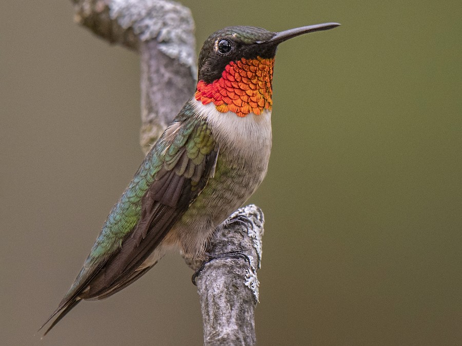
Where to find Ruby-throated Hummingbird in July
within 25 miles of New York City, United States
This page shows which locations in the selected region historically had the highest probability of a checklist including Ruby-throated Hummingbird in July. Because some locations may be undersampled, the results are sorted based on a confidence score which takes into account how many samples are available. The bar chart shows how the probability of observing this species varies over the year.
- Click on a month in the bar chart to switch to that month.
- Click on a location to view its top birds.
- Click here to view a map on eBird.
| Evidence | Sampling | Score | ||||||||
|---|---|---|---|---|---|---|---|---|---|---|
| # | Location | Dist | Media | Years | Birders | Hits | Lists | Freq | Conf | |
| 1 | North Mt. Loretto SF--Sand Pits (Turtle Nesting Area) | 17.6 | 0 | 1 | 1 | 20 | 24 | 83.3% | 64.1% | |
| 2 | Cemetery of the Resurrection--North Overlook | 17.6 | 0 | 6 | 2 | 72 | 109 | 66.1% | 56.8% | |
| 3 | Wagner College | 8.3 | 0 | 10 | 1 | 97 | 233 | 41.6% | 35.5% | |
| 4 | Great Neck Estates Wildlife Sanctuary | 14.4 | 0 | 1 | 1 | 2 | 2 | 100.0% | 34.2% | |
| 5 | North Mt. Loretto SF--Reed Marsh | 17.6 | 0 | 3 | 1 | 21 | 54 | 38.9% | 27.0% | |
| 6 | Great Swamp NWR | 23.9 | 2 | 17 | 31 | 61 | 189 | 32.3% | 26.0% | |
| 7 | Van Vleck House & Gardens | 13.6 | 3 | 2 | 1 | 3 | 5 | 60.0% | 23.1% | |
| 8 | Fort Tryon Park | 10.9 | 17 | 6 | 27 | 42 | 144 | 29.2% | 22.4% | |
| 9 | Mountain Ave. Yard | 23.3 | 0 | 7 | 1 | 12 | 33 | 36.4% | 22.2% | |
| 10 | Pelham Bay Park--Rodmans Neck | 14.6 | 0 | 1 | 1 | 1 | 1 | 100.0% | 20.7% | |
| 11 | Cemetery of the Resurrection--scrub W of maint. bldgs | 17.6 | 0 | 2 | 1 | 31 | 110 | 28.2% | 20.6% | |
| 12 | Jay Estate | 23.0 | 0 | 3 | 1 | 7 | 18 | 38.9% | 20.3% | |
| 13 | Clove Lakes Park | 8.6 | 0 | 15 | 2 | 69 | 280 | 24.6% | 20.0% | |
| 14 | Cemetery of the Resurrection | 17.4 | 0 | 6 | 3 | 15 | 53 | 28.3% | 18.0% | |
| 15 | Marshlands Conservancy | 22.9 | 14 | 14 | 89 | 111 | 528 | 21.0% | 17.8% | |
| 16 | Goodhue Park | 7.2 | 0 | 4 | 1 | 21 | 84 | 25.0% | 17.0% | |
| 17 | South Mountain Reservation--Wildflower and Forest Preserve | 15.0 | 0 | 2 | 2 | 2 | 4 | 50.0% | 15.0% | |
| 18 | Old Troy County Park | 22.3 | 0 | 2 | 1 | 7 | 24 | 29.2% | 14.9% | |
| 19 | Sandy Hook | 19.0 | 3 | 16 | 45 | 80 | 446 | 17.9% | 14.7% | |
| 20 | McFaul Environmental Center | 21.7 | 1 | 4 | 4 | 6 | 28 | 21.4% | 10.2% | |
| 21 | Lorrimer Sanctuary (NJAS) | 21.8 | 0 | 4 | 4 | 5 | 22 | 22.7% | 10.1% | |
| 22 | Huber Woods County Park | 22.6 | 0 | 4 | 6 | 9 | 50 | 18.0% | 9.8% | |
| 23 | Clark Botanic Garden | 19.6 | 0 | 4 | 3 | 5 | 23 | 21.7% | 9.7% | |
| 24 | Ellis Rd., waterfront (Richmond Co.) | 17.3 | 0 | 1 | 1 | 1 | 2 | 50.0% | 9.5% | |
| 25 | The Celery Farm | 23.1 | 3 | 19 | 38 | 61 | 536 | 11.4% | 9.0% | |
| 26 | Central Park--The Ravine (incl. The Loch) | 6.1 | 6 | 3 | 15 | 17 | 124 | 13.7% | 8.7% | |
| 27 | Hartshorne Woods | 22.4 | 1 | 7 | 9 | 8 | 48 | 16.7% | 8.7% | |
| 28 | Teaneck Creek Conservancy | 11.1 | 0 | 5 | 4 | 13 | 91 | 14.3% | 8.5% | |
| 29 | Alonzo F. Bonsal Wildlife Preserve | 13.4 | 0 | 3 | 2 | 6 | 34 | 17.6% | 8.3% | |
| 30 | Great Swamp NWR--Long Hill Rd | 24.9 | 0 | 2 | 2 | 2 | 7 | 28.6% | 8.2% | |
| 31 | Maplewood Memorial Park | 14.1 | 0 | 5 | 3 | 14 | 106 | 13.2% | 8.0% | |
| 32 | Jamaica Bay Wildlife Refuge--South Garden | 11.6 | 1 | 4 | 7 | 7 | 44 | 15.9% | 7.9% | |
| 33 | Jamaica Bay Wildlife Refuge--West Pond | 11.3 | 0 | 11 | 82 | 59 | 602 | 9.8% | 7.7% | |
| 34 | Frelinghuysen Arboretum | 24.3 | 0 | 3 | 4 | 5 | 29 | 17.2% | 7.6% | |
| 35 | Watchung Reservation | 19.7 | 1 | 4 | 3 | 7 | 46 | 15.2% | 7.6% | |
| 36 | Troy Meadows Natural Area--So. Beverwyck Rd/Patriots Path | 21.6 | 0 | 3 | 2 | 3 | 14 | 21.4% | 7.6% | |
| 37 | Pelham Bay Park--Southern Meadow and environs | 13.6 | 0 | 4 | 3 | 6 | 38 | 15.8% | 7.4% | |
| 38 | Loantaka Brook Reservation | 23.9 | 0 | 7 | 8 | 19 | 170 | 11.2% | 7.3% | |
| 39 | Sands Point Preserve | 19.0 | 4 | 5 | 8 | 10 | 77 | 13.0% | 7.2% | |
| 40 | Great Kills Park--Crookes Point | 14.3 | 0 | 5 | 3 | 7 | 51 | 13.7% | 6.8% | |
| 41 | Mt. Loretto Unique Area | 18.0 | 0 | 8 | 17 | 14 | 125 | 11.2% | 6.8% | |
| 42 | Jamaica Bay Wildlife Refuge--North Garden | 11.3 | 1 | 3 | 4 | 4 | 24 | 16.7% | 6.7% | |
| 43 | Brookfield Park | 13.3 | 0 | 4 | 6 | 7 | 52 | 13.5% | 6.7% | |
| 44 | The Landing, Dobbs Ferry | 22.1 | 0 | 5 | 3 | 12 | 108 | 11.1% | 6.5% | |
| 45 | Van Saun Park--Walden Pond | 14.7 | 0 | 1 | 3 | 5 | 34 | 14.7% | 6.4% | |
| 46 | Central Park--Tupelo Meadow | 4.8 | 1 | 1 | 2 | 2 | 9 | 22.2% | 6.3% | |
| 47 | Popamora Point County Park | 21.0 | 0 | 2 | 2 | 2 | 9 | 22.2% | 6.3% | |
| 48 | Snug Harbor Cultural Center & Botanical Garden | 7.1 | 0 | 4 | 4 | 6 | 45 | 13.3% | 6.3% | |
| 49 | Backyard of Isaac Grant, Staten Island | 6.3 | 0 | 1 | 1 | 1 | 3 | 33.3% | 6.1% | |
| 50 | Scarsdale Public Library, Olmsted | 22.6 | 0 | 1 | 2 | 1 | 3 | 33.3% | 6.1% | |
| 51 | Cemetery of the Resurrection--Perpendicular Pond | 17.5 | 0 | 5 | 2 | 34 | 404 | 8.4% | 6.1% | |
| 52 | Laurelwood Arboretum | 23.3 | 0 | 1 | 4 | 2 | 10 | 20.0% | 5.7% | |
| 53 | Jamaica Bay Wildlife Refuge | 11.6 | 9 | 19 | 109 | 86 | 1246 | 6.9% | 5.6% | |
| 54 | Prospect Park | 4.2 | 20 | 12 | 43 | 85 | 1278 | 6.7% | 5.4% | |
| 55 | Van Saun Park | 15.0 | 0 | 2 | 2 | 2 | 11 | 18.2% | 5.1% | |
| 56 | Ocean Breeze Park | 9.6 | 0 | 1 | 2 | 2 | 11 | 18.2% | 5.1% | |
| 57 | Hastings Meadowlands & Rowley's Bridge Trail | 19.9 | 0 | 2 | 2 | 2 | 11 | 18.2% | 5.1% | |
| 58 | Garret Mountain Reservation (Park) | 15.7 | 0 | 6 | 3 | 14 | 175 | 8.0% | 4.8% | |
| 59 | Keansburg Beach | 19.3 | 0 | 1 | 1 | 1 | 4 | 25.0% | 4.6% | |
| 60 | Kreischer St., creek | 17.5 | 0 | 1 | 1 | 1 | 4 | 25.0% | 4.6% | |
| 61 | Fort Tryon Park--Cabrini Woods (W of Cabrini Blvd) | 10.6 | 0 | 1 | 1 | 1 | 4 | 25.0% | 4.6% | |
| 62 | Hepburn Woods | 22.4 | 0 | 1 | 1 | 1 | 4 | 25.0% | 4.6% | |
| 63 | South Mountain Reservation--Southern Section | 15.6 | 0 | 1 | 1 | 1 | 4 | 25.0% | 4.6% | |
| 64 | Overpeck County Park | 10.5 | 0 | 4 | 7 | 9 | 106 | 8.5% | 4.5% | |
| 65 | Floyd Bennett Field | 10.3 | 2 | 10 | 10 | 20 | 298 | 6.7% | 4.4% | |
| 66 | Brooklyn Botanic Garden | 3.9 | 1 | 6 | 12 | 14 | 210 | 6.7% | 4.0% | |
| 67 | Hartshorne Woods Park--Claypit Creek | 22.1 | 0 | 2 | 2 | 2 | 14 | 14.3% | 4.0% | |
| 68 | Kissena Park | 10.6 | 0 | 2 | 3 | 4 | 42 | 9.5% | 3.8% | |
| 69 | Sandy Hook--Lighthouse & bike path | 17.4 | 1 | 1 | 2 | 2 | 15 | 13.3% | 3.7% | |
| 70 | Alley Pond Park--Little Alley Pond | 14.0 | 0 | 1 | 1 | 1 | 5 | 20.0% | 3.6% | |
| 71 | Central Park-Hanover Twp./Whippany Paper Board (private) | 23.6 | 0 | 1 | 1 | 1 | 5 | 20.0% | 3.6% | |
| 72 | Washington Rock SP | 25.0 | 0 | 1 | 1 | 1 | 5 | 20.0% | 3.6% | |
| 73 | Edith G. Read Wildlife Sanctuary | 24.9 | 5 | 5 | 7 | 12 | 198 | 6.1% | 3.5% | |
| 74 | Overpeck County Park--Stables/Wildlife Refuge | 10.1 | 0 | 1 | 3 | 2 | 16 | 12.5% | 3.5% | |
| 75 | Old Westbury Gardens | 21.9 | 0 | 2 | 2 | 2 | 16 | 12.5% | 3.5% | |
| 76 | Conference House Park | 19.7 | 0 | 3 | 11 | 6 | 80 | 7.5% | 3.5% | |
| 77 | Prospect Park--Vale of Cashmere | 3.7 | 1 | 2 | 4 | 4 | 47 | 8.5% | 3.4% | |
| 78 | Silver Lake Park (Richmond Co.) | 7.6 | 0 | 2 | 2 | 3 | 31 | 9.7% | 3.3% | |
| 79 | Mindowaskin Park | 18.3 | 0 | 1 | 1 | 2 | 17 | 11.8% | 3.3% | |
| 80 | Lemon Creek Pier | 17.7 | 0 | 4 | 1 | 4 | 51 | 7.8% | 3.1% | |
| 81 | Francis Lewis Park | 11.1 | 0 | 1 | 1 | 1 | 6 | 16.7% | 3.0% | |
| 82 | Grover Cleveland Park and Essex Fells | 16.8 | 0 | 1 | 1 | 1 | 6 | 16.7% | 3.0% | |
| 83 | VE Macy Park--Great Hunger Memorial | 23.0 | 0 | 1 | 1 | 1 | 6 | 16.7% | 3.0% | |
| 84 | Mayapple Hill | 15.3 | 0 | 1 | 1 | 2 | 19 | 10.5% | 2.9% | |
| 85 | Central Park--North End | 6.2 | 3 | 4 | 9 | 7 | 119 | 5.9% | 2.9% | |
| 86 | Irvington Woods | 23.8 | 0 | 1 | 1 | 1 | 7 | 14.3% | 2.6% | |
| 87 | Alley Pond Park--Restoration Area | 14.0 | 0 | 1 | 1 | 1 | 7 | 14.3% | 2.6% | |
| 88 | Watchung Reservation--Lake Surprise | 19.1 | 0 | 1 | 1 | 1 | 7 | 14.3% | 2.6% | |
| 89 | River Rd. marshes and RR tracks | 11.9 | 0 | 4 | 3 | 4 | 62 | 6.5% | 2.5% | |
| 90 | New York Botanical Garden | 12.3 | 0 | 4 | 8 | 8 | 164 | 4.9% | 2.5% | |
| 91 | Central Park--Shakespeare Garden | 4.9 | 1 | 2 | 2 | 2 | 23 | 8.7% | 2.4% | |
| 92 | Conaskonk Point | 20.1 | 1 | 3 | 6 | 6 | 115 | 5.2% | 2.4% | |
| 93 | Liberty SP | 2.4 | 1 | 8 | 6 | 14 | 360 | 3.9% | 2.3% | |
| 94 | Alley Pond Park | 14.0 | 0 | 4 | 4 | 5 | 95 | 5.3% | 2.3% | |
| 95 | Cemetery of the Resurrection--North Pond | 17.4 | 0 | 1 | 1 | 4 | 70 | 5.7% | 2.2% | |
| 96 | Great Swamp Outdoor Education Center | 21.7 | 0 | 1 | 1 | 1 | 8 | 12.5% | 2.2% | |
| 97 | Floyd Bennett Field--Ecology Village Area | 10.9 | 0 | 1 | 1 | 1 | 8 | 12.5% | 2.2% | |
| 98 | Central Park--The Dene Slope (Wildflower Meadow) | 4.2 | 0 | 1 | 1 | 1 | 8 | 12.5% | 2.2% | |
| 99 | Sandy Hook--E & D Lot Beaches | 19.7 | 0 | 2 | 3 | 2 | 25 | 8.0% | 2.2% | |
| 100 | North Mt. Loretto SF--Snag Swamp | 17.8 | 0 | 1 | 1 | 3 | 48 | 6.2% | 2.1% | |
| 101 | West Essex Wetlands, Livingston, New Jersey, US (40.808, -74.344) | 18.9 | 1 | 1 | 3 | 3 | 48 | 6.2% | 2.1% | |
| 102 | Oceanside Marine Nature Study Area | 21.0 | 1 | 8 | 3 | 37 | 1322 | 2.8% | 2.0% | |
| 103 | Cemetery of the Resurrection--S entrance (maint. bldgs) | 17.5 | 0 | 2 | 1 | 5 | 108 | 4.6% | 2.0% | |
| 104 | New Bridge Landing | 13.8 | 0 | 1 | 1 | 1 | 9 | 11.1% | 2.0% | |
| 105 | Brookdale Park | 12.7 | 0 | 2 | 2 | 3 | 52 | 5.8% | 2.0% | |
| 106 | Fort Wadsworth | 8.3 | 1 | 3 | 2 | 3 | 52 | 5.8% | 2.0% | |
| 107 | Echo Lake Park | 18.0 | 0 | 3 | 1 | 3 | 55 | 5.5% | 1.9% | |
| 108 | Meadowlands--Cromakill Creek Marsh | 5.9 | 0 | 1 | 1 | 1 | 10 | 10.0% | 1.8% | |
| 109 | Harbor Island Park, Mamaroneck | 21.4 | 0 | 1 | 1 | 1 | 10 | 10.0% | 1.8% | |
| 110 | Deep Cut Gardens | 23.3 | 0 | 1 | 1 | 1 | 10 | 10.0% | 1.8% | |
| 111 | Sandy Hook--F Lot/Fishing Beach | 19.1 | 0 | 1 | 1 | 1 | 10 | 10.0% | 1.8% | |
| 112 | Halsey Pond Park | 23.1 | 0 | 1 | 1 | 1 | 10 | 10.0% | 1.8% | |
| 113 | Sharrotts Pond | 16.9 | 0 | 1 | 2 | 4 | 88 | 4.5% | 1.8% | |
| 114 | Hatfield Swamp IBA--Great Piece Meadow | 20.6 | 0 | 2 | 3 | 3 | 61 | 4.9% | 1.7% | |
| 115 | Sandy Hook--Spermaceti Cove area | 19.9 | 0 | 3 | 4 | 4 | 93 | 4.3% | 1.7% | |
| 116 | Bayswater Point SP | 14.2 | 1 | 1 | 1 | 1 | 11 | 9.1% | 1.6% | |
| 117 | Moravian Cemetery | 10.9 | 0 | 1 | 1 | 1 | 11 | 9.1% | 1.6% | |
| 118 | Shellbank Basin | 9.7 | 0 | 1 | 1 | 1 | 11 | 9.1% | 1.6% | |
| 119 | Great Kills Park | 13.0 | 0 | 5 | 6 | 6 | 180 | 3.3% | 1.5% | |
| 120 | Canarsie Beach Park | 8.4 | 0 | 1 | 1 | 3 | 69 | 4.3% | 1.5% | |
| 121 | Riis Landing | 12.0 | 0 | 1 | 1 | 1 | 12 | 8.3% | 1.5% | |
| 122 | Freshkills Park--North Park (Phase l) | 12.8 | 0 | 1 | 1 | 1 | 12 | 8.3% | 1.5% | |
| 123 | Rockefeller University | 4.3 | 0 | 1 | 1 | 1 | 12 | 8.3% | 1.5% | |
| 124 | Central Park--The Ramble | 4.7 | 1 | 4 | 8 | 13 | 518 | 2.5% | 1.5% | |
| 125 | Central Park | 4.3 | 2 | 4 | 16 | 20 | 884 | 2.3% | 1.5% | |
| 126 | Hatfield Swamp IBA--West Essex Park | 18.2 | 0 | 3 | 3 | 4 | 108 | 3.7% | 1.4% | |
| 127 | Pelham Bay Park | 14.8 | 0 | 4 | 2 | 4 | 113 | 3.5% | 1.4% | |
| 128 | Pelham Bay Park--The Meadow and adj. woodland | 15.0 | 0 | 1 | 2 | 1 | 13 | 7.7% | 1.4% | |
| 129 | Otter Creek Preserve | 22.0 | 0 | 1 | 1 | 1 | 13 | 7.7% | 1.4% | |
| 130 | Alley Pond Park--Restoration Pond | 14.1 | 0 | 1 | 1 | 1 | 13 | 7.7% | 1.4% | |
| 131 | Jersey Gardens Mall--Bayfront Wetlands--Restricted Access | 9.1 | 0 | 2 | 2 | 2 | 43 | 4.7% | 1.3% | |
| 132 | South Mountain Reservation | 15.5 | 0 | 3 | 4 | 3 | 80 | 3.8% | 1.3% | |
| 133 | Pelham Bay Park--Bartow-Pell Mansion | 15.1 | 0 | 1 | 1 | 1 | 14 | 7.1% | 1.3% | |
| 134 | Tibbetts Brook Park | 15.9 | 0 | 1 | 1 | 1 | 14 | 7.1% | 1.3% | |
| 135 | Lincoln Park Gravel Pits | 21.5 | 0 | 2 | 1 | 2 | 45 | 4.4% | 1.2% | |
| 136 | Brightwood Park | 19.5 | 0 | 1 | 1 | 1 | 15 | 6.7% | 1.2% | |
| 137 | West Essex Wetlands | 18.9 | 0 | 1 | 1 | 1 | 15 | 6.7% | 1.2% | |
| 138 | Van Cortlandt Park | 14.2 | 0 | 2 | 2 | 2 | 47 | 4.3% | 1.2% | |
| 139 | Lake Tappan (NY), Convent Rd. | 23.5 | 0 | 2 | 4 | 4 | 135 | 3.0% | 1.2% | |
| 140 | Poricy Park | 24.4 | 0 | 1 | 1 | 1 | 16 | 6.2% | 1.1% | |
| 141 | Garden City (Nassau Co.) | 19.4 | 0 | 1 | 1 | 1 | 16 | 6.2% | 1.1% | |
| 142 | Troy Meadows Natural Area | 21.1 | 0 | 2 | 3 | 3 | 94 | 3.2% | 1.1% | |
| 143 | Sandy Hook--North End | 16.4 | 0 | 2 | 5 | 4 | 157 | 2.5% | 1.0% | |
| 144 | Fort Washington Park--Dyckman St. Boat Marina | 11.4 | 0 | 1 | 1 | 1 | 18 | 5.6% | 1.0% | |
| 145 | Barbour Pond Park | 20.9 | 0 | 1 | 1 | 1 | 18 | 5.6% | 1.0% | |
| 146 | Lenoir Preserve | 19.2 | 0 | 2 | 2 | 2 | 58 | 3.4% | 1.0% | |
| 147 | Jamaica Bay Wildlife Refuge--East Pond | 11.5 | 0 | 7 | 15 | 10 | 605 | 1.7% | 0.9% | |
| 148 | Blue Heron Park | 15.6 | 0 | 1 | 1 | 1 | 20 | 5.0% | 0.9% | |
| 149 | Drew University--Zuck Arboretum | 22.5 | 0 | 1 | 1 | 1 | 20 | 5.0% | 0.9% | |
| 150 | Sandy Hook--Platform & North Pond | 16.8 | 0 | 2 | 2 | 2 | 63 | 3.2% | 0.9% | |
| 151 | Parsons Pond Park | 23.2 | 0 | 1 | 1 | 1 | 21 | 4.8% | 0.8% | |
| 152 | Central Park--The Knoll | 6.1 | 1 | 1 | 1 | 1 | 21 | 4.8% | 0.8% | |
| 153 | Atlantic Highlands Marina | 20.6 | 0 | 1 | 1 | 1 | 21 | 4.8% | 0.8% | |
| 154 | Meadowlands IBA--Harrier Meadows (restricted access) | 7.8 | 0 | 1 | 1 | 2 | 66 | 3.0% | 0.8% | |
| 155 | Meadowlands District IBA | 7.6 | 0 | 2 | 2 | 2 | 69 | 2.9% | 0.8% | |
| 156 | Meadowlands IBA--Mill Creek Marsh | 6.1 | 0 | 4 | 5 | 6 | 347 | 1.7% | 0.8% | |
| 157 | Demarest Nature Center | 17.3 | 0 | 1 | 1 | 1 | 23 | 4.3% | 0.8% | |
| 158 | Clarks Pond | 11.9 | 0 | 1 | 2 | 1 | 23 | 4.3% | 0.8% | |
| 159 | Pelham Bay Park--Hunter Island | 15.9 | 1 | 1 | 2 | 1 | 24 | 4.2% | 0.7% | |
| 160 | Bayshore Waterfront Park | 19.5 | 0 | 2 | 1 | 2 | 75 | 2.7% | 0.7% | |
| 161 | Piermont Pier | 23.4 | 0 | 4 | 7 | 9 | 674 | 1.3% | 0.7% | |
| 162 | Jamaica Bay Wildlife Refuge--Terrapin Point (Brooklyn) | 11.3 | 0 | 2 | 2 | 2 | 80 | 2.5% | 0.7% | |
| 163 | Alley Pond Park--Oakland Lake | 13.3 | 2 | 2 | 3 | 3 | 155 | 1.9% | 0.7% | |
| 164 | Garvies Point Preserve | 21.1 | 0 | 1 | 1 | 1 | 27 | 3.7% | 0.7% | |
| 165 | Alley Pond Park--Environmental Center | 13.6 | 0 | 2 | 2 | 2 | 86 | 2.3% | 0.6% | |
| 166 | Sandy Hook--Salt Marsh | 18.3 | 0 | 1 | 1 | 1 | 28 | 3.6% | 0.6% | |
| 167 | Sandy Hook--Scout Camp & Randolph Drive | 18.2 | 0 | 1 | 1 | 1 | 28 | 3.6% | 0.6% | |
| 168 | Larchmont (Westchester Co.) | 19.9 | 0 | 1 | 1 | 1 | 28 | 3.6% | 0.6% | |
| 169 | Oakwood Beach--Delwit Ave. marsh | 12.6 | 0 | 1 | 1 | 2 | 90 | 2.2% | 0.6% | |
| 170 | Lincoln Park West | 4.5 | 0 | 1 | 2 | 1 | 29 | 3.4% | 0.6% | |
| 171 | Jamaica Bay Wildlife Refuge--East Pond, north end | 11.1 | 0 | 2 | 6 | 4 | 261 | 1.5% | 0.6% | |
| 172 | Meadowlands IBA--Skeetkill Marsh | 7.8 | 0 | 1 | 1 | 1 | 30 | 3.3% | 0.6% | |
| 173 | Raritan Bay Waterfront Park & Morgan Avenue Mudflats | 21.4 | 0 | 3 | 4 | 4 | 265 | 1.5% | 0.6% | |
| 174 | Central Park--North Meadow | 5.9 | 0 | 1 | 1 | 1 | 31 | 3.2% | 0.6% | |
| 175 | Hilltop Reservation | 15.8 | 0 | 1 | 1 | 1 | 33 | 3.0% | 0.5% | |
| 176 | Pelham Bay Park--Turtle Cove | 14.7 | 0 | 2 | 3 | 2 | 105 | 1.9% | 0.5% | |
| 177 | Richard W. DeKorte Park | 6.9 | 1 | 8 | 13 | 14 | 1597 | 0.9% | 0.5% | |
| 178 | Sandy Hook--Horseshoe Cove area | 18.5 | 0 | 1 | 1 | 1 | 34 | 2.9% | 0.5% | |
| 179 | Pelham Bay Park--Thomas Pell WS and Goose Creek Marsh | 15.0 | 0 | 1 | 1 | 1 | 34 | 2.9% | 0.5% | |
| 180 | Sheldrake Lake (Larchmont Reservoir) | 20.5 | 0 | 1 | 1 | 1 | 34 | 2.9% | 0.5% | |
| 181 | Coney Island Creek Park | 9.2 | 0 | 1 | 1 | 1 | 37 | 2.7% | 0.5% | |
| 182 | Lemon Creek, bridge at Hylan Blvd. | 17.0 | 0 | 1 | 1 | 1 | 37 | 2.7% | 0.5% | |
| 183 | Oakwood Beach--Riga St. marsh | 12.5 | 0 | 1 | 1 | 1 | 37 | 2.7% | 0.5% | |
| 184 | Oradell Reservoir and Emerson Woods | 17.7 | 0 | 1 | 1 | 1 | 38 | 2.6% | 0.5% | |
| 185 | Freshkills Park | 13.4 | 0 | 1 | 1 | 1 | 38 | 2.6% | 0.5% | |
| 186 | Hommocks Conservation Area | 20.4 | 0 | 1 | 1 | 1 | 38 | 2.6% | 0.5% | |
| 187 | Hempstead Lake SP--north end | 19.3 | 0 | 1 | 1 | 1 | 38 | 2.6% | 0.5% | |
| 188 | Linden Hawk Rise Sanctuary | 14.8 | 0 | 2 | 3 | 3 | 227 | 1.3% | 0.5% | |
| 189 | Olympia Blvd. Pond | 10.5 | 0 | 2 | 1 | 2 | 123 | 1.6% | 0.4% | |
| 190 | Green-Wood Cemetery, Brooklyn | 4.4 | 1 | 3 | 7 | 6 | 636 | 0.9% | 0.4% | |
| 191 | Oakwood Beach--tidal marshes, NW to Mill Rd. | 12.7 | 0 | 2 | 2 | 2 | 129 | 1.6% | 0.4% | |
| 192 | Jamaica Bay, Ruffle Bar | 11.1 | 0 | 1 | 1 | 1 | 44 | 2.3% | 0.4% | |
| 193 | Central Park--The Pool | 6.0 | 0 | 1 | 2 | 2 | 139 | 1.4% | 0.4% | |
| 194 | Central Park--The Pond and Hallett Sanctuary | 4.0 | 0 | 2 | 3 | 3 | 263 | 1.1% | 0.4% | |
| 195 | Jamaica Bay, North Channel Bridge | 10.5 | 0 | 1 | 2 | 1 | 46 | 2.2% | 0.4% | |
| 196 | Orange Reservoir | 15.0 | 0 | 1 | 1 | 1 | 47 | 2.1% | 0.4% | |
| 197 | Hillside Woods & Children's Village | 20.7 | 0 | 1 | 1 | 1 | 49 | 2.0% | 0.4% | |
| 198 | Wave Hill | 13.6 | 0 | 1 | 1 | 1 | 50 | 2.0% | 0.4% | |
| 199 | Pelham Bay Park--Orchard Beach & parking lot | 15.3 | 0 | 1 | 1 | 1 | 52 | 1.9% | 0.3% | |
| 200 | Breezy Point Beach | 12.1 | 0 | 1 | 1 | 1 | 52 | 1.9% | 0.3% | |
| 201 | Franklin D. Roosevelt Boardwalk and Beach | 9.8 | 0 | 1 | 1 | 1 | 53 | 1.9% | 0.3% | |
| 202 | Meadowlands IBA--Kearny Marsh East | 5.9 | 0 | 1 | 1 | 1 | 54 | 1.9% | 0.3% | |
| 203 | Norman J. Levy Park and Preserve | 23.7 | 0 | 1 | 1 | 1 | 55 | 1.8% | 0.3% | |
| 204 | Treasure Lake | 21.4 | 0 | 1 | 1 | 1 | 56 | 1.8% | 0.3% | |
| 205 | Lenape Park | 16.4 | 0 | 1 | 1 | 1 | 59 | 1.7% | 0.3% | |
| 206 | Wolfe's Pond Park | 16.8 | 0 | 2 | 2 | 2 | 184 | 1.1% | 0.3% | |
| 207 | New Creek Watershed, Olympia Blvd. bridge | 10.3 | 0 | 1 | 1 | 1 | 60 | 1.7% | 0.3% | |
| 208 | Cemetery of the Resurrection--Parallel Pond | 17.4 | 0 | 2 | 1 | 2 | 188 | 1.1% | 0.3% | |
| 209 | Laurel Hill Park | 5.2 | 0 | 1 | 1 | 1 | 62 | 1.6% | 0.3% | |
| 210 | Ernest L. Oros Wildlife Preserve | 16.1 | 0 | 1 | 1 | 1 | 64 | 1.6% | 0.3% | |
| 211 | Salt Marsh Nature Center at Marine Park | 9.1 | 0 | 4 | 4 | 4 | 575 | 0.7% | 0.3% | |
| 212 | Joline Ave. Beach | 18.9 | 0 | 1 | 1 | 1 | 66 | 1.5% | 0.3% | |
| 213 | South Amboy Boat Ramp | 21.2 | 0 | 1 | 1 | 1 | 66 | 1.5% | 0.3% | |
| 214 | Walker Avenue Wetlands | 20.7 | 0 | 2 | 2 | 2 | 206 | 1.0% | 0.3% | |
| 215 | Bronx Zoo | 11.6 | 0 | 2 | 1 | 2 | 232 | 0.9% | 0.2% | |
| 216 | Breezy Point Tip | 11.9 | 0 | 1 | 2 | 2 | 235 | 0.9% | 0.2% | |
| 217 | Jamaica Bay Wildlife Refuge--Big Johns Pond | 11.5 | 0 | 1 | 1 | 1 | 81 | 1.2% | 0.2% | |
| 218 | Meadowlands IBA--Valley Brook Ave. | 7.2 | 0 | 1 | 1 | 1 | 93 | 1.1% | 0.2% | |
| 219 | Hillview Reservoir (restricted access) | 15.4 | 0 | 1 | 1 | 1 | 97 | 1.0% | 0.2% | |
| 220 | Jamaica Bay Wildlife Refuge--East Pond, south end | 11.7 | 0 | 2 | 3 | 2 | 312 | 0.6% | 0.2% | |
| 221 | Prospect Park--Prospect Lake | 4.5 | 0 | 1 | 2 | 1 | 105 | 1.0% | 0.2% | |
| 222 | Richard W. DeKorte Park--Marsh Discovery Trail | 7.0 | 1 | 1 | 1 | 1 | 111 | 0.9% | 0.2% | |
| 223 | Palisades Park IBA--State Line Lookout | 19.7 | 0 | 1 | 1 | 1 | 147 | 0.7% | 0.1% | |
| 224 | Miller Field | 11.3 | 0 | 1 | 1 | 1 | 152 | 0.7% | 0.1% | |
| 225 | Great Kills Park--Mudflats | 13.0 | 0 | 1 | 1 | 1 | 169 | 0.6% | 0.1% | |
| 226 | Swindler Cove Park and Sherman Creek | 10.9 | 0 | 1 | 1 | 1 | 183 | 0.5% | 0.1% | |
| 227 | Cemetery of the Resurrection--N entrance | 17.3 | 0 | 1 | 1 | 1 | 254 | 0.4% | 0.1% | |
| 228 | Governors Island (reopening Spring 2021) | 1.9 | 0 | 1 | 1 | 1 | 462 | 0.2% | 0.0% | |
| 229 | Inwood Hill Park | 11.7 | 0 | 1 | 1 | 1 | 700 | 0.1% | 0.0% | |
| 230 | Plumb Beach | 10.3 | 0 | 1 | 3 | 1 | 977 | 0.1% | 0.0% | |